No search filters
Air Temperature Entries (showing 100 of 1935 results)
| Edit | Date/Time Recorded | Waterbody | Site Name | Site ID | Temperature (°C) | ||||||||||||
|---|---|---|---|---|---|---|---|---|---|---|---|---|---|---|---|---|---|
| Jun 25, 2026, 11:17 am | Jun 25, 2026, 11:21 am | Green Lake, Green Lake County, WI, USA | West End Deep Hole | WI-47-7 | Green Lake Secchi Disk | 43.795906 | -89.043590 | lake/pond/reservoir | Houseofthreebears | 3 entries | Optional/Pending | Web | 23.89 | ||||
| Jun 25, 2026, 11:10 am | Jun 25, 2026, 11:13 am | Green Lake, Green Lake County, WI, USA | West End Deep Hole | WI-47-7 | Green Lake Secchi Disk | 43.795906 | -89.043590 | lake/pond/reservoir | Houseofthreebears | 3 entries | Optional/Pending | Web | 22.78 | ||||
| Jun 25, 2026, 11:10 am | Jun 25, 2026, 11:14 am | Green Lake, Green Lake County, WI, USA | West End Deep Hole | WI-47-7 | Green Lake Secchi Disk | 43.795906 | -89.043590 | lake/pond/reservoir | Houseofthreebears | 3 entries | Optional/Pending | Web | 22.78 | ||||
| Jun 25, 2026, 11:10 am | Jun 25, 2026, 11:15 am | Green Lake, Green Lake County, WI, USA | West End Deep Hole | WI-47-7 | Green Lake Secchi Disk | 43.795906 | -89.043590 | lake/pond/reservoir | Houseofthreebears | 3 entries | Optional/Pending | Web | 22.78 | ||||
| Jun 25, 2026, 11:10 am | Jun 25, 2026, 11:16 am | Green Lake, Green Lake County, WI, USA | West End Deep Hole | WI-47-7 | Green Lake Secchi Disk | 43.795906 | -89.043590 | lake/pond/reservoir | Houseofthreebears | 3 entries | Optional/Pending | Web | 22.78 | ||||
| Jun 23, 2026, 08:01 pm | Jun 23, 2026, 08:01 pm | Pigeon Lake, AB, CAN | 53.561437 | -113.900910 | lake/pond/reservoir | piperrad | Not Available | iOS 2.4.4 | 19.00 | ||||||||
| Jun 23, 2026, 05:08 pm | Jun 23, 2026, 05:16 pm | Gulf St Vincent, AUS, -34.919754, 138.490906 | Glenelg Jetty | AUS-0-4 | FOSVG Secchi Project SA | -34.978151 | 138.507504 | other water | Johanna | 8 entries | Completed | Web | 15.00 | ||||
| Jun 20, 2026, 01:25 pm | Jun 20, 2026, 01:26 pm | Gulf St Vincent, AUS, -34.919754, 138.490906 | Henley Beach Jetty | AUS-0-1 | FOSVG Secchi Project SA | -34.919800 | 138.490900 | other water | peter957 | 4 entries | Completed | iOS 2.4.4 | 13.30 | ||||
| Jun 19, 2026, 09:37 am | Jun 19, 2026, 09:37 am | Lake Naraneka, Fairfield County, CT, USA | CT-1-49 | CT-1-49 | 41.321836 | -73.508931 | lake/pond/reservoir | Bdwillet | 3 entries | Not Available | iOS 2.4.4 | 24.00 | |||||
| Jun 18, 2026, 10:53 am | Jun 18, 2026, 10:55 am | Pameacha Pond, Middlesex County, CT, USA | Pameacha-DH | CT-7-14 | Connecticut Lake Watch | 41.546550 | -72.652683 | lake/pond/reservoir | 9699 | 5 entries | Optional/Pending | iOS 2.4.4 | 28.28 | ||||
| Jun 17, 2026, 10:24 pm | Jun 17, 2026, 10:32 pm | Gulf St Vincent, AUS, -34.919754, 138.490906 | Glenelg Jetty | AUS-0-4 | FOSVG Secchi Project SA | -34.978151 | 138.507504 | other water | Johanna | 7 entries | Completed | Web | 17.60 | ||||
| Jun 14, 2026, 09:15 am | Jun 14, 2026, 09:24 am | Lake Wallenpaupack, Pike County, PA, USA | PA-103-21 | 41.408956 | -75.239216 | lake/pond/reservoir | mentalfloss | 7 entries | Not Available | Web | 24.00 | ||||||
| Jun 13, 2026, 11:46 am | Jun 13, 2026, 12:41 pm | Pameacha Pond, Middlesex County, CT, USA | Connecticut Lake Watch | 41.544200 | -72.652800 | lake/pond/reservoir | 9699 | 6 entries | Optional/Pending | Web | 28.33 | ||||||
| Jun 12, 2026, 02:53 pm | Jun 12, 2026, 02:54 pm | Gulf St Vincent, AUS, -34.919754, 138.490906 | Henley Beach Jetty | AUS-0-1 | FOSVG Secchi Project SA | -34.919800 | 138.490900 | other water | peter957 | 2 entries | Completed | iOS 2.4.4 | 21.90 | ||||
| Jun 11, 2026, 10:13 am | Jun 11, 2026, 10:15 am | Lake Naraneka, Fairfield County, CT, USA | CT-1-49 | CT-1-49 | 41.321836 | -73.508931 | lake/pond/reservoir | Bdwillet | 2 entries | Not Available | iOS 2.4.4 | 31.00 | |||||
| Jun 10, 2026, 10:26 am | Jun 10, 2026, 12:29 pm | Lake Naraneka, Fairfield County, CT, USA | CT-1-49 | CT-1-49 | 41.321836 | -73.508931 | lake/pond/reservoir | Bdwillet | 2 entries | Not Available | iOS 2.4.4 | 19.00 | |||||
| Jun 09, 2026, 11:22 am | Jun 09, 2026, 11:28 am | Lake Wallenpaupack, Pike County, PA, USA | PA-103-21 | 41.408956 | -75.239216 | lake/pond/reservoir | mentalfloss | 7 entries | Not Available | Web | 24.50 | ||||||
| Jun 09, 2026, 02:50 pm | Jun 09, 2026, 02:54 pm | Gulf St Vincent, AUS, -34.919754, 138.490906 | Glenelg Jetty | AUS-0-4 | FOSVG Secchi Project SA | -34.978151 | 138.507504 | other water | Johanna | 8 entries | Completed | Web | 17.70 | ||||
| Jun 07, 2026, 08:36 am | Jun 07, 2026, 08:44 am | Lake Wallenpaupack, Pike County, PA, USA | BNS | PA-103-21 | 41.408956 | -75.239216 | lake/pond/reservoir | mentalfloss | 7 entries | Not Available | Web | 24.50 | |||||
| Jun 07, 2026, 01:11 pm | Jun 07, 2026, 01:14 pm | Gulf St Vincent, AUS, -34.919754, 138.490906 | Henley Beach Jetty | AUS-0-1 | FOSVG Secchi Project SA | -34.919800 | 138.490900 | other water | peter957 | 6 entries | Completed | iOS 2.4.4 | 17.00 | ||||
| Jun 06, 2026, 11:05 am | Jun 19, 2026, 08:34 am | Pameacha Pond, Middlesex County, CT, USA | Pameacha-DH | CT-7-14 | Connecticut Lake Watch | 41.546550 | -72.652683 | lake/pond/reservoir | 9699 | 5 entries | Optional/Pending | iOS 2.4.4 | 30.72 | ||||
| Jun 06, 2026, 11:05 am | Jun 06, 2026, 05:19 pm | Pameacha Pond, Middlesex County, CT, USA | Pameacha-DH | CT-7-14 | Connecticut Lake Watch | 41.546550 | -72.652680 | lake/pond/reservoir | 9699 | 5 entries | Optional/Pending | Web | 30.56 | ||||
| Jun 05, 2026, 05:58 am | Jun 07, 2026, 06:10 am | Gulf St Vincent, AUS, -34.919754, 138.490906 | Glenelg Jetty | AUS-0-4 | FOSVG Secchi Project SA | -34.978151 | 138.507504 | other water | Johanna | 8 entries | Completed | Web | 15.10 | ||||
| Jun 04, 2026, 11:48 am | Jun 04, 2026, 12:20 pm | Gulf St Vincent, AUS, -34.919754, 138.490906 | Henley Beach Jetty | AUS-0-1 | FOSVG Secchi Project SA | -34.919800 | 138.490900 | other water | peter957 | 6 entries | Completed | Web | 13.50 | ||||
| Jun 03, 2026, 11:48 am | Jun 03, 2026, 11:48 am | Lake Memphremagog, Orleans County, VT, USA | Citizen Science on Lake Memphremagog | 44.937507 | -72.211922 | lake/pond/reservoir | MemSEC | 9 entries | Completed | iOS 2.4.4 | 26.67 | ||||||
| Jun 02, 2026, 10:56 am | Jun 02, 2026, 10:57 am | Lake Memphremagog, Orleans County, VT, USA | Citizen Science on Lake Memphremagog | 44.943523 | -72.225437 | lake/pond/reservoir | MemSEC | 5 entries | Completed | iOS 2.4.4 | 21.11 | ||||||
| May 26, 2026, 01:49 pm | May 25, 2026, 02:14 pm | Gulf St Vincent, AUS, -34.919754, 138.490906 | FOSVG Secchi Project SA | -34.980573 | 138.508082 | other water | Johanna | 6 entries | Completed | Web | 15.40 | ||||||
| May 24, 2026, 03:20 pm | May 24, 2026, 03:24 pm | Gulf St Vincent, AUS, -34.919754, 138.490906 | Henley Beach Jetty | AUS-0-1 | FOSVG Secchi Project SA | -34.919800 | 138.490900 | other water | peter957 | 6 entries | Completed | iOS 2.4.4 | 12.30 | ||||
| May 21, 2026, 12:40 pm | May 21, 2026, 12:50 pm | Gulf St Vincent, AUS, -34.919754, 138.490906 | FOSVG Secchi Project SA | -34.980556 | 138.508076 | other water | Johanna | 7 entries | Completed | Android 2.5.10 | 18.90 | ||||||
| May 19, 2026, 12:36 pm | May 19, 2026, 12:39 pm | Gulf St Vincent, AUS, -34.919754, 138.490906 | Henley Beach Jetty | AUS-0-1 | FOSVG Secchi Project SA | -34.919800 | 138.490900 | other water | peter957 | 6 entries | Completed | iOS 2.4.4 | 17.00 | ||||
| May 16, 2026, 01:00 pm | Jun 19, 2026, 08:48 am | Pameacha Pond, Middlesex County, CT, USA | Pameacha-DH | CT-7-14 | Connecticut Lake Watch | 41.546550 | -72.652683 | lake/pond/reservoir | 9699 | 5 entries | Optional/Pending | iOS 2.4.4 | 22.22 | ||||
| May 15, 2026, 07:36 am | May 20, 2026, 09:45 am | Pameacha Pond, Middlesex County, CT, USA | Connecticut Lake Watch | 41.544200 | -72.652800 | lake/pond/reservoir | 9699 | 7 entries | Optional/Pending | Web | 22.22 | ||||||
| May 15, 2026, 07:36 am | May 20, 2026, 09:45 am | Pameacha Pond, Middlesex County, CT, USA | Connecticut Lake Watch | 41.544200 | -72.652800 | lake/pond/reservoir | 9699 | 7 entries | Optional/Pending | Web | 22.22 | ||||||
| May 15, 2026, 07:36 am | May 20, 2026, 09:45 am | Pameacha Pond, Middlesex County, CT, USA | Connecticut Lake Watch | 41.544200 | -72.652800 | lake/pond/reservoir | 9699 | 7 entries | Optional/Pending | Web | 22.22 | ||||||
| May 14, 2026, 12:57 pm | May 19, 2026, 06:33 pm | Gulf St Vincent, AUS, -34.919754, 138.490906 | FOSVG Secchi Project SA | -34.902623 | 138.495583 | other water | diver257a | 11 entries | Completed | iOS 2.4.4 | 23.00 | ||||||
| May 13, 2026, 04:36 pm | May 13, 2026, 04:42 pm | Gulf St Vincent, AUS, -34.919754, 138.490906 | Glenelg Jetty | AUS-0-4 | FOSVG Secchi Project SA | -34.978151 | 138.507504 | other water | Johanna | 8 entries | Completed | Web | 20.20 | ||||
| May 12, 2026, 06:24 pm | May 12, 2026, 06:30 pm | Gulf St Vincent, AUS, -34.919754, 138.490906 | Glenelg Jetty | AUS-0-4 | FOSVG Secchi Project SA | -34.978151 | 138.507504 | other water | Johanna | 8 entries | Completed | Web | 20.20 | ||||
| May 12, 2026, 12:45 pm | May 13, 2026, 04:49 pm | Gulf St Vincent, AUS, -34.919754, 138.490906 | FOSVG Secchi Project SA | -34.980568 | 138.508065 | other water | Johanna | 7 entries | Completed | Android 2.5.10 | 20.20 | ||||||
| May 08, 2026, 03:39 pm | May 08, 2026, 03:47 pm | Pameacha Pond, Middlesex County, CT, USA | North | CT-7-14 | 41.546550 | -72.652683 | lake/pond/reservoir | 9699 | 6 entries | Not Available | Web | 12.22 | |||||
| May 08, 2026, 03:33 pm | May 08, 2026, 03:35 pm | Pameacha Pond, Middlesex County, CT, USA | North Side | CT-7-14 | 41.546551 | -72.652679 | lake/pond/reservoir | 9699 | 9 entries | Not Available | iOS 2.4.4 | 12.22 | |||||
| May 08, 2026, 12:00 pm | Jun 19, 2026, 08:43 am | Pameacha Pond, Middlesex County, CT, USA | Pameacha-DH | CT-7-14 | Connecticut Lake Watch | 41.546550 | -72.652683 | lake/pond/reservoir | 9699 | 5 entries | Optional/Pending | iOS 2.4.4 | 12.22 | ||||
| May 08, 2026, 04:18 pm | May 06, 2026, 05:00 pm | Gulf St Vincent, AUS, -34.919754, 138.490906 | FOSVG Secchi Project SA | -34.902605 | 138.495579 | other water | diver257a | 6 entries | Completed | Web | 24.00 | ||||||
| May 07, 2026, 09:59 pm | May 07, 2026, 10:19 pm | Gulf St Vincent, AUS, -34.919754, 138.490906 | Glenelg Jetty | AUS-0-4 | FOSVG Secchi Project SA | -34.978151 | 138.507504 | other water | Johanna | 6 entries | Completed | Web | 15.70 | ||||
| May 01, 2026, 05:23 pm | May 01, 2026, 05:28 pm | Diamond Lake, Hartford County, CT, USA | Connecticut Lake Watch | 41.694100 | -72.481700 | lake/pond/reservoir | garymcase | 4 entries | Optional/Pending | Web | 16.67 | ||||||
| Apr 27, 2026, 09:45 am | Apr 27, 2026, 10:45 am | Kirby Lake, Taylor County, TX, USA | NALMS Secchi Dip-In | 32.430320 | -99.791183 | lake/pond/reservoir | SJESeagles | 8 entries | Optional/Pending | iOS 2.4.4 | 20.00 | ||||||
| Apr 16, 2026, 09:00 am | Apr 16, 2026, 09:01 am | Lake Monona, Dane County, WI, USA | 43.061388 | -89.386323 | lake/pond/reservoir | erpeterson7 | Not Available | iOS 2.4.4 | 14.44 | ||||||||
| Apr 09, 2026, 10:08 am | Apr 09, 2026, 10:08 am | Gulf St Vincent, AUS, -34.919754, 138.490906 | AUS-0-1 | FOSVG Secchi Project SA | -34.919800 | 138.490900 | other water | FOSVGtu | 5 entries | Completed | iOS 2.4.4 | 22.00 | |||||
| Apr 05, 2026, 09:50 am | Apr 05, 2026, 09:59 am | Gulf St Vincent, AUS, -34.919754, 138.490906 | undefined | AUS-0-2 | FOSVG Secchi Project SA | -35.040276 | 138.513147 | other water | MichaelA | 7 entries | Completed | Android 2.5.10 | 19.00 | ||||
| Apr 01, 2026, 05:10 am | Apr 01, 2026, 05:16 am | Gulf St Vincent, AUS, -34.919754, 138.490906 | undefined | AUS-0-2 | FOSVG Secchi Project SA | -35.040276 | 138.513147 | other water | MichaelA | 7 entries | Completed | Android 2.5.10 | 55.00 | ||||
| Apr 01, 2026, 02:59 am | Apr 01, 2026, 03:04 am | Gulf St Vincent, AUS, -34.919754, 138.490906 | undefined | AUS-0-2 | FOSVG Secchi Project SA | -35.040276 | 138.513147 | other water | 5 | MichaelA | 8 entries | Completed | Android 2.5.10 | 5.00 | |||
| Mar 29, 2026, 10:03 am | Mar 29, 2026, 10:10 am | Gulf St Vincent, AUS, -34.919754, 138.490906 | undefined | AUS-0-2 | FOSVG Secchi Project SA | -35.040276 | 138.513147 | other water | MichaelA | 6 entries | Completed | Android 2.5.10 | 25.00 | ||||
| Mar 29, 2026, 09:34 am | Mar 29, 2026, 09:49 am | Gulf St Vincent, AUS, -34.919754, 138.490906 | undefined | AUS-0-2 | FOSVG Secchi Project SA | -35.040276 | 138.513147 | other water | MichaelA | 6 entries | Completed | Android 2.5.10 | 25.00 | ||||
| Mar 27, 2026, 05:29 pm | Mar 27, 2026, 05:30 pm | Gulf St Vincent, AUS, -34.919754, 138.490906 | AUS-0-1 | FOSVG Secchi Project SA | -34.919800 | 138.490900 | other water | FOSVGtu | 6 entries | Completed | iOS 2.4.4 | -0.56 | |||||
| Mar 27, 2026, 05:24 pm | Mar 27, 2026, 05:03 pm | Gulf St Vincent, AUS, -34.919754, 138.490906 | AUS-0-1 | AUS-0-1 | FOSVG Secchi Project SA | -34.919800 | 138.490900 | other water | FOSVGtu | 7 entries | Completed | Web | 25.00 | ||||
| Mar 25, 2026, 09:44 am | Mar 25, 2026, 09:44 am | Gulf St Vincent, AUS, -34.919754, 138.490906 | AUS-0-2 | FOSVG Secchi Project SA | -35.040276 | 138.513147 | other water | FOSVGtu | 5 entries | Completed | iOS 2.4.4 | 12.78 | |||||
| Mar 25, 2026, 09:37 am | Mar 25, 2026, 09:43 am | Gulf St Vincent, AUS, -34.919754, 138.490906 | AUS-0-2 | FOSVG Secchi Project SA | -35.040276 | 138.513147 | other water | FOSVGtu | 11 entries | Completed | iOS 2.4.4 | 15.00 | |||||
| Mar 25, 2026, 09:32 am | Mar 25, 2026, 09:43 am | Gulf St Vincent, AUS, -34.919754, 138.490906 | AUS-0-1 | FOSVG Secchi Project SA | -34.919800 | 138.490900 | other water | MichaelA | 5 entries | Completed | Android 2.5.10 | 15.00 | |||||
| Mar 20, 2026, 10:12 am | Mar 20, 2026, 10:14 am | Pigeon Lake, AB, CAN | 52.970872 | -113.968460 | lake/pond/reservoir | MaurieMahon | 4 entries | Not Available | iOS 2.4.4 | 1.00 | |||||||
| Mar 15, 2026, 04:41 pm | Mar 15, 2026, 04:43 pm | Gulf St Vincent, AUS, -34.919754, 138.490906 | AUS-0-2 | FOSVG Secchi Project SA | -35.040276 | 138.513147 | other water | FOSVGtu | 5 entries | Completed | iOS 2.4.4 | 35.00 | |||||
| Mar 15, 2026, 04:33 pm | Mar 15, 2026, 04:34 pm | Gulf St Vincent, AUS, -34.919754, 138.490906 | AUS-0-2 | FOSVG Secchi Project SA | -35.040276 | 138.513147 | other water | FOSVGtu | 5 entries | Completed | iOS 2.4.4 | -9.44 | |||||
| Mar 15, 2026, 04:30 pm | Mar 15, 2026, 04:31 pm | Gulf St Vincent, AUS, -34.919754, 138.490906 | AUS-0-2 | FOSVG Secchi Project SA | -35.040276 | 138.513147 | other water | FOSVGtu | 5 entries | Completed | iOS 2.4.4 | 25.00 | |||||
| Mar 13, 2026, 11:45 am | Mar 13, 2026, 11:46 am | Gulf St Vincent, AUS, -34.919754, 138.490906 | AUS-0-2 | FOSVG Secchi Project SA | -35.040276 | 138.513147 | other water | FOSVGtu | 5 entries | Completed | iOS 2.4.4 | 25.00 | |||||
| Mar 11, 2026, 12:54 pm | Mar 11, 2026, 12:55 pm | Gulf St Vincent, AUS, -34.919754, 138.490906 | AUS-0-1 | AUS-0-1 | FOSVG Secchi Project SA | -34.919800 | 138.490900 | other water | FOSVGtu | 7 entries | Completed | Web | 27.00 | ||||
| Feb 09, 2026, 09:30 am | Feb 09, 2026, 10:37 am | Kirby Lake, Taylor County, TX, USA | NALMS Secchi Dip-In | 32.374997 | -99.721018 | lake/pond/reservoir | SJESeagles | 7 entries | Optional/Pending | iOS 2.4.4 | 9.40 | ||||||
| Feb 01, 2026, 02:45 pm | Feb 01, 2026, 02:45 pm | Charles River Reservoir, Middlesex County, MA, USA, 42.3134306, | 42.359194 | -71.257353 | lake/pond/reservoir | LiorB | 2 entries | Not Available | iOS 2.4.4 | -5.00 | |||||||
| Dec 15, 2025, 09:35 am | Feb 09, 2026, 10:44 am | Kirby Lake, Taylor County, TX, USA | NALMS Secchi Dip-In | 32.374997 | -99.721018 | lake/pond/reservoir | SJESeagles | 7 entries | Optional/Pending | iOS 2.4.4 | 5.40 | ||||||
| Dec 15, 2025, 09:35 am | Dec 15, 2025, 10:19 am | Kirby Lake, Taylor County, TX, USA | NALMS Secchi Dip-In | 32.374600 | -99.733500 | lake/pond/reservoir | SJESeagles | 8 entries | Optional/Pending | Web | 5.40 | ||||||
| Nov 13, 2025, 11:22 am | Nov 13, 2025, 11:23 am | Goodwin Pond, Hartford County, CT, USA | 41.726716 | -72.683042 | lake/pond/reservoir | Oliverbb | 2 entries | Not Available | Android 2.5.10 | 7.78 | |||||||
| Nov 04, 2025, 07:19 pm | Nov 04, 2025, 07:19 pm | Lake Plymouth, Litchfield County, CT, USA | Plymouth-DH | CT-5-17 | Connecticut Lake Watch | 41.651200 | -73.044900 | lake/pond/reservoir | RebeccaW | 6 entries | Optional/Pending | Web | 24.44 | ||||
| Oct 25, 2025, 09:44 am | Oct 25, 2025, 09:45 am | Lake Naraneka, Fairfield County, CT, USA | Naraneka-Out | CT-1-55 | Connecticut Lake Watch | 41.324491 | -73.508580 | lake/pond/reservoir | Bdwillet | 3 entries | Optional/Pending | iOS 2.4.2 | 8.00 | ||||
| Oct 20, 2025, 10:20 am | Oct 20, 2025, 10:21 am | Lake Naraneka, Fairfield County, CT, USA | Naraneka-Out | CT-1-55 | Connecticut Lake Watch | 41.324491 | -73.508580 | lake/pond/reservoir | Bdwillet | 3 entries | Optional/Pending | iOS 2.4.2 | 19.00 | ||||
| Oct 16, 2025, 02:41 pm | Nov 22, 2025, 03:10 pm | Long Pond, New London County, CT, USA | Long-DH | CT-11-19 | Connecticut Lake Watch | 41.440040 | -71.945040 | lake/pond/reservoir | megdvm92 | 10 entries | Optional/Pending | Web | 11.67 | ||||
| Oct 16, 2025, 02:28 pm | Nov 22, 2025, 03:16 pm | Bush Pond, New London County, CT, USA, 41.441620, -71.942506 | BUSH-SouthCove | CT-11-20 | Connecticut Lake Watch | 41.438110 | -71.943040 | lake/pond/reservoir | megdvm92 | 10 entries | Optional/Pending | Web | 11.67 | ||||
| Oct 16, 2025, 02:03 pm | Nov 22, 2025, 03:02 pm | Long Pond, New London County, CT, USA | Long-Culv | CT-11-6 | Connecticut Lake Watch | 41.441130 | -71.945060 | lake/pond/reservoir | megdvm92 | 9 entries | Optional/Pending | Web | 10.56 | ||||
| Oct 12, 2025, 01:08 pm | Oct 12, 2025, 01:08 pm | Lake Naraneka, Fairfield County, CT, USA | Naraneka-Out | CT-1-55 | Connecticut Lake Watch | 41.324491 | -73.508580 | lake/pond/reservoir | Bdwillet | 3 entries | Optional/Pending | iOS 2.4.2 | 16.50 | ||||
| Oct 11, 2025, 06:37 pm | Nov 04, 2025, 07:42 pm | Lake Plymouth, Litchfield County, CT, USA | Plymouth-DH | CT-5-17 | Connecticut Lake Watch | 41.651200 | -73.044900 | lake/pond/reservoir | RebeccaW | 6 entries | Optional/Pending | Web | 74.00 | ||||
| Oct 11, 2025, 11:20 am | Oct 11, 2025, 02:38 pm | Fox Hill Lake, Fairfield County, CT, USA | Fox hill lake | 41.327800 | -73.488800 | lake/pond/reservoir | jasonpeyser | 6 entries | Optional/Pending | Web | 19.00 | ||||||
| Oct 06, 2025, 12:25 pm | Oct 06, 2025, 12:27 pm | Lake Naraneka, Fairfield County, CT, USA | Naraneka-Out | CT-1-55 | Connecticut Lake Watch | 41.324491 | -73.508580 | lake/pond/reservoir | Bdwillet | 3 entries | Optional/Pending | Web | 22.00 | ||||
| Oct 06, 2025, 12:23 pm | Oct 06, 2025, 12:25 pm | Lake Naraneka, Fairfield County, CT, USA | Naraneka-Out | CT-1-55 | Connecticut Lake Watch | 41.324491 | -73.508580 | lake/pond/reservoir | Bdwillet | 3 entries | Optional/Pending | Web | 22.00 | ||||
| Oct 05, 2025, 03:15 pm | Oct 10, 2025, 10:23 am | Hitchcock Lake, New Haven County, CT, USA | At the Rock | CT-9-11 | Hitchcock lake | 41.567669 | -72.953434 | lake/pond/reservoir | HitchcockNorth | 5 entries | Optional/Pending | Web | 27.78 | ||||
| Oct 05, 2025, 02:25 pm | Oct 30, 2025, 07:05 pm | Lake Wallenpaupack, Pike County, PA, USA | SHM | PA-103-26 | PLEON: Wallenpaupack Citizen Science Program | 41.439818 | -75.211476 | lake/pond/reservoir | rick | 4 entries | Completed | Web | 29.00 | ||||
| Oct 05, 2025, 12:37 pm | Oct 09, 2025, 11:50 am | Hitchcock Lake, New Haven County, CT, USA | Hitchcock-South | CT-9-12 | Connecticut Lake Watch | 41.559846 | -72.953045 | lake/pond/reservoir | HitchcockSouth | 5 entries | Optional/Pending | Web | 26.00 | ||||
| Oct 04, 2025, 02:17 pm | Oct 04, 2025, 02:20 pm | Lake Wallenpaupack, Pike County, PA, USA | FLD | PA-103-36 | PLEON: Wallenpaupack Citizen Science Program | 41.367040 | -75.272540 | lake/pond/reservoir | Mayerk | 6 entries | Completed | iOS 2.4.4 | 31.00 | ||||
| Oct 03, 2025, 09:25 am | Oct 03, 2025, 09:33 am | Pigeon Lake, AB, CAN | 52.970872 | -113.968451 | lake/pond/reservoir | MaurieMahon | 5 entries | Not Available | iOS 2.4.4 | 2.00 | |||||||
| Sep 30, 2025, 10:45 am | Oct 10, 2025, 10:19 am | Hitchcock Lake, New Haven County, CT, USA | At the Rock | CT-9-11 | Hitchcock lake | 41.567669 | -72.953434 | lake/pond/reservoir | HitchcockNorth | 5 entries | Optional/Pending | Web | 22.39 | ||||
| Sep 29, 2025, 10:10 am | Sep 29, 2025, 10:16 am | Lake Kirby, Taylor County, TX, USA | 32.430296 | -99.791192 | lake/pond/reservoir | SJESeagles | 9 entries | Not Available | iOS 2.4.4 | 22.70 | |||||||
| Sep 29, 2025, 10:19 am | Sep 29, 2025, 10:21 am | Long Pond, New London County, CT, USA | Long-Culv | CT-11-6 | Connecticut Lake Watch | 41.441130 | -71.945060 | lake/pond/reservoir | Water temp 73.5° F | megdvm92 | 3 entries | Optional/Pending | Web | 23.44 | |||
| Sep 29, 2025, 10:14 am | Sep 29, 2025, 10:19 am | Long Pond, New London County, CT, USA | Long-In | CT-11-4 | Connecticut Lake Watch | 41.448960 | -71.949160 | lake/pond/reservoir | Water temp 73.5° F | megdvm92 | 2 entries | Optional/Pending | Web | 23.44 | |||
| Sep 29, 2025, 09:10 am | Oct 01, 2025, 12:04 pm | Kirby Lake, Taylor County, TX, USA | NALMS Secchi Dip-In | 32.430255 | -99.791094 | lake/pond/reservoir | SJESeagles | 7 entries | Optional/Pending | iOS 2.4.4 | 22.70 | ||||||
| Sep 28, 2025, 02:25 pm | Oct 30, 2025, 07:01 pm | Lake Wallenpaupack, Pike County, PA, USA | SHM | PA-103-26 | PLEON: Wallenpaupack Citizen Science Program | 41.439818 | -75.211476 | lake/pond/reservoir | Warmer than last week | rick | 5 entries | Completed | Web | 29.00 | |||
| Sep 28, 2025, 11:42 am | Sep 28, 2025, 11:43 am | Lake Naraneka, Fairfield County, CT, USA | Naraneka-Out | CT-1-55 | Connecticut Lake Watch | 41.324491 | -73.508580 | lake/pond/reservoir | Bdwillet | 3 entries | Optional/Pending | iOS 2.4.2 | 24.00 | ||||
| Sep 27, 2025, 06:30 pm | Nov 04, 2025, 07:36 pm | Lake Plymouth, Litchfield County, CT, USA | Plymouth-DH | CT-5-17 | Connecticut Lake Watch | 41.651200 | -73.044900 | lake/pond/reservoir | RebeccaW | 6 entries | Optional/Pending | Web | 25.56 | ||||
| Sep 27, 2025, 06:30 pm | Nov 04, 2025, 07:37 pm | Lake Plymouth, Litchfield County, CT, USA | Plymouth-DH | CT-5-17 | Connecticut Lake Watch | 41.651200 | -73.044900 | lake/pond/reservoir | RebeccaW | 6 entries | Optional/Pending | Web | 25.56 | ||||
| Sep 27, 2025, 01:31 pm | Sep 27, 2025, 01:33 pm | Lake Wallenpaupack, Pike County, PA, USA | FLD | PA-103-36 | PLEON: Wallenpaupack Citizen Science Program | 41.367040 | -75.272540 | lake/pond/reservoir | Mayerk | 6 entries | Completed | iOS 2.4.4 | 26.00 | ||||
| Sep 27, 2025, 11:45 am | Oct 09, 2025, 11:47 am | Hitchcock Lake, New Haven County, CT, USA | Hitchcock-South | CT-9-12 | Connecticut Lake Watch | 41.559846 | -72.953045 | lake/pond/reservoir | HitchcockSouth | 5 entries | Optional/Pending | Web | 26.00 | ||||
| Sep 24, 2025, 11:02 am | Dec 08, 2025, 04:23 pm | Amos Lake, New London County, CT, USA | Amos-DH | CT-11-1 | Connecticut Lake Watch | 41.516200 | -71.974700 | lake/pond/reservoir | Pmonahan | 67 entries | Optional/Pending | Web | 23.41 | ||||
| Sep 23, 2025, 03:30 pm | Oct 10, 2025, 10:15 am | Hitchcock Lake, New Haven County, CT, USA | At the Rock | CT-9-11 | Hitchcock lake | 41.567669 | -72.953434 | lake/pond/reservoir | HitchcockNorth | 4 entries | Optional/Pending | Web | 26.67 | ||||
| Sep 21, 2025, 03:05 pm | Oct 11, 2025, 02:41 pm | Fox Hill Lake, Fairfield County, CT, USA | Fox hill lake | 41.327800 | -73.488800 | lake/pond/reservoir | jasonpeyser | 6 entries | Optional/Pending | Web | 21.00 | ||||||
| Sep 21, 2025, 02:45 pm | Oct 30, 2025, 06:58 pm | Lake Wallenpaupack, Pike County, PA, USA | SHM | PA-103-26 | PLEON: Wallenpaupack Citizen Science Program | 41.439818 | -75.211476 | lake/pond/reservoir | rick | 5 entries | Completed | Web | 22.00 | ||||
| Sep 21, 2025, 01:00 pm | Oct 09, 2025, 11:45 am | Hitchcock Lake, New Haven County, CT, USA | Hitchcock-South | CT-9-12 | Connecticut Lake Watch | 41.559846 | -72.953045 | lake/pond/reservoir | HitchcockSouth | 5 entries | Optional/Pending | Web | 19.00 |
Cloud Cover Entries (showing 100 of 2575 results)
| Edit | Date/Time Recorded | Waterbody | Site Name | Site ID | Cloud Cover | ||||||||||||
|---|---|---|---|---|---|---|---|---|---|---|---|---|---|---|---|---|---|
| Jun 20, 2026, 01:25 pm | Jun 20, 2026, 01:26 pm | Gulf St Vincent, AUS, -34.919754, 138.490906 | Henley Beach Jetty | AUS-0-1 | FOSVG Secchi Project SA | -34.919800 | 138.490900 | other water | peter957 | 4 entries | Completed | iOS 2.4.4 | 25-49 | ||||
| Jun 19, 2026, 08:48 am | Jun 19, 2026, 08:48 am | Pameacha Pond, Middlesex County, CT, USA | Pameacha-DH | CT-7-14 | Connecticut Lake Watch | 41.546550 | -72.652683 | lake/pond/reservoir | 9699 | 5 entries | Optional/Pending | iOS 2.4.4 | 0-5 | ||||
| Jun 18, 2026, 10:53 am | Jun 18, 2026, 10:55 am | Pameacha Pond, Middlesex County, CT, USA | Pameacha-DH | CT-7-14 | Connecticut Lake Watch | 41.546550 | -72.652683 | lake/pond/reservoir | 9699 | 5 entries | Optional/Pending | iOS 2.4.4 | 6-24 | ||||
| Jun 12, 2026, 02:54 pm | Jun 12, 2026, 02:58 pm | Gulf St Vincent, AUS, -34.919754, 138.490906 | Henley Beach Jetty | AUS-0-1 | FOSVG Secchi Project SA | -34.919800 | 138.490900 | other water | peter957 | 2 entries | Completed | iOS 2.4.4 | 90-100 | ||||
| Jun 09, 2026, 11:05 am | Jun 09, 2026, 03:05 pm | Lake Memphremagog, Orleans County, VT, USA | Citizen Science on Lake Memphremagog | 44.950909 | -72.227875 | lake/pond/reservoir | MemSEC | 5 entries | Completed | iOS 2.4.4 | 0-5 | ||||||
| Jun 07, 2026, 01:11 pm | Jun 07, 2026, 01:14 pm | Gulf St Vincent, AUS, -34.919754, 138.490906 | Henley Beach Jetty | AUS-0-1 | FOSVG Secchi Project SA | -34.919800 | 138.490900 | other water | peter957 | 6 entries | Completed | iOS 2.4.4 | 0-5 | ||||
| Jun 06, 2026, 11:05 am | Jun 19, 2026, 08:34 am | Pameacha Pond, Middlesex County, CT, USA | Pameacha-DH | CT-7-14 | Connecticut Lake Watch | 41.546550 | -72.652683 | lake/pond/reservoir | 9699 | 5 entries | Optional/Pending | iOS 2.4.4 | 25-49 | ||||
| Jun 04, 2026, 03:59 pm | Jun 04, 2026, 03:59 pm | Lake Memphremagog, Orleans County, VT, USA | Citizen Science on Lake Memphremagog | 44.944498 | -72.223479 | lake/pond/reservoir | MemSEC | 5 entries | Completed | iOS 2.4.4 | 6-24 | ||||||
| Jun 04, 2026, 12:18 pm | Jun 04, 2026, 12:20 pm | Gulf St Vincent, AUS, -34.919754, 138.490906 | Henley Beach Jetty | AUS-0-1 | FOSVG Secchi Project SA | -34.919800 | 138.490900 | other water | peter957 | 6 entries | Completed | iOS 2.4.4 | 70-89 | ||||
| Jun 03, 2026, 11:48 am | Jun 03, 2026, 11:49 am | Lake Memphremagog, Orleans County, VT, USA | Citizen Science on Lake Memphremagog | 44.937507 | -72.211922 | lake/pond/reservoir | MemSEC | 9 entries | Completed | iOS 2.4.4 | 0-5 | ||||||
| Jun 02, 2026, 10:56 am | Jun 02, 2026, 10:57 am | Lake Memphremagog, Orleans County, VT, USA | Citizen Science on Lake Memphremagog | 44.943523 | -72.225437 | lake/pond/reservoir | MemSEC | 5 entries | Completed | iOS 2.4.4 | 6-24 | ||||||
| May 25, 2026, 01:55 pm | May 25, 2026, 02:14 pm | Gulf St Vincent, AUS, -34.919754, 138.490906 | FOSVG Secchi Project SA | -34.980573 | 138.508082 | other water | Johanna | 6 entries | Completed | Android 2.5.10 | 0-5 | ||||||
| May 24, 2026, 03:20 pm | May 24, 2026, 03:24 pm | Gulf St Vincent, AUS, -34.919754, 138.490906 | Henley Beach Jetty | AUS-0-1 | FOSVG Secchi Project SA | -34.919800 | 138.490900 | other water | peter957 | 6 entries | Completed | iOS 2.4.4 | 90-100 | ||||
| May 21, 2026, 12:40 pm | May 21, 2026, 12:50 pm | Gulf St Vincent, AUS, -34.919754, 138.490906 | FOSVG Secchi Project SA | -34.980556 | 138.508076 | other water | Johanna | 7 entries | Completed | Android 2.5.10 | 0-5 | ||||||
| May 19, 2026, 12:37 pm | May 19, 2026, 12:39 pm | Gulf St Vincent, AUS, -34.919754, 138.490906 | Henley Beach Jetty | AUS-0-1 | FOSVG Secchi Project SA | -34.919800 | 138.490900 | other water | peter957 | 6 entries | Completed | iOS 2.4.4 | 25-49 | ||||
| May 15, 2026, 07:36 am | May 20, 2026, 09:45 am | Pameacha Pond, Middlesex County, CT, USA | Connecticut Lake Watch | 41.544200 | -72.652800 | lake/pond/reservoir | 9699 | 7 entries | Optional/Pending | Web | 0-5 | ||||||
| May 15, 2026, 07:36 am | May 20, 2026, 09:45 am | Pameacha Pond, Middlesex County, CT, USA | Connecticut Lake Watch | 41.544200 | -72.652800 | lake/pond/reservoir | 9699 | 7 entries | Optional/Pending | Web | 0-5 | ||||||
| May 15, 2026, 07:36 am | May 20, 2026, 09:45 am | Pameacha Pond, Middlesex County, CT, USA | Connecticut Lake Watch | 41.544200 | -72.652800 | lake/pond/reservoir | 9699 | 7 entries | Optional/Pending | Web | 0-5 | ||||||
| May 14, 2026, 12:57 pm | May 19, 2026, 06:33 pm | Gulf St Vincent, AUS, -34.919754, 138.490906 | FOSVG Secchi Project SA | -34.902623 | 138.495583 | other water | diver257a | 11 entries | Completed | iOS 2.4.4 | 0-5 | ||||||
| May 12, 2026, 12:45 pm | May 13, 2026, 04:49 pm | Gulf St Vincent, AUS, -34.919754, 138.490906 | FOSVG Secchi Project SA | -34.980568 | 138.508065 | other water | Johanna | 7 entries | Completed | Android 2.5.10 | 70-89 | ||||||
| May 08, 2026, 03:39 pm | May 08, 2026, 03:47 pm | Pameacha Pond, Middlesex County, CT, USA | North | CT-7-14 | 41.546550 | -72.652683 | lake/pond/reservoir | 9699 | 6 entries | Not Available | Web | 50-69 | |||||
| May 08, 2026, 03:33 pm | May 08, 2026, 03:35 pm | Pameacha Pond, Middlesex County, CT, USA | North Side | CT-7-14 | 41.546550 | -72.652683 | lake/pond/reservoir | 9699 | 9 entries | Not Available | iOS 2.4.4 | 50-69 | |||||
| May 08, 2026, 12:00 pm | Jun 19, 2026, 08:43 am | Pameacha Pond, Middlesex County, CT, USA | Pameacha-DH | CT-7-14 | Connecticut Lake Watch | 41.546550 | -72.652683 | lake/pond/reservoir | 9699 | 5 entries | Optional/Pending | iOS 2.4.4 | 25-49 | ||||
| May 06, 2026, 04:54 pm | May 06, 2026, 05:00 pm | Gulf St Vincent, AUS, -34.919754, 138.490906 | FOSVG Secchi Project SA | -34.902605 | 138.495579 | other water | diver257a | 6 entries | Completed | iOS 2.4.4 | 6-24 | ||||||
| May 01, 2026, 05:23 pm | May 01, 2026, 05:28 pm | Diamond Lake, Hartford County, CT, USA | Connecticut Lake Watch | 41.694100 | -72.481700 | lake/pond/reservoir | garymcase | 4 entries | Optional/Pending | Web | 0-5 | ||||||
| Apr 27, 2026, 09:45 am | Apr 27, 2026, 10:45 am | Kirby Lake, Taylor County, TX, USA | NALMS Secchi Dip-In | 32.430320 | -99.791183 | lake/pond/reservoir | SJESeagles | 8 entries | Optional/Pending | iOS 2.4.4 | 0-5 | ||||||
| Apr 09, 2026, 10:08 am | Apr 09, 2026, 10:08 am | Gulf St Vincent, AUS, -34.919754, 138.490906 | AUS-0-1 | FOSVG Secchi Project SA | -34.919800 | 138.490900 | other water | FOSVGtu | 5 entries | Completed | iOS 2.4.4 | 6-24 | |||||
| Apr 05, 2026, 09:50 am | Apr 05, 2026, 09:59 am | Gulf St Vincent, AUS, -34.919754, 138.490906 | undefined | AUS-0-2 | FOSVG Secchi Project SA | -35.040276 | 138.513147 | other water | MichaelA | 7 entries | Completed | Android 2.5.10 | 70-89 | ||||
| Apr 01, 2026, 05:10 am | Apr 01, 2026, 05:16 am | Gulf St Vincent, AUS, -34.919754, 138.490906 | undefined | AUS-0-2 | FOSVG Secchi Project SA | -35.040276 | 138.513147 | other water | MichaelA | 7 entries | Completed | Android 2.5.10 | 0-5 | ||||
| Apr 01, 2026, 02:59 am | Apr 01, 2026, 03:04 am | Gulf St Vincent, AUS, -34.919754, 138.490906 | undefined | AUS-0-2 | FOSVG Secchi Project SA | -35.040276 | 138.513147 | other water | 5 | MichaelA | 8 entries | Completed | Android 2.5.10 | 0-5 | |||
| Mar 29, 2026, 10:03 am | Mar 29, 2026, 10:10 am | Gulf St Vincent, AUS, -34.919754, 138.490906 | undefined | AUS-0-2 | FOSVG Secchi Project SA | -35.040276 | 138.513147 | other water | MichaelA | 6 entries | Completed | Android 2.5.10 | 0-5 | ||||
| Mar 29, 2026, 09:34 am | Mar 29, 2026, 09:49 am | Gulf St Vincent, AUS, -34.919754, 138.490906 | undefined | AUS-0-2 | FOSVG Secchi Project SA | -35.040276 | 138.513147 | other water | MichaelA | 6 entries | Completed | Android 2.5.10 | 0-5 | ||||
| Mar 27, 2026, 05:29 pm | Mar 27, 2026, 05:30 pm | Gulf St Vincent, AUS, -34.919754, 138.490906 | AUS-0-1 | FOSVG Secchi Project SA | -34.919800 | 138.490900 | other water | FOSVGtu | 6 entries | Completed | iOS 2.4.4 | 50-69 | |||||
| Mar 27, 2026, 04:56 pm | Mar 27, 2026, 05:03 pm | Gulf St Vincent, AUS, -34.919754, 138.490906 | AUS-0-1 | FOSVG Secchi Project SA | -34.919800 | 138.490906 | other water | FOSVGtu | 7 entries | Completed | iOS 2.4.4 | 0-5 | |||||
| Mar 25, 2026, 09:44 am | Mar 25, 2026, 09:44 am | Gulf St Vincent, AUS, -34.919754, 138.490906 | AUS-0-2 | FOSVG Secchi Project SA | -35.040276 | 138.513147 | other water | FOSVGtu | 5 entries | Completed | iOS 2.4.4 | 0-5 | |||||
| Mar 25, 2026, 09:37 am | Mar 25, 2026, 09:43 am | Gulf St Vincent, AUS, -34.919754, 138.490906 | AUS-0-2 | FOSVG Secchi Project SA | -35.040276 | 138.513147 | other water | FOSVGtu | 11 entries | Completed | iOS 2.4.4 | 0-5 | |||||
| Mar 25, 2026, 09:32 am | Mar 25, 2026, 09:43 am | Gulf St Vincent, AUS, -34.919754, 138.490906 | AUS-0-1 | FOSVG Secchi Project SA | -34.919800 | 138.490900 | other water | MichaelA | 5 entries | Completed | Android 2.5.10 | 0-5 | |||||
| Mar 20, 2026, 10:13 am | Mar 20, 2026, 10:14 am | Pigeon Lake, AB, CAN | 52.970872 | -113.968460 | lake/pond/reservoir | MaurieMahon | 4 entries | Not Available | iOS 2.4.4 | 90-100 | |||||||
| Mar 15, 2026, 04:42 pm | Mar 15, 2026, 04:43 pm | Gulf St Vincent, AUS, -34.919754, 138.490906 | AUS-0-2 | FOSVG Secchi Project SA | -35.040276 | 138.513147 | other water | FOSVGtu | 5 entries | Completed | iOS 2.4.4 | 70-89 | |||||
| Mar 15, 2026, 04:33 pm | Mar 15, 2026, 04:34 pm | Gulf St Vincent, AUS, -34.919754, 138.490906 | AUS-0-2 | FOSVG Secchi Project SA | -35.040276 | 138.513147 | other water | FOSVGtu | 5 entries | Completed | iOS 2.4.4 | 6-24 | |||||
| Mar 15, 2026, 04:31 pm | Mar 15, 2026, 04:31 pm | Gulf St Vincent, AUS, -34.919754, 138.490906 | AUS-0-2 | FOSVG Secchi Project SA | -35.040276 | 138.513147 | other water | FOSVGtu | 5 entries | Completed | iOS 2.4.4 | 25-49 | |||||
| Mar 13, 2026, 11:45 am | Mar 13, 2026, 11:46 am | Gulf St Vincent, AUS, -34.919754, 138.490906 | AUS-0-2 | FOSVG Secchi Project SA | -35.040276 | 138.513147 | other water | FOSVGtu | 5 entries | Completed | iOS 2.4.4 | 25-49 | |||||
| Mar 11, 2026, 12:57 pm | Mar 11, 2026, 01:06 pm | Gulf St Vincent, AUS, -34.919754, 138.490906 | AUS-0-1 | AUS-0-1 | FOSVG Secchi Project SA | -34.919800 | 138.490900 | other water | FOSVGtu | 5 entries | Completed | Web | 0-5 | ||||
| Mar 11, 2026, 12:54 pm | Mar 11, 2026, 12:55 pm | Gulf St Vincent, AUS, -34.919754, 138.490906 | AUS-0-1 | AUS-0-1 | FOSVG Secchi Project SA | -34.919800 | 138.490900 | other water | FOSVGtu | 7 entries | Completed | Web | 50-69 | ||||
| Feb 09, 2026, 09:30 am | Feb 09, 2026, 10:37 am | Kirby Lake, Taylor County, TX, USA | NALMS Secchi Dip-In | 32.374997 | -99.721018 | lake/pond/reservoir | SJESeagles | 7 entries | Optional/Pending | iOS 2.4.4 | 50-69 | ||||||
| Dec 15, 2025, 09:35 am | Dec 15, 2025, 10:19 am | Kirby Lake, Taylor County, TX, USA | NALMS Secchi Dip-In | 32.374600 | -99.733500 | lake/pond/reservoir | SJESeagles | 8 entries | Optional/Pending | Web | 90-100 | ||||||
| Dec 15, 2025, 09:35 am | Feb 09, 2026, 10:44 am | Kirby Lake, Taylor County, TX, USA | NALMS Secchi Dip-In | 32.374997 | -99.721018 | lake/pond/reservoir | SJESeagles | 7 entries | Optional/Pending | iOS 2.4.4 | 90-100 | ||||||
| Nov 13, 2025, 11:22 am | Nov 13, 2025, 11:23 am | Goodwin Pond, Hartford County, CT, USA | 41.726716 | -72.683042 | lake/pond/reservoir | Oliverbb | 2 entries | Not Available | Android 2.5.10 | 90-100 | |||||||
| Oct 16, 2025, 02:03 pm | Nov 22, 2025, 03:02 pm | Long Pond, New London County, CT, USA | Long-Culv | CT-11-6 | Connecticut Lake Watch | 41.441130 | -71.945060 | lake/pond/reservoir | megdvm92 | 9 entries | Optional/Pending | Web | 6-24 | ||||
| Oct 16, 2025, 01:41 pm | Nov 22, 2025, 03:10 pm | Long Pond, New London County, CT, USA | Long-DH | CT-11-19 | Connecticut Lake Watch | 41.440045 | -71.945039 | lake/pond/reservoir | megdvm92 | 10 entries | Optional/Pending | Web | 6-24 | ||||
| Oct 16, 2025, 01:28 pm | Nov 22, 2025, 03:16 pm | Bush Pond, New London County, CT, USA, 41.441620, -71.942506 | Long-DH | CT-11-19 | Connecticut Lake Watch | 41.440045 | -71.945039 | lake/pond/reservoir | megdvm92 | 10 entries | Optional/Pending | Web | 6-24 | ||||
| Oct 11, 2025, 06:37 pm | Nov 04, 2025, 07:42 pm | Lake Plymouth, Litchfield County, CT, USA | Plymouth-DH | CT-5-17 | Connecticut Lake Watch | 41.651200 | -73.044900 | lake/pond/reservoir | RebeccaW | 6 entries | Optional/Pending | Web | 25-49 | ||||
| Oct 11, 2025, 11:20 am | Oct 11, 2025, 02:38 pm | Fox Hill Lake, Fairfield County, CT, USA | Fox hill lake | 41.327800 | -73.488800 | lake/pond/reservoir | jasonpeyser | 6 entries | Optional/Pending | Web | 90-100 | ||||||
| Oct 05, 2025, 03:15 pm | Oct 10, 2025, 10:23 am | Hitchcock Lake, New Haven County, CT, USA | At the Rock | CT-9-11 | Hitchcock lake | 41.567669 | -72.953434 | lake/pond/reservoir | HitchcockNorth | 5 entries | Optional/Pending | Web | 0-5 | ||||
| Oct 05, 2025, 12:37 pm | Oct 09, 2025, 11:50 am | Hitchcock Lake, New Haven County, CT, USA | Hitchcock-South | CT-9-12 | Connecticut Lake Watch | 41.559846 | -72.953045 | lake/pond/reservoir | HitchcockSouth | 5 entries | Optional/Pending | Web | 0-5 | ||||
| Oct 04, 2025, 02:17 pm | Oct 04, 2025, 02:20 pm | Lake Wallenpaupack, Pike County, PA, USA | FLD | PA-103-36 | PLEON: Wallenpaupack Citizen Science Program | 41.367040 | -75.272540 | lake/pond/reservoir | Mayerk | 6 entries | Completed | iOS 2.4.4 | 6-24 | ||||
| Oct 03, 2025, 09:26 am | Oct 03, 2025, 09:33 am | Pigeon Lake, AB, CAN | 52.970872 | -113.968451 | lake/pond/reservoir | MaurieMahon | 5 entries | Not Available | iOS 2.4.4 | 25-49 | |||||||
| Sep 30, 2025, 10:45 am | Oct 10, 2025, 10:19 am | Hitchcock Lake, New Haven County, CT, USA | At the Rock | CT-9-11 | Hitchcock lake | 41.567669 | -72.953434 | lake/pond/reservoir | HitchcockNorth | 5 entries | Optional/Pending | Web | 25-49 | ||||
| Sep 29, 2025, 10:11 am | Sep 29, 2025, 10:16 am | Lake Kirby, Taylor County, TX, USA | 32.430296 | -99.791192 | lake/pond/reservoir | SJESeagles | 9 entries | Not Available | iOS 2.4.4 | 6-24 | |||||||
| Sep 29, 2025, 10:19 am | Sep 29, 2025, 10:21 am | Long Pond, New London County, CT, USA | Long-Culv | CT-11-6 | Connecticut Lake Watch | 41.441130 | -71.945060 | lake/pond/reservoir | megdvm92 | 3 entries | Optional/Pending | Web | 0-5 | ||||
| Sep 29, 2025, 09:10 am | Oct 01, 2025, 12:04 pm | Kirby Lake, Taylor County, TX, USA | NALMS Secchi Dip-In | 32.430255 | -99.791094 | lake/pond/reservoir | SJESeagles | 7 entries | Optional/Pending | iOS 2.4.4 | 6-24 | ||||||
| Sep 28, 2025, 02:25 pm | Oct 30, 2025, 07:01 pm | Lake Wallenpaupack, Pike County, PA, USA | SHM | PA-103-26 | PLEON: Wallenpaupack Citizen Science Program | 41.439818 | -75.211476 | lake/pond/reservoir | rick | 5 entries | Completed | Web | 6-24 | ||||
| Sep 27, 2025, 06:30 pm | Nov 04, 2025, 07:36 pm | Lake Plymouth, Litchfield County, CT, USA | Plymouth-DH | CT-5-17 | Connecticut Lake Watch | 41.651200 | -73.044900 | lake/pond/reservoir | RebeccaW | 6 entries | Optional/Pending | Web | 25-49 | ||||
| Sep 27, 2025, 06:30 pm | Nov 04, 2025, 07:37 pm | Lake Plymouth, Litchfield County, CT, USA | Plymouth-DH | CT-5-17 | Connecticut Lake Watch | 41.651200 | -73.044900 | lake/pond/reservoir | RebeccaW | 6 entries | Optional/Pending | Web | 25-49 | ||||
| Sep 27, 2025, 01:32 pm | Sep 27, 2025, 01:33 pm | Lake Wallenpaupack, Pike County, PA, USA | FLD | PA-103-36 | PLEON: Wallenpaupack Citizen Science Program | 41.367040 | -75.272540 | lake/pond/reservoir | Mayerk | 6 entries | Completed | iOS 2.4.4 | 6-24 | ||||
| Sep 27, 2025, 11:45 am | Oct 09, 2025, 11:47 am | Hitchcock Lake, New Haven County, CT, USA | Hitchcock-South | CT-9-12 | Connecticut Lake Watch | 41.559846 | -72.953045 | lake/pond/reservoir | HitchcockSouth | 5 entries | Optional/Pending | Web | 25-49 | ||||
| Sep 24, 2025, 02:43 pm | Dec 08, 2025, 04:23 pm | Amos Lake, New London County, CT, USA | Amos-DH | CT-11-1 | Connecticut Lake Watch | 41.516200 | -71.974700 | lake/pond/reservoir | Pmonahan | 67 entries | Optional/Pending | Web | 90-100 | ||||
| Sep 23, 2025, 03:30 pm | Oct 10, 2025, 10:15 am | Hitchcock Lake, New Haven County, CT, USA | At the Rock | CT-9-11 | Hitchcock lake | 41.567669 | -72.953434 | lake/pond/reservoir | HitchcockNorth | 4 entries | Optional/Pending | Web | 25-49 | ||||
| Sep 21, 2025, 03:05 pm | Oct 11, 2025, 02:41 pm | Fox Hill Lake, Fairfield County, CT, USA | Fox hill lake | 41.327800 | -73.488800 | lake/pond/reservoir | jasonpeyser | 6 entries | Optional/Pending | Web | 70-89 | ||||||
| Sep 21, 2025, 03:05 pm | Oct 11, 2025, 02:36 pm | Fox Hill Lake, Fairfield County, CT, USA | Fox hill lake | 41.327800 | -73.488800 | lake/pond/reservoir | jasonpeyser | 5 entries | Optional/Pending | Web | 70-89 | ||||||
| Sep 21, 2025, 02:45 pm | Oct 30, 2025, 06:58 pm | Lake Wallenpaupack, Pike County, PA, USA | SHM | PA-103-26 | PLEON: Wallenpaupack Citizen Science Program | 41.439818 | -75.211476 | lake/pond/reservoir | rick | 5 entries | Completed | Web | 70-89 | ||||
| Sep 21, 2025, 01:00 pm | Oct 09, 2025, 11:45 am | Hitchcock Lake, New Haven County, CT, USA | Hitchcock-South | CT-9-12 | Connecticut Lake Watch | 41.559846 | -72.953045 | lake/pond/reservoir | HitchcockSouth | 5 entries | Optional/Pending | Web | 70-89 | ||||
| Sep 19, 2025, 11:01 am | Nov 22, 2025, 02:35 pm | Long Pond, New London County, CT, USA | Long-DH | CT-11-19 | Connecticut Lake Watch | 41.440045 | -71.945039 | lake/pond/reservoir | megdvm92 | 8 entries | Optional/Pending | Web | 0-5 | ||||
| Sep 19, 2025, 10:46 am | Nov 22, 2025, 02:29 pm | Bush Pond, New London County, CT, USA, 41.441620, -71.942506 | BUSH-SouthCove | CT-11-20 | Connecticut Lake Watch | 41.438107 | -71.943044 | lake/pond/reservoir | megdvm92 | 8 entries | Optional/Pending | Web | 0-5 | ||||
| Sep 18, 2025, 02:05 pm | Sep 18, 2025, 02:09 pm | Long Pond, New London County, CT, USA | Long-In | CT-11-4 | Connecticut Lake Watch | 41.448960 | -71.949160 | lake/pond/reservoir | megdvm92 | 3 entries | Optional/Pending | Web | 0-5 | ||||
| Sep 15, 2025, 03:45 pm | Sep 17, 2025, 06:54 pm | Fox Hill Lake, Fairfield County, CT, USA | Fox hill lake | 41.327800 | -73.488800 | lake/pond/reservoir | jasonpeyser | 6 entries | Optional/Pending | Web | 50-69 | ||||||
| Sep 15, 2025, 11:58 am | Sep 26, 2025, 11:18 am | Pameacha Pond, Middlesex County, CT, USA | Pameacha-DH | CT-7-14 | Connecticut Lake Watch | 41.546550 | -72.652683 | lake/pond/reservoir | Pameacha | 14 entries | Optional/Pending | iOS 2.4.3 | 6-24 | ||||
| Sep 14, 2025, 06:27 pm | Nov 04, 2025, 07:30 pm | Lake Plymouth, Litchfield County, CT, USA | Plymouth-DH | CT-5-17 | Connecticut Lake Watch | 41.651200 | -73.044900 | lake/pond/reservoir | RebeccaW | 6 entries | Optional/Pending | Web | 50-69 | ||||
| Sep 14, 2025, 04:32 pm | Sep 14, 2025, 04:34 pm | Lake Wallenpaupack, Pike County, PA, USA | FLD | PA-103-36 | PLEON: Wallenpaupack Citizen Science Program | 41.367040 | -75.272540 | lake/pond/reservoir | Mayerk | 6 entries | Completed | iOS 2.4.4 | 6-24 | ||||
| Sep 14, 2025, 01:35 pm | Oct 10, 2025, 10:09 am | Hitchcock Lake, New Haven County, CT, USA | At the Rock | CT-9-11 | Hitchcock lake | 41.567669 | -72.953434 | lake/pond/reservoir | HitchcockNorth | 5 entries | Optional/Pending | Web | 6-24 | ||||
| Sep 14, 2025, 12:50 pm | Oct 14, 2025, 08:53 pm | Lake Wallenpaupack, Pike County, PA, USA | SHM | PA-103-26 | PLEON: Wallenpaupack Citizen Science Program | 41.439818 | -75.211476 | lake/pond/reservoir | rick | 5 entries | Completed | Web | 50-69 | ||||
| Sep 14, 2025, 11:50 am | Oct 09, 2025, 11:43 am | Hitchcock Lake, New Haven County, CT, USA | Hitchcock-South | CT-9-12 | Connecticut Lake Watch | 41.559846 | -72.953045 | lake/pond/reservoir | HitchcockSouth | 5 entries | Optional/Pending | Web | 25-49 | ||||
| Sep 12, 2025, 06:58 pm | Sep 17, 2025, 07:00 pm | Fox Hill Lake, Fairfield County, CT, USA | Fox hill lake | 41.327800 | -73.488800 | lake/pond/reservoir | jasonpeyser | 6 entries | Optional/Pending | Web | 50-69 | ||||||
| Sep 09, 2025, 03:30 am | Sep 17, 2025, 06:52 pm | Fox Hill Lake, Fairfield County, CT, USA | Fox hill lake | 41.327800 | -73.488800 | lake/pond/reservoir | jasonpeyser | 5 entries | Optional/Pending | Web | 0-5 | ||||||
| Sep 08, 2025, 04:04 pm | Oct 10, 2025, 10:04 am | Hitchcock Lake, New Haven County, CT, USA | At the Rock | CT-9-11 | Hitchcock lake | 41.567669 | -72.953434 | lake/pond/reservoir | HitchcockNorth | 5 entries | Optional/Pending | Web | 6-24 | ||||
| Sep 07, 2025, 03:36 pm | Sep 07, 2025, 03:47 pm | Pigeon Lake, AB, CAN | 52.970888 | -113.968499 | lake/pond/reservoir | hazy due to wildfire smoke | MaurieMahon | Not Available | iOS 2.4.4 | 25-49 | |||||||
| Sep 07, 2025, 02:42 pm | Sep 07, 2025, 02:43 pm | Lake Wallenpaupack, Pike County, PA, USA | FLD | PA-103-36 | PLEON: Wallenpaupack Citizen Science Program | 41.367040 | -75.272540 | lake/pond/reservoir | Mayerk | 6 entries | Completed | iOS 2.4.4 | 6-24 | ||||
| Sep 07, 2025, 12:00 pm | Sep 07, 2025, 05:12 pm | Lake Wallenpaupack, Pike County, PA, USA | SHM | PA-103-26 | PLEON: Wallenpaupack Citizen Science Program | 41.439818 | -75.211476 | lake/pond/reservoir | rick | 6 entries | Completed | Web | 50-69 | ||||
| Sep 05, 2025, 12:30 pm | Sep 08, 2025, 02:36 pm | Hitchcock Lake, New Haven County, CT, USA | Hitchcock-South | CT-9-12 | Connecticut Lake Watch | 41.559846 | -72.953045 | lake/pond/reservoir | HitchcockSouth | 5 entries | Optional/Pending | Web | 50-69 | ||||
| Sep 03, 2025, 03:16 pm | Sep 17, 2025, 09:37 pm | Long Pond, New London County, CT, USA | Long-DH | CT-11-19 | Connecticut Lake Watch | 41.440045 | -71.945039 | lake/pond/reservoir | megdvm92 | 7 entries | Optional/Pending | Web | 6-24 | ||||
| Sep 03, 2025, 01:55 pm | Sep 03, 2025, 01:57 pm | Long Pond, New London County, CT, USA | Long-In | CT-11-4 | Connecticut Lake Watch | 41.448960 | -71.949160 | lake/pond/reservoir | megdvm92 | 4 entries | Optional/Pending | Web | 6-24 | ||||
| Sep 02, 2025, 12:21 pm | Sep 26, 2025, 11:07 am | Pameacha Pond, Middlesex County, CT, USA | Pameacha-DH | CT-7-14 | Connecticut Lake Watch | 41.546550 | -72.652683 | lake/pond/reservoir | Pameacha | 5 entries | Optional/Pending | iOS 2.4.3 | 25-49 | ||||
| Sep 01, 2025, 07:33 am | Sep 01, 2025, 07:34 am | Pameacha Pond, Middlesex County, CT, USA | Pameacha-DH | CT-7-14 | Connecticut Lake Watch | 41.546550 | -72.652683 | lake/pond/reservoir | Pameacha | 5 entries | Optional/Pending | iOS 2.4.3 | 0-5 | ||||
| Aug 31, 2025, 05:56 pm | Aug 31, 2025, 05:56 pm | Little Tracys Pond, New Haven County, CT, USA | Tracy’s Center | CT-9-14 | Connecticut Lake Watch | 41.552200 | -73.087200 | lake/pond/reservoir | jasondondi | 5 entries | Optional/Pending | iOS 2.4.4 | 0-5 | ||||
| Aug 31, 2025, 01:23 pm | Aug 31, 2025, 07:24 pm | Lake Wallenpaupack, Pike County, PA, USA | FLD | PA-103-36 | PLEON: Wallenpaupack Citizen Science Program | 41.367040 | -75.272540 | lake/pond/reservoir | Mayerk | 6 entries | Completed | iOS 2.4.4 | 25-49 | ||||
| Aug 31, 2025, 11:53 am | Sep 07, 2025, 05:04 pm | Lake Wallenpaupack, Pike County, PA, USA | SHM | PA-103-26 | PLEON: Wallenpaupack Citizen Science Program | 41.439818 | -75.211476 | lake/pond/reservoir | rick | 6 entries | Completed | Web | 50-69 | ||||
| Aug 31, 2025, 11:30 am | Sep 08, 2025, 02:34 pm | Hitchcock Lake, New Haven County, CT, USA | Hitchcock-South | CT-9-12 | Connecticut Lake Watch | 41.559846 | -72.953045 | lake/pond/reservoir | HitchcockSouth | 5 entries | Optional/Pending | Web | 0-5 | ||||
| Aug 25, 2025, 12:23 pm | Sep 17, 2025, 10:06 pm | Long Pond, New London County, CT, USA | Long-Culv | CT-11-6 | Connecticut Lake Watch | 41.441130 | -71.945060 | lake/pond/reservoir | megdvm92 | 8 entries | Optional/Pending | Web | 6-24 | ||||
| Aug 25, 2025, 11:56 am | Sep 17, 2025, 09:58 pm | Bush Pond, New London County, CT, USA, 41.441620, -71.942506 | BUSH-SouthCove | CT-11-20 | Connecticut Lake Watch | 41.438107 | -71.943044 | lake/pond/reservoir | megdvm92 | 7 entries | Optional/Pending | Web | 0-5 | ||||
| Aug 24, 2025, 03:03 pm | Aug 24, 2025, 03:09 pm | Lake Wallenpaupack, Pike County, PA, USA | FLD | PA-103-36 | PLEON: Wallenpaupack Citizen Science Program | 41.367040 | -75.272540 | lake/pond/reservoir | light shower | Mayerk | 7 entries | Completed | iOS 2.4.4 | 90-100 |
Precipitation Entries (showing 100 of 370 results)
| Edit | Date/Time Recorded | Waterbody | Site Name | Site ID | Category | Amount (cm) | Period Length (hours) |
Period Start | Period End | Active Precipitation? | ||||||||||||
|---|---|---|---|---|---|---|---|---|---|---|---|---|---|---|---|---|---|---|---|---|---|---|
| Jun 23, 2026, 05:08 pm | Jun 23, 2026, 05:16 pm | Gulf St Vincent, AUS, -34.919754, 138.490906 | Glenelg Jetty | AUS-0-4 | FOSVG Secchi Project SA | -34.978151 | 138.507504 | other water | Johanna | 8 entries | Completed | Web | Rain | 0.20 | 72.0 | Jun 20, 2026, 05:38 pm | Jun 23, 2026, 05:38 pm | |||||
| Jun 20, 2026, 01:25 pm | Jun 20, 2026, 01:26 pm | Gulf St Vincent, AUS, -34.919754, 138.490906 | Henley Beach Jetty | AUS-0-1 | FOSVG Secchi Project SA | -34.919800 | 138.490900 | other water | peter957 | 4 entries | Completed | iOS 2.4.4 | Rain | 2.08 | 72.0 | Jun 17, 2026, 01:55 pm | Jun 20, 2026, 01:55 pm | |||||
| Jun 17, 2026, 10:24 pm | Jun 17, 2026, 10:32 pm | Gulf St Vincent, AUS, -34.919754, 138.490906 | Glenelg Jetty | AUS-0-4 | FOSVG Secchi Project SA | -34.978151 | 138.507504 | other water | Johanna | 7 entries | Completed | Web | Rain | 0.60 | 72.0 | Jun 14, 2026, 10:54 pm | Jun 17, 2026, 10:54 pm | |||||
| Jun 14, 2026, 09:15 am | Jun 14, 2026, 09:24 am | Lake Wallenpaupack, Pike County, PA, USA | PA-103-21 | 41.408956 | -75.239216 | lake/pond/reservoir | rain over past several days accumulation at this site 1.6" | mentalfloss | 7 entries | Not Available | Web | Rain | 4.06 | 2.0 | Jun 14, 2026, 07:15 am | Jun 14, 2026, 09:15 am | ||||||
| Jun 12, 2026, 02:56 pm | Jun 12, 2026, 02:58 pm | Gulf St Vincent, AUS, -34.919754, 138.490906 | Henley Beach Jetty | AUS-0-1 | FOSVG Secchi Project SA | -34.919800 | 138.490900 | other water | no rain | peter957 | 2 entries | Completed | iOS 2.4.4 | Rain | 0.00 | 72.0 | Jun 09, 2026, 03:26 pm | Jun 12, 2026, 03:26 pm | ||||
| Jun 09, 2026, 11:22 am | Jun 09, 2026, 11:28 am | Lake Wallenpaupack, Pike County, PA, USA | PA-103-21 | 41.408956 | -75.239216 | lake/pond/reservoir | mentalfloss | 7 entries | Not Available | Web | Clear/No Precipitation | 0.00 | 0.0 | Jun 09, 2026, 11:22 am | Jun 09, 2026, 11:22 am | |||||||
| Jun 09, 2026, 02:50 pm | Jun 09, 2026, 02:54 pm | Gulf St Vincent, AUS, -34.919754, 138.490906 | Glenelg Jetty | AUS-0-4 | FOSVG Secchi Project SA | -34.978151 | 138.507504 | other water | Johanna | 8 entries | Completed | Web | Rain | 0.00 | 72.0 | Jun 06, 2026, 03:20 pm | Jun 09, 2026, 03:20 pm | |||||
| Jun 07, 2026, 08:36 am | Jun 07, 2026, 08:44 am | Lake Wallenpaupack, Pike County, PA, USA | BNS | PA-103-21 | 41.408956 | -75.239216 | lake/pond/reservoir | mentalfloss | 7 entries | Not Available | Web | Clear/No Precipitation | 0.00 | 0.0 | Jun 07, 2026, 08:36 am | Jun 07, 2026, 08:36 am | ||||||
| Jun 07, 2026, 01:11 pm | Jun 07, 2026, 01:14 pm | Gulf St Vincent, AUS, -34.919754, 138.490906 | Henley Beach Jetty | AUS-0-1 | FOSVG Secchi Project SA | -34.919800 | 138.490900 | other water | clear day after rains | peter957 | 6 entries | Completed | iOS 2.4.4 | Rain | 6.20 | 72.0 | Jun 04, 2026, 01:41 pm | Jun 07, 2026, 01:41 pm | ||||
| Jun 05, 2026, 05:58 am | Jun 07, 2026, 06:10 am | Gulf St Vincent, AUS, -34.919754, 138.490906 | Glenelg Jetty | AUS-0-4 | FOSVG Secchi Project SA | -34.978151 | 138.507504 | other water | Johanna | 8 entries | Completed | Web | Rain | 0.10 | 72.0 | Jun 02, 2026, 11:34 am | Jun 05, 2026, 11:34 am | |||||
| Jun 04, 2026, 11:48 am | Jun 04, 2026, 12:20 pm | Gulf St Vincent, AUS, -34.919754, 138.490906 | Henley Beach Jetty | AUS-0-1 | FOSVG Secchi Project SA | -34.919800 | 138.490900 | other water | strong winds and rain | peter957 | 6 entries | Completed | Web | Rain | 4.10 | 72.0 | Jun 01, 2026, 12:48 pm | Jun 04, 2026, 12:48 pm | ||||
| Jun 02, 2026, 10:56 am | Jun 02, 2026, 10:57 am | Lake Memphremagog, Orleans County, VT, USA | Citizen Science on Lake Memphremagog | 44.943523 | -72.225437 | lake/pond/reservoir | MemSEC | 5 entries | Completed | iOS 2.4.4 | Rain | 0.00 | 2.0 | Jun 02, 2026, 08:56 am | Jun 02, 2026, 10:56 am | |||||||
| May 25, 2026, 01:55 pm | May 25, 2026, 02:14 pm | Gulf St Vincent, AUS, -34.919754, 138.490906 | FOSVG Secchi Project SA | -34.980573 | 138.508082 | other water | 11.4mm rain past 72 hours | Johanna | 6 entries | Completed | Android 2.5.10 | Rain | 0.11 | 72.0 | May 22, 2026, 05:11 am | May 25, 2026, 05:11 am | ||||||
| May 24, 2026, 03:20 pm | May 24, 2026, 03:24 pm | Gulf St Vincent, AUS, -34.919754, 138.490906 | Henley Beach Jetty | AUS-0-1 | FOSVG Secchi Project SA | -34.919800 | 138.490900 | other water | drizzle | peter957 | 6 entries | Completed | iOS 2.4.4 | Rain | 7.20 | 72.0 | May 21, 2026, 03:50 pm | May 24, 2026, 03:50 pm | Yes | |||
| May 21, 2026, 12:40 pm | May 21, 2026, 12:50 pm | Gulf St Vincent, AUS, -34.919754, 138.490906 | FOSVG Secchi Project SA | -34.980556 | 138.508076 | other water | Johanna | 7 entries | Completed | Android 2.5.10 | Rain | 0.24 | 72.0 | May 18, 2026, 03:45 am | May 21, 2026, 03:45 am | |||||||
| May 19, 2026, 12:37 pm | May 19, 2026, 12:39 pm | Gulf St Vincent, AUS, -34.919754, 138.490906 | Henley Beach Jetty | AUS-0-1 | FOSVG Secchi Project SA | -34.919800 | 138.490900 | other water | 3mm at 7:00am | peter957 | 6 entries | Completed | iOS 2.4.4 | Rain | 3.00 | 6.0 | May 19, 2026, 07:07 am | May 19, 2026, 01:07 pm | ||||
| May 15, 2026, 07:36 am | May 20, 2026, 09:45 am | Pameacha Pond, Middlesex County, CT, USA | Connecticut Lake Watch | 41.544200 | -72.652800 | lake/pond/reservoir | 9699 | 7 entries | Optional/Pending | Web | Clear/No Precipitation | 0.00 | 1.0 | May 20, 2026, 08:37 am | May 20, 2026, 09:37 am | |||||||
| May 15, 2026, 07:36 am | May 20, 2026, 09:45 am | Pameacha Pond, Middlesex County, CT, USA | Connecticut Lake Watch | 41.544200 | -72.652800 | lake/pond/reservoir | 9699 | 7 entries | Optional/Pending | Web | Clear/No Precipitation | 0.00 | 1.0 | May 20, 2026, 08:37 am | May 20, 2026, 09:37 am | |||||||
| May 15, 2026, 07:36 am | May 20, 2026, 09:45 am | Pameacha Pond, Middlesex County, CT, USA | Connecticut Lake Watch | 41.544200 | -72.652800 | lake/pond/reservoir | 9699 | 7 entries | Optional/Pending | Web | Clear/No Precipitation | 0.00 | 1.0 | May 20, 2026, 08:37 am | May 20, 2026, 09:37 am | |||||||
| May 14, 2026, 12:57 pm | May 19, 2026, 06:33 pm | Gulf St Vincent, AUS, -34.919754, 138.490906 | FOSVG Secchi Project SA | -34.902623 | 138.495583 | other water | diver257a | 11 entries | Completed | iOS 2.4.4 | Rain | 0.00 | 4.0 | May 14, 2026, 09:27 am | May 14, 2026, 01:27 pm | |||||||
| May 12, 2026, 12:45 pm | May 13, 2026, 04:49 pm | Gulf St Vincent, AUS, -34.919754, 138.490906 | FOSVG Secchi Project SA | -34.980568 | 138.508065 | other water | Nil rain | Johanna | 7 entries | Completed | Android 2.5.10 | Rain | 0.00 | 0.0 | May 12, 2026, 03:45 am | May 12, 2026, 03:45 am | ||||||
| May 08, 2026, 03:39 pm | May 08, 2026, 03:47 pm | Pameacha Pond, Middlesex County, CT, USA | North | CT-7-14 | 41.546550 | -72.652683 | lake/pond/reservoir | 9699 | 6 entries | Not Available | Web | Clear/No Precipitation | 0.00 | 1.0 | May 08, 2026, 02:39 pm | May 08, 2026, 03:39 pm | ||||||
| May 07, 2026, 09:59 pm | May 07, 2026, 10:19 pm | Gulf St Vincent, AUS, -34.919754, 138.490906 | Glenelg Jetty | AUS-0-4 | FOSVG Secchi Project SA | -34.978151 | 138.507504 | other water | he coastal area experienced a total of 12.2 mm of rainfall in the 72 hours preceding 7 May. The majority of this rain fell as steady, heavier rain on May 4 (6.2 mm) and steady showers on May 6 (5.8 mm) | Johanna | 6 entries | Completed | Web | Rain | 1.20 | 72.0 | May 04, 2026, 10:29 pm | May 07, 2026, 10:29 pm | ||||
| May 06, 2026, 04:54 pm | May 06, 2026, 05:00 pm | Gulf St Vincent, AUS, -34.919754, 138.490906 | FOSVG Secchi Project SA | -34.902605 | 138.495579 | other water | 0.56 cm | diver257a | 6 entries | Completed | iOS 2.4.4 | Rain | 0.02 | 7.0 | May 04, 2026, 07:15 am | May 04, 2026, 02:15 pm | ||||||
| Apr 27, 2026, 09:45 am | Apr 27, 2026, 10:45 am | Kirby Lake, Taylor County, TX, USA | NALMS Secchi Dip-In | 32.430320 | -99.791183 | lake/pond/reservoir | n/a | SJESeagles | 8 entries | Optional/Pending | iOS 2.4.4 | Rain | 0.00 | 0.0 | Apr 27, 2026, 10:43 am | Apr 27, 2026, 10:43 am | ||||||
| Apr 05, 2026, 09:50 am | Apr 05, 2026, 09:59 am | Gulf St Vincent, AUS, -34.919754, 138.490906 | undefined | AUS-0-2 | FOSVG Secchi Project SA | -35.040276 | 138.513147 | other water | no rain | MichaelA | 7 entries | Completed | Android 2.5.10 | Rain | 0.00 | 0.0 | Apr 05, 2026, 12:55 am | Apr 05, 2026, 12:55 am | ||||
| Apr 01, 2026, 08:36 am | Apr 01, 2026, 08:37 am | Gulf St Vincent, AUS, -34.919754, 138.490906 | AUS-0-1 | FOSVG Secchi Project SA | -34.919800 | 138.490900 | other water | FOSVGtu | Completed | iOS 2.4.4 | Rain | 0.00 | 0.0 | Apr 01, 2026, 09:06 am | Apr 01, 2026, 09:06 am | |||||||
| Apr 01, 2026, 08:31 am | Apr 01, 2026, 08:33 am | Gulf St Vincent, AUS, -34.919754, 138.490906 | AUS-0-1 | FOSVG Secchi Project SA | -34.919800 | 138.490900 | other water | FOSVGtu | Completed | iOS 2.4.4 | Rain | 2.00 | 2.0 | Apr 01, 2026, 07:01 am | Apr 01, 2026, 09:01 am | |||||||
| Mar 20, 2026, 10:13 am | Mar 20, 2026, 10:14 am | Pigeon Lake, AB, CAN | 52.970872 | -113.968460 | lake/pond/reservoir | MaurieMahon | 4 entries | Not Available | iOS 2.4.4 | Rain | 0.50 | 2.0 | Mar 20, 2026, 08:13 am | Mar 20, 2026, 10:13 am | ||||||||
| Dec 15, 2025, 09:35 am | Dec 15, 2025, 10:19 am | Kirby Lake, Taylor County, TX, USA | NALMS Secchi Dip-In | 32.374600 | -99.733500 | lake/pond/reservoir | SJESeagles | 8 entries | Optional/Pending | Web | Clear/No Precipitation | 0.00 | 0.0 | Dec 15, 2025, 10:07 am | Dec 15, 2025, 10:07 am | |||||||
| Nov 28, 2025, 05:06 pm | Nov 28, 2025, 05:07 pm | Pigeon Lake, AB, CAN | 52.970876 | -113.968483 | lake/pond/reservoir | MaurieMahon | 2 entries | Not Available | iOS 2.4.4 | Snow | 2.00 | 12.0 | Nov 28, 2025, 05:06 am | Nov 28, 2025, 05:06 pm | ||||||||
| Oct 16, 2025, 01:41 pm | Nov 22, 2025, 03:10 pm | Long Pond, New London County, CT, USA | Long-DH | CT-11-19 | Connecticut Lake Watch | 41.440045 | -71.945039 | lake/pond/reservoir | megdvm92 | 10 entries | Optional/Pending | Web | Clear/No Precipitation | 0.00 | 48.0 | Oct 14, 2025, 03:05 pm | Oct 16, 2025, 03:05 pm | |||||
| Oct 16, 2025, 01:28 pm | Nov 22, 2025, 03:16 pm | Bush Pond, New London County, CT, USA, 41.441620, -71.942506 | Long-DH | CT-11-19 | Connecticut Lake Watch | 41.440045 | -71.945039 | lake/pond/reservoir | megdvm92 | 10 entries | Optional/Pending | Web | Clear/No Precipitation | 0.00 | 48.0 | Oct 14, 2025, 03:12 pm | Oct 16, 2025, 03:12 pm | |||||
| Oct 11, 2025, 06:37 pm | Nov 04, 2025, 07:42 pm | Lake Plymouth, Litchfield County, CT, USA | Plymouth-DH | CT-5-17 | Connecticut Lake Watch | 41.651200 | -73.044900 | lake/pond/reservoir | RebeccaW | 6 entries | Optional/Pending | Web | Clear/No Precipitation | 0.00 | 0.0 | Nov 04, 2025, 07:37 pm | Nov 04, 2025, 07:37 pm | |||||
| Oct 11, 2025, 11:20 am | Oct 11, 2025, 02:38 pm | Fox Hill Lake, Fairfield County, CT, USA | Fox hill lake | 41.327800 | -73.488800 | lake/pond/reservoir | jasonpeyser | 6 entries | Optional/Pending | Web | Clear/No Precipitation | 0.00 | 0.0 | Oct 11, 2025, 02:36 pm | Oct 11, 2025, 02:36 pm | |||||||
| Oct 03, 2025, 09:26 am | Oct 03, 2025, 09:33 am | Pigeon Lake, AB, CAN | 52.970872 | -113.968451 | lake/pond/reservoir | MaurieMahon | 5 entries | Not Available | iOS 2.4.4 | Rain | 0.00 | 1.0 | Oct 03, 2025, 08:26 am | Oct 03, 2025, 09:26 am | ||||||||
| Sep 29, 2025, 10:11 am | Sep 29, 2025, 10:16 am | Lake Kirby, Taylor County, TX, USA | 32.430296 | -99.791192 | lake/pond/reservoir | SJESeagles | 9 entries | Not Available | iOS 2.4.4 | Clear/No Precipitation | 0.00 | 0.0 | Sep 29, 2025, 10:11 am | Sep 29, 2025, 10:11 am | ||||||||
| Sep 27, 2025, 06:30 pm | Nov 04, 2025, 07:36 pm | Lake Plymouth, Litchfield County, CT, USA | Plymouth-DH | CT-5-17 | Connecticut Lake Watch | 41.651200 | -73.044900 | lake/pond/reservoir | RebeccaW | 6 entries | Optional/Pending | Web | Clear/No Precipitation | 0.00 | 0.0 | Nov 04, 2025, 07:30 pm | Nov 04, 2025, 07:30 pm | |||||
| Sep 27, 2025, 06:30 pm | Nov 04, 2025, 07:37 pm | Lake Plymouth, Litchfield County, CT, USA | Plymouth-DH | CT-5-17 | Connecticut Lake Watch | 41.651200 | -73.044900 | lake/pond/reservoir | RebeccaW | 6 entries | Optional/Pending | Web | Clear/No Precipitation | 0.00 | 0.0 | Nov 04, 2025, 07:30 pm | Nov 04, 2025, 07:30 pm | |||||
| Sep 24, 2025, 02:43 pm | Dec 08, 2025, 04:23 pm | Amos Lake, New London County, CT, USA | Amos-DH | CT-11-1 | Connecticut Lake Watch | 41.516200 | -71.974700 | lake/pond/reservoir | Pmonahan | 67 entries | Optional/Pending | Web | Clear/No Precipitation | 0.00 | 2.0 | Sep 24, 2025, 10:02 am | Sep 24, 2025, 12:02 pm | |||||
| Sep 21, 2025, 03:05 pm | Oct 11, 2025, 02:36 pm | Fox Hill Lake, Fairfield County, CT, USA | Fox hill lake | 41.327800 | -73.488800 | lake/pond/reservoir | jasonpeyser | 5 entries | Optional/Pending | Web | Clear/No Precipitation | 0.00 | 0.0 | Oct 11, 2025, 02:33 pm | Oct 11, 2025, 02:33 pm | |||||||
| Sep 21, 2025, 03:05 pm | Oct 11, 2025, 02:41 pm | Fox Hill Lake, Fairfield County, CT, USA | Fox hill lake | 41.327800 | -73.488800 | lake/pond/reservoir | jasonpeyser | 6 entries | Optional/Pending | Web | Clear/No Precipitation | 0.00 | 0.0 | Oct 11, 2025, 02:39 pm | Oct 11, 2025, 02:39 pm | |||||||
| Sep 15, 2025, 03:45 pm | Sep 17, 2025, 06:54 pm | Fox Hill Lake, Fairfield County, CT, USA | Fox hill lake | 41.327800 | -73.488800 | lake/pond/reservoir | jasonpeyser | 6 entries | Optional/Pending | Web | Clear/No Precipitation | 0.00 | 0.0 | Sep 17, 2025, 06:52 pm | Sep 17, 2025, 06:52 pm | |||||||
| Sep 14, 2025, 06:27 pm | Nov 04, 2025, 07:30 pm | Lake Plymouth, Litchfield County, CT, USA | Plymouth-DH | CT-5-17 | Connecticut Lake Watch | 41.651200 | -73.044900 | lake/pond/reservoir | RebeccaW | 6 entries | Optional/Pending | Web | Rain | 0.00 | 0.0 | Nov 04, 2025, 07:27 pm | Nov 04, 2025, 07:27 pm | |||||
| Sep 12, 2025, 06:58 pm | Sep 17, 2025, 07:00 pm | Fox Hill Lake, Fairfield County, CT, USA | Fox hill lake | 41.327800 | -73.488800 | lake/pond/reservoir | jasonpeyser | 6 entries | Optional/Pending | Web | Clear/No Precipitation | 0.00 | 0.0 | Sep 17, 2025, 06:58 pm | Sep 17, 2025, 06:58 pm | |||||||
| Sep 10, 2025, 11:17 am | Sep 10, 2025, 11:18 am | Floyd Lake, Becker County, MN, USA | MN-5-7 | MN-5-7 | MPCA | 46.862180 | -95.860933 | lake/pond/reservoir | KirstinStutzman | 4 entries | Completed | Web | Clear/No Precipitation | 0.00 | 0.0 | Sep 10, 2025, 10:41 am | Sep 10, 2025, 11:17 am | |||||
| Sep 09, 2025, 03:30 am | Sep 17, 2025, 06:52 pm | Fox Hill Lake, Fairfield County, CT, USA | Fox hill lake | 41.327800 | -73.488800 | lake/pond/reservoir | jasonpeyser | 5 entries | Optional/Pending | Web | Clear/No Precipitation | 0.00 | 0.0 | Sep 17, 2025, 06:46 pm | Sep 17, 2025, 06:46 pm | |||||||
| Sep 07, 2025, 03:37 pm | Sep 07, 2025, 03:47 pm | Pigeon Lake, AB, CAN | 52.970888 | -113.968499 | lake/pond/reservoir | MaurieMahon | Not Available | iOS 2.4.4 | Clear/No Precipitation | 0.00 | 1.0 | Sep 07, 2025, 08:37 pm | Sep 07, 2025, 09:37 pm | |||||||||
| Sep 03, 2025, 02:25 pm | Nov 22, 2025, 03:31 pm | Long Pond, New London County, CT, USA | Long-Culv | CT-11-6 | Connecticut Lake Watch | 41.441130 | -71.945060 | lake/pond/reservoir | megdvm92 | 9 entries | Optional/Pending | Web | Clear/No Precipitation | 0.00 | 48.0 | Sep 01, 2025, 03:28 pm | Sep 03, 2025, 03:28 pm | |||||
| Aug 24, 2025, 03:04 pm | Aug 24, 2025, 03:09 pm | Lake Wallenpaupack, Pike County, PA, USA | FLD | PA-103-36 | PLEON: Wallenpaupack Citizen Science Program | 41.367040 | -75.272540 | lake/pond/reservoir | Mayerk | 7 entries | Completed | iOS 2.4.4 | Rain | 0.38 | 0.5 | Aug 24, 2025, 02:34 pm | Aug 24, 2025, 03:04 pm | Yes | ||||
| Aug 20, 2025, 06:24 pm | Nov 04, 2025, 07:27 pm | Lake Plymouth, Litchfield County, CT, USA | Plymouth-DH | CT-5-17 | Connecticut Lake Watch | 41.651200 | -73.044900 | lake/pond/reservoir | RebeccaW | 6 entries | Optional/Pending | Web | Rain | 0.00 | 0.0 | Nov 04, 2025, 07:24 pm | Nov 04, 2025, 07:24 pm | |||||
| Aug 12, 2025, 06:21 pm | Nov 04, 2025, 07:24 pm | Lake Plymouth, Litchfield County, CT, USA | Plymouth-DH | CT-5-17 | Connecticut Lake Watch | 41.651200 | -73.044900 | lake/pond/reservoir | RebeccaW | 6 entries | Optional/Pending | Web | Rain | 0.00 | 0.0 | Nov 04, 2025, 07:21 pm | Nov 04, 2025, 07:21 pm | |||||
| Aug 11, 2025, 03:00 pm | Aug 12, 2025, 12:37 pm | Hitchcock Lake, New Haven County, CT, USA | Hitchcock-South | CT-9-12 | Connecticut Lake Watch | 41.559846 | -72.953045 | lake/pond/reservoir | HitchcockSouth | 7 entries | Optional/Pending | Web | Clear/No Precipitation | 0.00 | 0.0 | Aug 12, 2025, 12:33 pm | Aug 12, 2025, 12:33 pm | |||||
| Aug 08, 2025, 01:35 pm | Aug 08, 2025, 01:38 pm | Fox Lake, Charlevoix County, MI, USA | Beaver Island LakeWatch | 45.651551 | -85.566999 | lake/pond/reservoir | borrel | 6 entries | Completed | iOS 2.4.2 | Rain | 0.00 | 0.0 | Aug 08, 2025, 01:35 pm | Aug 08, 2025, 01:35 pm | |||||||
| Aug 05, 2025, 06:15 pm | Nov 04, 2025, 07:19 pm | Lake Plymouth, Litchfield County, CT, USA | Plymouth-DH | CT-5-17 | Connecticut Lake Watch | 41.651200 | -73.044900 | lake/pond/reservoir | RebeccaW | 6 entries | Optional/Pending | Web | Rain | 0.00 | 0.0 | Nov 04, 2025, 07:15 pm | Nov 04, 2025, 07:15 pm | |||||
| Aug 05, 2025, 03:10 pm | Aug 12, 2025, 12:33 pm | Hitchcock Lake, New Haven County, CT, USA | Hitchcock-South | CT-9-12 | Connecticut Lake Watch | 41.559846 | -72.953045 | lake/pond/reservoir | HitchcockSouth | 8 entries | Optional/Pending | Web | Clear/No Precipitation | 0.00 | 0.0 | Aug 12, 2025, 12:26 pm | Aug 12, 2025, 12:26 pm | |||||
| Jul 30, 2025, 01:51 pm | Jul 30, 2025, 01:57 pm | Fox Lake, Charlevoix County, MI, USA | Beaver Island LakeWatch | 45.653683 | -85.566211 | lake/pond/reservoir | borrel | 7 entries | Completed | iOS 2.4.2 | Clear/No Precipitation | 0.00 | 24.0 | Jul 29, 2025, 01:51 pm | Jul 30, 2025, 01:51 pm | |||||||
| Jul 29, 2025, 06:10 pm | Nov 04, 2025, 07:15 pm | Lake Plymouth, Litchfield County, CT, USA | Plymouth-DH | CT-5-17 | Connecticut Lake Watch | 41.651200 | -73.044900 | lake/pond/reservoir | RebeccaW | 7 entries | Optional/Pending | Web | Rain | 0.00 | 0.0 | Nov 04, 2025, 07:10 pm | Nov 04, 2025, 07:10 pm | |||||
| Jul 29, 2025, 10:15 am | Jul 29, 2025, 11:01 am | Hitchcock Lake, New Haven County, CT, USA | Hitchcock lake | 41.567669 | -72.953434 | lake/pond/reservoir | HitchcockNorth | 6 entries | Optional/Pending | Android 2.5.9 | Rain | 0.00 | 0.1 | Jul 29, 2025, 02:53 pm | Jul 29, 2025, 02:59 pm | |||||||
| Jul 23, 2025, 05:46 pm | Nov 04, 2025, 06:48 pm | Lake Plymouth, Litchfield County, CT, USA | Plymouth-DH | CT-5-17 | Connecticut Lake Watch | 41.651200 | -73.044900 | lake/pond/reservoir | RebeccaW | 8 entries | Optional/Pending | Web | Rain | 0.00 | 0.0 | Nov 04, 2025, 06:41 pm | Nov 04, 2025, 06:46 pm | |||||
| Jul 23, 2025, 10:30 am | Jul 23, 2025, 11:37 am | Fox Hill Lake, Fairfield County, CT, USA | Fox hill lake | 41.327800 | -73.488800 | lake/pond/reservoir | jasonpeyser | 6 entries | Optional/Pending | Web | Clear/No Precipitation | 0.00 | 0.5 | Jul 23, 2025, 11:05 am | Jul 23, 2025, 11:35 am | |||||||
| Jul 21, 2025, 01:15 pm | Jul 21, 2025, 02:18 pm | Hitchcock Lake, New Haven County, CT, USA | Hitchcock lake | 41.567669 | -72.953434 | lake/pond/reservoir | actual sample location 41 34.04, 72 57.24 | HitchcockNorth | 5 entries | Optional/Pending | Android 2.5.9 | Rain | 0.00 | 1.0 | Jul 21, 2025, 05:15 pm | Jul 21, 2025, 06:15 pm | ||||||
| Jul 18, 2025, 08:45 am | Jul 18, 2025, 09:09 am | Hitchcock Lake, New Haven County, CT, USA | Hitchcock lake | 41.567669 | -72.953434 | lake/pond/reservoir | HitchcockNorth | 6 entries | Optional/Pending | Android 2.5.9 | Rain | 0.00 | 0.5 | Jul 18, 2025, 12:36 pm | Jul 18, 2025, 01:06 pm | |||||||
| Jul 15, 2025, 05:53 pm | Nov 04, 2025, 07:10 pm | Lake Plymouth, Litchfield County, CT, USA | Plymouth-DH | CT-5-17 | Connecticut Lake Watch | 41.651200 | -73.044900 | lake/pond/reservoir | Rained the night before | RebeccaW | 7 entries | Optional/Pending | Web | Rain | 0.00 | 0.0 | Nov 04, 2025, 06:53 pm | Nov 04, 2025, 06:53 pm | ||||
| Jul 14, 2025, 01:30 pm | Jul 16, 2025, 12:26 pm | Willow Creek Reservoir, Morrow County, OR, USA | WCR Main site | OR-49-1 | NALMS Secchi Dip-In | 45.345900 | -119.543160 | lake/pond/reservoir | fwilhelm | 5 entries | Optional/Pending | Web | Clear/No Precipitation | 0.00 | 24.0 | Jul 15, 2025, 12:06 pm | Jul 14, 2025, 01:30 pm | |||||
| Jul 14, 2025, 01:04 pm | Jul 14, 2025, 07:47 pm | Long Pond, New London County, CT, USA | Long-Culv | CT-11-6 | Connecticut Lake Watch | 41.441130 | -71.945060 | lake/pond/reservoir | megdvm92 | 7 entries | Optional/Pending | Web | Clear/No Precipitation | 0.00 | 24.0 | Jul 13, 2025, 07:40 pm | Jul 14, 2025, 01:00 pm | |||||
| Jul 14, 2025, 12:25 pm | Jul 14, 2025, 01:44 pm | Fox Hill Lake, Fairfield County, CT, USA | Fox hill lake | 41.327800 | -73.488800 | lake/pond/reservoir | jasonpeyser | 6 entries | Optional/Pending | Web | Clear/No Precipitation | 0.00 | 0.3 | Jul 14, 2025, 01:24 pm | Jul 14, 2025, 12:25 pm | |||||||
| Jul 10, 2025, 05:30 pm | Nov 04, 2025, 06:41 pm | Lake Plymouth, Litchfield County, CT, USA | Plymouth-DH | CT-5-17 | Connecticut Lake Watch | 41.651200 | -73.044900 | lake/pond/reservoir | RebeccaW | 7 entries | Optional/Pending | Web | Rain | 0.00 | 0.0 | Nov 04, 2025, 06:30 pm | Nov 04, 2025, 06:30 pm | |||||
| Jul 06, 2025, 12:09 pm | Nov 22, 2025, 03:41 pm | Bush Pond, New London County, CT, USA, 41.441620, -71.942506 | BUSH-SouthCove | CT-11-20 | Connecticut Lake Watch | 41.438107 | -71.943044 | lake/pond/reservoir | megdvm92 | 10 entries | Optional/Pending | Web | Clear/No Precipitation | 0.00 | 48.0 | Jul 04, 2025, 01:09 pm | Jul 06, 2025, 01:09 pm | |||||
| Jul 06, 2025, 12:31 pm | Jul 09, 2025, 07:30 am | Long Pond, New London County, CT, USA | Long-Culv | CT-11-6 | Connecticut Lake Watch | 41.441130 | -71.945060 | lake/pond/reservoir | megdvm92 | 7 entries | Optional/Pending | Web | Clear/No Precipitation | 0.00 | 48.0 | Jul 07, 2025, 07:26 am | Jul 06, 2025, 12:31 pm | |||||
| Jul 06, 2025, 12:31 pm | Jul 09, 2025, 11:42 am | Long Pond, New London County, CT, USA | Long-Culv | CT-11-6 | Connecticut Lake Watch | 41.441130 | -71.945060 | lake/pond/reservoir | megdvm92 | 2 entries | Optional/Pending | Web | Clear/No Precipitation | 0.00 | 24.0 | Jul 08, 2025, 11:39 am | Jul 09, 2025, 11:39 am | |||||
| Jul 06, 2025, 11:40 am | Jul 11, 2025, 01:30 pm | Long Meadow Pond, Litchfield County, CT, USA | Connecticut Lake Watch | 41.658800 | -73.208200 | lake/pond/reservoir | SammyC | 8 entries | Optional/Pending | Web | Clear/No Precipitation | 0.00 | 0.0 | Jul 11, 2025, 01:21 pm | Jul 11, 2025, 01:21 pm | |||||||
| Jul 04, 2025, 02:00 pm | Jul 04, 2025, 02:48 pm | Long Pond, New London County, CT, USA | Long-In | CT-11-4 | Connecticut Lake Watch | 41.448960 | -71.949160 | lake/pond/reservoir | megdvm92 | 5 entries | Optional/Pending | Web | Clear/No Precipitation | 0.00 | 16.0 | Jul 03, 2025, 10:44 pm | Jul 04, 2025, 02:44 pm | |||||
| Jun 30, 2025, 08:53 am | Jul 06, 2025, 02:01 pm | Green Lake, Green Lake County, WI, USA | Sandstone Bluff | WI-47-12 | Green Lake Secchi Disk | 43.821538 | -88.963482 | lake/pond/reservoir | forcforum | 5 entries | Optional/Pending | Web | Clear/No Precipitation | 0.00 | 0.0 | Jul 06, 2025, 01:16 pm | Jul 06, 2025, 01:16 pm | |||||
| Jun 29, 2025, 11:15 am | Jun 30, 2025, 06:37 pm | Green Lake, Green Lake County, WI, USA | Malcom Bay | WI-47-2 | Green Lake Secchi Disk | 43.826772 | -88.988633 | lake/pond/reservoir | Joybowen | 6 entries | Optional/Pending | Web | Clear/No Precipitation | 0.00 | 0.0 | Jun 30, 2025, 06:23 pm | Jun 30, 2025, 06:23 pm | |||||
| Jun 28, 2025, 05:05 pm | Nov 22, 2025, 03:54 pm | Long Pond, New London County, CT, USA | Long-Culv | CT-11-6 | Connecticut Lake Watch | 41.441130 | -71.945060 | lake/pond/reservoir | megdvm92 | 10 entries | Optional/Pending | Web | Clear/No Precipitation | 0.00 | 24.0 | Jun 27, 2025, 05:05 pm | Jun 28, 2025, 05:05 pm | |||||
| Jun 28, 2025, 04:47 pm | Nov 22, 2025, 03:48 pm | Long Pond, New London County, CT, USA | Long-DH | CT-11-19 | Connecticut Lake Watch | 41.440045 | -71.945039 | lake/pond/reservoir | megdvm92 | 10 entries | Optional/Pending | Web | Clear/No Precipitation | 0.00 | 24.0 | Nov 21, 2025, 03:42 pm | Nov 22, 2025, 03:42 pm | |||||
| Jun 22, 2025, 09:28 pm | Jun 22, 2025, 09:51 pm | Green Lake, Green Lake County, WI, USA | East End Deep Hole | WI-47-14 | Green Lake Secchi Disk | 43.826496 | -88.950155 | lake/pond/reservoir | Flamingos | 6 entries | Optional/Pending | Web | Clear/No Precipitation | 0.00 | 1.0 | Jun 22, 2025, 08:28 pm | Jun 22, 2025, 09:28 pm | Yes | ||||
| Jun 17, 2025, 12:33 pm | Jun 17, 2025, 12:41 pm | Hitchcock Lake, New Haven County, CT, USA | Hitchcock-North | CT-9-11 | Connecticut Lake Watch | 41.567669 | -72.953434 | lake/pond/reservoir | Kathy | 9 entries | Optional/Pending | Web | Clear/No Precipitation | 0.00 | 1.0 | Jun 17, 2025, 11:33 am | Jun 04, 2025, 01:04 pm | |||||
| Jun 17, 2025, 12:05 pm | Jun 17, 2025, 12:22 pm | Hitchcock Lake, New Haven County, CT, USA | Hitchcock-North | CT-9-11 | Connecticut Lake Watch | 41.567669 | -72.953434 | lake/pond/reservoir | Kathy | 10 entries | Optional/Pending | Web | Clear/No Precipitation | 0.00 | 1.0 | Nov 30, -0001, 12:00 am | Jun 04, 2025, 01:00 pm | |||||
| Jun 15, 2025, 05:30 pm | Jul 24, 2025, 12:17 pm | Hitchcock Lake, New Haven County, CT, USA | Connecticut Lake Watch | 41.567500 | -72.951700 | lake/pond/reservoir | HitchcockSouth | 6 entries | Optional/Pending | Web | Clear/No Precipitation | 0.00 | 0.0 | Jul 24, 2025, 12:06 pm | Jul 24, 2025, 12:06 pm | |||||||
| Jun 10, 2025, 12:59 pm | Jun 16, 2025, 12:38 pm | Long Pond, New London County, CT, USA | Long-Culv | CT-11-6 | Connecticut Lake Watch | 41.441130 | -71.945060 | lake/pond/reservoir | megdvm92 | 7 entries | Optional/Pending | Web | Rain | 0.22 | 24.0 | Jun 09, 2025, 12:55 pm | Jun 10, 2025, 12:55 pm | |||||
| Jun 10, 2025, 12:53 pm | Jun 16, 2025, 12:00 pm | Long Pond, New London County, CT, USA | Long-DH | CT-11-19 | Connecticut Lake Watch | 41.440045 | -71.945039 | lake/pond/reservoir | megdvm92 | 7 entries | Optional/Pending | Web | Rain | 0.56 | 24.0 | Jun 09, 2025, 12:50 pm | Jun 10, 2025, 12:50 pm | |||||
| Jun 10, 2025, 12:37 pm | Jun 16, 2025, 11:55 am | Bush Pond, New London County, CT, USA, 41.441620, -71.942506 | BUSH-SouthCove | CT-11-20 | Connecticut Lake Watch | 41.438107 | -71.943044 | lake/pond/reservoir | megdvm92 | 7 entries | Optional/Pending | Web | Rain | 0.56 | 24.0 | Jun 09, 2025, 12:00 pm | Jun 10, 2025, 12:00 pm | |||||
| Jun 08, 2025, 01:41 pm | Jun 08, 2025, 01:46 pm | Lake Wallenpaupack, Pike County, PA, USA | FLD | PA-103-36 | PLEON: Wallenpaupack Citizen Science Program | 41.367040 | -75.272540 | lake/pond/reservoir | Mayerk | 6 entries | Completed | iOS 2.4.2 | Clear/No Precipitation | 0.00 | 0.0 | Jun 08, 2025, 01:41 pm | Jun 08, 2025, 01:41 pm | |||||
| Jun 04, 2025, 04:05 pm | Jun 04, 2025, 04:13 pm | Hitchcock Lake, New Haven County, CT, USA | Hitchcock-North | CT-9-11 | Connecticut Lake Watch | 41.567669 | -72.953434 | lake/pond/reservoir | Kathy | 7 entries | Optional/Pending | Web | Clear/No Precipitation | 0.00 | 1.0 | Jun 04, 2025, 03:05 pm | Jun 04, 2025, 04:05 pm | |||||
| Jun 04, 2025, 03:19 pm | Jun 04, 2025, 03:25 pm | Hitchcock Lake, New Haven County, CT, USA | Hitchcock-North | CT-9-11 | Connecticut Lake Watch | 41.567669 | -72.953434 | lake/pond/reservoir | Kathy | 9 entries | Optional/Pending | Web | Clear/No Precipitation | 0.00 | 1.0 | Jun 04, 2025, 02:19 pm | Jun 04, 2025, 03:19 pm | |||||
| Jun 04, 2025, 01:07 pm | Jun 04, 2025, 02:38 pm | Hitchcock Lake, New Haven County, CT, USA | Hitchcock-North | CT-9-11 | Connecticut Lake Watch | 41.567669 | -72.953434 | lake/pond/reservoir | Kathy | 9 entries | Optional/Pending | Web | Clear/No Precipitation | 0.00 | 0.0 | Jun 04, 2025, 01:30 pm | Jun 04, 2025, 01:30 pm | |||||
| Jun 04, 2025, 01:07 pm | Jun 04, 2025, 03:15 pm | Hitchcock Lake, New Haven County, CT, USA | Hitchcock-North | CT-9-11 | Connecticut Lake Watch | 41.567669 | -72.953434 | lake/pond/reservoir | Kathy | 7 entries | Optional/Pending | Web | Clear/No Precipitation | 0.00 | 1.0 | Jun 04, 2025, 01:57 pm | Jun 04, 2025, 02:30 pm | |||||
| Jun 04, 2025, 01:07 pm | Jun 17, 2025, 12:05 pm | Hitchcock Lake, New Haven County, CT, USA | Hitchcock-North | CT-9-11 | Connecticut Lake Watch | 41.567669 | -72.953434 | lake/pond/reservoir | Kathy | 8 entries | Optional/Pending | Web | Clear/No Precipitation | 0.00 | 1.0 | Jun 17, 2025, 10:51 am | Jun 04, 2025, 02:00 pm | |||||
| Jun 04, 2025, 01:00 pm | Jun 17, 2025, 12:33 pm | Hitchcock Lake, New Haven County, CT, USA | Hitchcock-North | CT-9-11 | Connecticut Lake Watch | 41.567669 | -72.953434 | lake/pond/reservoir | Kathy | 8 entries | Optional/Pending | Web | Clear/No Precipitation | 0.00 | 1.0 | Jun 17, 2025, 11:22 am | Jun 04, 2025, 01:30 pm | |||||
| Jun 04, 2025, 12:12 pm | Jun 16, 2025, 11:45 am | Long Pond, New London County, CT, USA | Long-Culv | CT-11-6 | Connecticut Lake Watch | 41.441130 | -71.945060 | lake/pond/reservoir | megdvm92 | 7 entries | Optional/Pending | Web | Clear/No Precipitation | 0.00 | 24.0 | Jun 03, 2025, 12:15 pm | Jun 04, 2025, 12:15 pm | |||||
| Jun 04, 2025, 12:05 pm | Jun 16, 2025, 11:37 am | Long Pond, New London County, CT, USA | Long-DH | CT-11-19 | Connecticut Lake Watch | 41.440045 | -71.945039 | lake/pond/reservoir | megdvm92 | Optional/Pending | Web | Clear/No Precipitation | 0.00 | 24.0 | Jun 03, 2025, 12:05 pm | Jun 04, 2025, 12:05 pm | ||||||
| Jun 04, 2025, 11:51 am | Jun 16, 2025, 11:16 am | Bush Pond, New London County, CT, USA, 41.441620, -71.942506 | BUSH-SouthCove | CT-11-20 | Connecticut Lake Watch | 41.438110 | -71.943040 | lake/pond/reservoir | megdvm92 | Optional/Pending | Web | Clear/No Precipitation | 0.00 | 25.0 | Jun 03, 2025, 10:50 am | Jun 04, 2025, 11:50 am | ||||||
| Jun 03, 2025, 03:25 pm | Jul 14, 2025, 01:38 pm | Fox Hill Lake, Fairfield County, CT, USA | Fox hill lake | 41.327800 | -73.488800 | lake/pond/reservoir | jasonpeyser | 5 entries | Optional/Pending | Web | Clear/No Precipitation | 0.00 | 0.5 | Jun 03, 2025, 03:02 pm | Jun 03, 2025, 03:32 pm | |||||||
| Jun 02, 2025, 02:17 pm | May 27, 2025, 07:48 am | Green Lake, Green Lake County, WI, USA | Malcom Bay | WI-47-2 | Green Lake Secchi Disk | 43.826770 | -88.988630 | lake/pond/reservoir | Joybowen | 5 entries | Optional/Pending | Web | Clear/No Precipitation | 0.00 | 0.0 | May 27, 2025, 07:39 am | May 27, 2025, 07:39 am | |||||
| May 25, 2025, 09:13 pm | Jun 22, 2025, 09:27 pm | Green Lake, Green Lake County, WI, USA | East End Deep Hole | WI-47-14 | Green Lake Secchi Disk | 43.826496 | -88.950155 | lake/pond/reservoir | Flamingos | 3 entries | Optional/Pending | Web | Clear/No Precipitation | 0.00 | 1.0 | Nov 30, -0001, 12:00 am | May 25, 2025, 09:13 pm | Yes | ||||
| May 24, 2025, 11:35 am | May 24, 2025, 01:23 pm | Long Pond, New London County, CT, USA | Long-Culv | CT-11-6 | Connecticut Lake Watch | 41.441130 | -71.945060 | lake/pond/reservoir | megdvm92 | 7 entries | Optional/Pending | Web | Clear/No Precipitation | 0.00 | 16.0 | May 23, 2025, 07:35 pm | May 24, 2025, 11:35 am | |||||
| May 21, 2025, 03:14 pm | May 22, 2025, 03:23 pm | Green Lake, Green Lake County, WI, USA | Sandstone Bluff | WI-47-12 | Green Lake Secchi Disk | 43.819795 | -88.963977 | lake/pond/reservoir | forcforum | 7 entries | Optional/Pending | Web | Clear/No Precipitation | 0.00 | 0.0 | May 22, 2025, 03:14 pm | May 22, 2025, 03:14 pm | |||||
| May 14, 2025, 10:38 am | Dec 08, 2025, 04:45 pm | Amos Lake, New London County, CT, USA | Connecticut Lake Watch | 41.517200 | -71.975700 | lake/pond/reservoir | light | Pmonahan | 62 entries | Optional/Pending | Web | Rain | 0.00 | 1.0 | May 14, 2025, 10:38 am | May 14, 2025, 11:38 am | Yes |
Wind Entries (showing 100 of 1299 results)
| Edit | Date/Time Recorded | Waterbody | Site Name | Site ID | Qualitative Speed |
Quantitative Speed (m/s) |
Direction | ||||||||||||
|---|---|---|---|---|---|---|---|---|---|---|---|---|---|---|---|---|---|---|---|
| Jun 23, 2026, 05:08 pm | Jun 23, 2026, 05:16 pm | Gulf St Vincent, AUS, -34.919754, 138.490906 | Glenelg Jetty | AUS-0-4 | FOSVG Secchi Project SA | -34.978151 | 138.507504 | other water | Johanna | 8 entries | Completed | Web | Light | 3.05 | North West | ||||
| Jun 20, 2026, 04:24 pm | Jun 20, 2026, 04:27 pm | Gulf St Vincent, AUS, -34.919754, 138.490906 | Henley Beach Jetty | AUS-0-1 | FOSVG Secchi Project SA | -34.919800 | 138.490900 | other water | peter957 | 2 entries | Completed | Web | Light | 5.3 | South West | ||||
| Jun 17, 2026, 10:24 pm | Jun 17, 2026, 10:32 pm | Gulf St Vincent, AUS, -34.919754, 138.490906 | Glenelg Jetty | AUS-0-4 | FOSVG Secchi Project SA | -34.978151 | 138.507504 | other water | Johanna | 7 entries | Completed | Web | Light | 7.2 | North | ||||
| Jun 17, 2026, 03:33 pm | Jun 17, 2026, 03:35 pm | Gulf St Vincent, AUS, -34.919754, 138.490906 | Henley Beach Jetty | AUS-0-1 | FOSVG Secchi Project SA | -34.919800 | 138.490900 | other water | pjames0123 | 2 entries | Completed | Web | Light | 4 | North West | ||||
| Jun 12, 2026, 04:48 pm | Jun 12, 2026, 04:49 pm | Gulf St Vincent, AUS, -34.919754, 138.490906 | Henley Beach Jetty | AUS-0-1 | FOSVG Secchi Project SA | -34.919800 | 138.490900 | other water | FOSVGtu | Completed | Web | Breezy | 9.2 | North West | |||||
| Jun 09, 2026, 02:50 pm | Jun 09, 2026, 02:54 pm | Gulf St Vincent, AUS, -34.919754, 138.490906 | Glenelg Jetty | AUS-0-4 | FOSVG Secchi Project SA | -34.978151 | 138.507504 | other water | Johanna | 8 entries | Completed | Web | Windy | 8.9 | North | ||||
| Jun 07, 2026, 12:12 pm | Jun 07, 2026, 01:14 pm | Gulf St Vincent, AUS, -34.919754, 138.490906 | Henley Beach Jetty | AUS-0-1 | FOSVG Secchi Project SA | -34.919800 | 138.490900 | other water | peter957 | 6 entries | Completed | Web | Calm | 4 | North West | ||||
| Jun 05, 2026, 05:58 am | Jun 07, 2026, 06:10 am | Gulf St Vincent, AUS, -34.919754, 138.490906 | Glenelg Jetty | AUS-0-4 | FOSVG Secchi Project SA | -34.978151 | 138.507504 | other water | 9km per hour NNW | Johanna | 8 entries | Completed | Web | Light | North West | ||||
| Jun 04, 2026, 12:19 pm | Jun 04, 2026, 12:20 pm | Gulf St Vincent, AUS, -34.919754, 138.490906 | Henley Beach Jetty | AUS-0-1 | FOSVG Secchi Project SA | -34.919800 | 138.490900 | other water | peter957 | 6 entries | Completed | iOS 2.4.4 | Very Windy | 10.28 | South West | ||||
| Jun 02, 2026, 10:57 am | Jun 02, 2026, 10:57 am | Lake Memphremagog, Orleans County, VT, USA | Citizen Science on Lake Memphremagog | 44.943523 | -72.225437 | lake/pond/reservoir | MemSEC | 5 entries | Completed | iOS 2.4.4 | Light | 3.58 | North West | ||||||
| May 25, 2026, 01:55 pm | May 25, 2026, 02:14 pm | Gulf St Vincent, AUS, -34.919754, 138.490906 | FOSVG Secchi Project SA | -34.980573 | 138.508082 | other water | wind 26km per hour | Johanna | 6 entries | Completed | Android 2.5.10 | Windy | North West | ||||||
| May 24, 2026, 03:22 pm | May 24, 2026, 03:24 pm | Gulf St Vincent, AUS, -34.919754, 138.490906 | Henley Beach Jetty | AUS-0-1 | FOSVG Secchi Project SA | -34.919800 | 138.490900 | other water | 11kmh | peter957 | 6 entries | Completed | iOS 2.4.4 | Light | North East | ||||
| May 21, 2026, 12:40 pm | May 21, 2026, 12:50 pm | Gulf St Vincent, AUS, -34.919754, 138.490906 | FOSVG Secchi Project SA | -34.980556 | 138.508076 | other water | 13km/hr | Johanna | 7 entries | Completed | Android 2.5.10 | Light | South West | ||||||
| May 19, 2026, 12:38 pm | May 19, 2026, 12:39 pm | Gulf St Vincent, AUS, -34.919754, 138.490906 | Henley Beach Jetty | AUS-0-1 | FOSVG Secchi Project SA | -34.919800 | 138.490900 | other water | peter957 | 6 entries | Completed | iOS 2.4.4 | Windy | South West | |||||
| May 15, 2026, 07:36 am | May 20, 2026, 09:45 am | Pameacha Pond, Middlesex County, CT, USA | Connecticut Lake Watch | 41.544200 | -72.652800 | lake/pond/reservoir | Breezy | 9699 | 7 entries | Optional/Pending | Web | Breezy | South | ||||||
| May 15, 2026, 07:36 am | May 20, 2026, 09:45 am | Pameacha Pond, Middlesex County, CT, USA | Connecticut Lake Watch | 41.544200 | -72.652800 | lake/pond/reservoir | Breezy | 9699 | 7 entries | Optional/Pending | Web | Breezy | South | ||||||
| May 15, 2026, 07:36 am | May 20, 2026, 09:45 am | Pameacha Pond, Middlesex County, CT, USA | Connecticut Lake Watch | 41.544200 | -72.652800 | lake/pond/reservoir | Breezy | 9699 | 7 entries | Optional/Pending | Web | Breezy | South | ||||||
| May 14, 2026, 12:57 pm | May 19, 2026, 06:33 pm | Gulf St Vincent, AUS, -34.919754, 138.490906 | FOSVG Secchi Project SA | -34.902623 | 138.495583 | other water | diver257a | 11 entries | Completed | iOS 2.4.4 | 4.16 | West | |||||||
| May 12, 2026, 12:45 pm | May 13, 2026, 04:49 pm | Gulf St Vincent, AUS, -34.919754, 138.490906 | FOSVG Secchi Project SA | -34.980568 | 138.508065 | other water | Johanna | 7 entries | Completed | Android 2.5.10 | Light | 1 | South West | ||||||
| May 08, 2026, 03:34 pm | May 08, 2026, 03:35 pm | Pameacha Pond, Middlesex County, CT, USA | North Side | CT-7-14 | 41.546550 | -72.652683 | lake/pond/reservoir | 9699 | 9 entries | Not Available | iOS 2.4.4 | Light | |||||||
| May 07, 2026, 09:59 pm | May 07, 2026, 10:19 pm | Gulf St Vincent, AUS, -34.919754, 138.490906 | Glenelg Jetty | AUS-0-4 | FOSVG Secchi Project SA | -34.978151 | 138.507504 | other water | Johanna | 6 entries | Completed | Web | Light to Breezy | 5.56 | South West | ||||
| May 06, 2026, 04:58 pm | May 06, 2026, 05:00 pm | Gulf St Vincent, AUS, -34.919754, 138.490906 | FOSVG Secchi Project SA | -34.902605 | 138.495579 | other water | diver257a | 6 entries | Completed | iOS 2.4.4 | 7.7 | West | |||||||
| Apr 27, 2026, 09:45 am | Apr 27, 2026, 10:45 am | Kirby Lake, Taylor County, TX, USA | NALMS Secchi Dip-In | 32.430320 | -99.791183 | lake/pond/reservoir | SJESeagles | 8 entries | Optional/Pending | iOS 2.4.4 | Light to Breezy | 4.92 | |||||||
| Apr 09, 2026, 10:08 am | Apr 09, 2026, 10:08 am | Gulf St Vincent, AUS, -34.919754, 138.490906 | AUS-0-1 | FOSVG Secchi Project SA | -34.919800 | 138.490900 | other water | FOSVGtu | 5 entries | Completed | iOS 2.4.4 | Calm | |||||||
| Apr 05, 2026, 09:50 am | Apr 05, 2026, 09:59 am | Gulf St Vincent, AUS, -34.919754, 138.490906 | undefined | AUS-0-2 | FOSVG Secchi Project SA | -35.040276 | 138.513147 | other water | MichaelA | 7 entries | Completed | Android 2.5.10 | Light | 1.03 | |||||
| Apr 01, 2026, 05:10 am | Apr 01, 2026, 05:16 am | Gulf St Vincent, AUS, -34.919754, 138.490906 | undefined | AUS-0-2 | FOSVG Secchi Project SA | -35.040276 | 138.513147 | other water | MichaelA | 7 entries | Completed | Android 2.5.10 | Light | 11.32 | East | ||||
| Apr 01, 2026, 02:59 am | Apr 01, 2026, 03:04 am | Gulf St Vincent, AUS, -34.919754, 138.490906 | undefined | AUS-0-2 | FOSVG Secchi Project SA | -35.040276 | 138.513147 | other water | 5 | MichaelA | 8 entries | Completed | Android 2.5.10 | Light | 5 | North East | |||
| Mar 29, 2026, 10:03 am | Mar 29, 2026, 10:10 am | Gulf St Vincent, AUS, -34.919754, 138.490906 | undefined | AUS-0-2 | FOSVG Secchi Project SA | -35.040276 | 138.513147 | other water | MichaelA | 6 entries | Completed | Android 2.5.10 | Light | 0.51 | North East | ||||
| Mar 29, 2026, 09:34 am | Mar 29, 2026, 09:49 am | Gulf St Vincent, AUS, -34.919754, 138.490906 | undefined | AUS-0-2 | FOSVG Secchi Project SA | -35.040276 | 138.513147 | other water | MichaelA | 6 entries | Completed | Android 2.5.10 | Calm | ||||||
| Mar 27, 2026, 05:29 pm | Mar 27, 2026, 05:30 pm | Gulf St Vincent, AUS, -34.919754, 138.490906 | AUS-0-1 | FOSVG Secchi Project SA | -34.919800 | 138.490900 | other water | FOSVGtu | 6 entries | Completed | iOS 2.4.4 | Light to Breezy | South East | ||||||
| Mar 27, 2026, 05:00 pm | Mar 27, 2026, 05:03 pm | Gulf St Vincent, AUS, -34.919754, 138.490906 | AUS-0-1 | FOSVG Secchi Project SA | -34.919800 | 138.490906 | other water | FOSVGtu | 7 entries | Completed | iOS 2.4.4 | Calm | |||||||
| Mar 25, 2026, 09:44 am | Mar 25, 2026, 09:44 am | Gulf St Vincent, AUS, -34.919754, 138.490906 | AUS-0-2 | FOSVG Secchi Project SA | -35.040276 | 138.513147 | other water | FOSVGtu | 5 entries | Completed | iOS 2.4.4 | Calm | |||||||
| Mar 25, 2026, 09:37 am | Mar 25, 2026, 09:43 am | Gulf St Vincent, AUS, -34.919754, 138.490906 | AUS-0-2 | FOSVG Secchi Project SA | -35.040276 | 138.513147 | other water | FOSVGtu | 11 entries | Completed | iOS 2.4.4 | Light to Breezy | North East | ||||||
| Mar 25, 2026, 09:32 am | Mar 25, 2026, 09:43 am | Gulf St Vincent, AUS, -34.919754, 138.490906 | AUS-0-1 | FOSVG Secchi Project SA | -34.919800 | 138.490900 | other water | MichaelA | 5 entries | Completed | Android 2.5.10 | Light | 1.54 | North East | |||||
| Mar 20, 2026, 11:28 am | Mar 20, 2026, 11:28 am | Gulf St Vincent, AUS, -34.919754, 138.490906 | AUS-0-2 | FOSVG Secchi Project SA | -35.040276 | 138.513147 | other water | FOSVGtu | 3 entries | Completed | iOS 2.4.4 | Light to Breezy | North East | ||||||
| Mar 15, 2026, 04:43 pm | Mar 15, 2026, 04:43 pm | Gulf St Vincent, AUS, -34.919754, 138.490906 | AUS-0-2 | FOSVG Secchi Project SA | -35.040276 | 138.513147 | other water | FOSVGtu | 5 entries | Completed | iOS 2.4.4 | Breezy | South | ||||||
| Mar 15, 2026, 04:34 pm | Mar 15, 2026, 04:34 pm | Gulf St Vincent, AUS, -34.919754, 138.490906 | AUS-0-2 | FOSVG Secchi Project SA | -35.040276 | 138.513147 | other water | FOSVGtu | 5 entries | Completed | iOS 2.4.4 | Light to Breezy | South West | ||||||
| Mar 15, 2026, 04:31 pm | Mar 15, 2026, 04:31 pm | Gulf St Vincent, AUS, -34.919754, 138.490906 | AUS-0-2 | FOSVG Secchi Project SA | -35.040276 | 138.513147 | other water | FOSVGtu | 5 entries | Completed | iOS 2.4.4 | Windy | North East | ||||||
| Mar 13, 2026, 11:45 am | Mar 13, 2026, 11:46 am | Gulf St Vincent, AUS, -34.919754, 138.490906 | AUS-0-2 | FOSVG Secchi Project SA | -35.040276 | 138.513147 | other water | FOSVGtu | 5 entries | Completed | iOS 2.4.4 | Breezy | North East | ||||||
| Mar 11, 2026, 12:57 pm | Mar 11, 2026, 01:06 pm | Gulf St Vincent, AUS, -34.919754, 138.490906 | AUS-0-1 | AUS-0-1 | FOSVG Secchi Project SA | -34.919800 | 138.490900 | other water | FOSVGtu | 5 entries | Completed | Web | 6 | South West | |||||
| Mar 11, 2026, 12:54 pm | Mar 11, 2026, 12:55 pm | Gulf St Vincent, AUS, -34.919754, 138.490906 | AUS-0-1 | AUS-0-1 | FOSVG Secchi Project SA | -34.919800 | 138.490900 | other water | FOSVGtu | 7 entries | Completed | Web | 5 | North West | |||||
| Dec 15, 2025, 09:40 am | Feb 09, 2026, 10:44 am | Kirby Lake, Taylor County, TX, USA | NALMS Secchi Dip-In | 32.374997 | -99.721018 | lake/pond/reservoir | SJESeagles | 7 entries | Optional/Pending | iOS 2.4.4 | Breezy | 11 | |||||||
| Dec 15, 2025, 09:39 am | Feb 09, 2026, 10:37 am | Kirby Lake, Taylor County, TX, USA | NALMS Secchi Dip-In | 32.374997 | -99.721018 | lake/pond/reservoir | SJESeagles | 7 entries | Optional/Pending | iOS 2.4.4 | Light | 0.89 | |||||||
| Dec 15, 2025, 09:35 am | Dec 15, 2025, 10:19 am | Kirby Lake, Taylor County, TX, USA | NALMS Secchi Dip-In | 32.374600 | -99.733500 | lake/pond/reservoir | SJESeagles | 8 entries | Optional/Pending | Web | Breezy | 11 | |||||||
| Oct 16, 2025, 02:03 pm | Nov 22, 2025, 03:02 pm | Long Pond, New London County, CT, USA | Long-Culv | CT-11-6 | Connecticut Lake Watch | 41.441130 | -71.945060 | lake/pond/reservoir | megdvm92 | 9 entries | Optional/Pending | Web | Windy | South East | |||||
| Oct 16, 2025, 01:41 pm | Nov 22, 2025, 03:10 pm | Long Pond, New London County, CT, USA | Long-DH | CT-11-19 | Connecticut Lake Watch | 41.440045 | -71.945039 | lake/pond/reservoir | megdvm92 | 10 entries | Optional/Pending | Web | Light to Breezy | North West | |||||
| Oct 16, 2025, 01:28 pm | Nov 22, 2025, 03:16 pm | Bush Pond, New London County, CT, USA, 41.441620, -71.942506 | Long-DH | CT-11-19 | Connecticut Lake Watch | 41.440045 | -71.945039 | lake/pond/reservoir | megdvm92 | 10 entries | Optional/Pending | Web | Light to Breezy | North West | |||||
| Oct 11, 2025, 06:37 pm | Nov 04, 2025, 07:42 pm | Lake Plymouth, Litchfield County, CT, USA | Plymouth-DH | CT-5-17 | Connecticut Lake Watch | 41.651200 | -73.044900 | lake/pond/reservoir | RebeccaW | 6 entries | Optional/Pending | Web | Calm | ||||||
| Oct 05, 2025, 03:15 pm | Oct 10, 2025, 10:23 am | Hitchcock Lake, New Haven County, CT, USA | At the Rock | CT-9-11 | Hitchcock lake | 41.567669 | -72.953434 | lake/pond/reservoir | HitchcockNorth | 5 entries | Optional/Pending | Web | Calm | ||||||
| Oct 05, 2025, 12:37 pm | Oct 09, 2025, 11:50 am | Hitchcock Lake, New Haven County, CT, USA | Hitchcock-South | CT-9-12 | Connecticut Lake Watch | 41.559846 | -72.953045 | lake/pond/reservoir | HitchcockSouth | 5 entries | Optional/Pending | Web | Calm | ||||||
| Oct 03, 2025, 09:27 am | Oct 03, 2025, 09:33 am | Pigeon Lake, AB, CAN | 52.970872 | -113.968451 | lake/pond/reservoir | MaurieMahon | 5 entries | Not Available | iOS 2.4.4 | Calm | |||||||||
| Sep 30, 2025, 10:45 am | Oct 10, 2025, 10:19 am | Hitchcock Lake, New Haven County, CT, USA | At the Rock | CT-9-11 | Hitchcock lake | 41.567669 | -72.953434 | lake/pond/reservoir | HitchcockNorth | 5 entries | Optional/Pending | Web | Windy | ||||||
| Sep 29, 2025, 10:12 am | Sep 29, 2025, 10:16 am | Lake Kirby, Taylor County, TX, USA | 32.430296 | -99.791192 | lake/pond/reservoir | SJESeagles | 9 entries | Not Available | iOS 2.4.4 | Light | 1.78 | ||||||||
| Sep 29, 2025, 09:10 am | Oct 01, 2025, 12:04 pm | Kirby Lake, Taylor County, TX, USA | NALMS Secchi Dip-In | 32.430255 | -99.791094 | lake/pond/reservoir | SJESeagles | 7 entries | Optional/Pending | iOS 2.4.4 | Light | 1.79 | |||||||
| Sep 27, 2025, 06:30 pm | Nov 04, 2025, 07:36 pm | Lake Plymouth, Litchfield County, CT, USA | Plymouth-DH | CT-5-17 | Connecticut Lake Watch | 41.651200 | -73.044900 | lake/pond/reservoir | RebeccaW | 6 entries | Optional/Pending | Web | Calm | ||||||
| Sep 27, 2025, 06:30 pm | Nov 04, 2025, 07:37 pm | Lake Plymouth, Litchfield County, CT, USA | Plymouth-DH | CT-5-17 | Connecticut Lake Watch | 41.651200 | -73.044900 | lake/pond/reservoir | RebeccaW | 6 entries | Optional/Pending | Web | Calm | ||||||
| Sep 27, 2025, 11:45 am | Oct 09, 2025, 11:47 am | Hitchcock Lake, New Haven County, CT, USA | Hitchcock-South | CT-9-12 | Connecticut Lake Watch | 41.559846 | -72.953045 | lake/pond/reservoir | HitchcockSouth | 5 entries | Optional/Pending | Web | Calm | ||||||
| Sep 21, 2025, 01:00 pm | Oct 09, 2025, 11:45 am | Hitchcock Lake, New Haven County, CT, USA | Hitchcock-South | CT-9-12 | Connecticut Lake Watch | 41.559846 | -72.953045 | lake/pond/reservoir | HitchcockSouth | 5 entries | Optional/Pending | Web | Light | ||||||
| Sep 19, 2025, 11:10 am | Nov 22, 2025, 02:39 pm | Long Pond, New London County, CT, USA | Long-Culv | CT-11-6 | Connecticut Lake Watch | 41.441130 | -71.945060 | lake/pond/reservoir | megdvm92 | 8 entries | Optional/Pending | Web | Light to Breezy | West | |||||
| Sep 19, 2025, 11:01 am | Nov 22, 2025, 02:35 pm | Long Pond, New London County, CT, USA | Long-DH | CT-11-19 | Connecticut Lake Watch | 41.440045 | -71.945039 | lake/pond/reservoir | megdvm92 | 8 entries | Optional/Pending | Web | Light | ||||||
| Sep 19, 2025, 10:46 am | Nov 22, 2025, 02:29 pm | Bush Pond, New London County, CT, USA, 41.441620, -71.942506 | BUSH-SouthCove | CT-11-20 | Connecticut Lake Watch | 41.438107 | -71.943044 | lake/pond/reservoir | megdvm92 | 8 entries | Optional/Pending | Web | Calm | ||||||
| Sep 14, 2025, 06:27 pm | Nov 04, 2025, 07:30 pm | Lake Plymouth, Litchfield County, CT, USA | Plymouth-DH | CT-5-17 | Connecticut Lake Watch | 41.651200 | -73.044900 | lake/pond/reservoir | RebeccaW | 6 entries | Optional/Pending | Web | Calm | ||||||
| Sep 14, 2025, 01:35 pm | Oct 10, 2025, 10:09 am | Hitchcock Lake, New Haven County, CT, USA | At the Rock | CT-9-11 | Hitchcock lake | 41.567669 | -72.953434 | lake/pond/reservoir | HitchcockNorth | 5 entries | Optional/Pending | Web | Breezy | ||||||
| Sep 14, 2025, 11:50 am | Oct 09, 2025, 11:43 am | Hitchcock Lake, New Haven County, CT, USA | Hitchcock-South | CT-9-12 | Connecticut Lake Watch | 41.559846 | -72.953045 | lake/pond/reservoir | HitchcockSouth | 5 entries | Optional/Pending | Web | Light to Breezy | ||||||
| Sep 08, 2025, 04:04 pm | Oct 10, 2025, 10:04 am | Hitchcock Lake, New Haven County, CT, USA | At the Rock | CT-9-11 | Hitchcock lake | 41.567669 | -72.953434 | lake/pond/reservoir | HitchcockNorth | 5 entries | Optional/Pending | Web | Light | ||||||
| Sep 07, 2025, 03:38 pm | Sep 07, 2025, 03:47 pm | Pigeon Lake, AB, CAN | 52.970888 | -113.968499 | lake/pond/reservoir | wind speed km/hr | MaurieMahon | Not Available | iOS 2.4.4 | Light | 3.58 | ||||||||
| Sep 07, 2025, 12:00 pm | Sep 07, 2025, 05:12 pm | Lake Wallenpaupack, Pike County, PA, USA | SHM | PA-103-26 | PLEON: Wallenpaupack Citizen Science Program | 41.439818 | -75.211476 | lake/pond/reservoir | wind speed 10 mph gust 12 | rick | 6 entries | Completed | Web | 4.47 | North | ||||
| Sep 05, 2025, 12:30 pm | Sep 08, 2025, 02:36 pm | Hitchcock Lake, New Haven County, CT, USA | Hitchcock-South | CT-9-12 | Connecticut Lake Watch | 41.559846 | -72.953045 | lake/pond/reservoir | HitchcockSouth | 5 entries | Optional/Pending | Web | Light to Breezy | ||||||
| Sep 03, 2025, 02:25 pm | Nov 22, 2025, 03:31 pm | Long Pond, New London County, CT, USA | Long-Culv | CT-11-6 | Connecticut Lake Watch | 41.441130 | -71.945060 | lake/pond/reservoir | megdvm92 | 9 entries | Optional/Pending | Web | Breezy | ||||||
| Aug 31, 2025, 11:53 am | Sep 07, 2025, 05:04 pm | Lake Wallenpaupack, Pike County, PA, USA | SHM | PA-103-26 | PLEON: Wallenpaupack Citizen Science Program | 41.439818 | -75.211476 | lake/pond/reservoir | 2-7 mph | rick | 6 entries | Completed | Web | 2.24 | South East | ||||
| Aug 31, 2025, 11:30 am | Sep 08, 2025, 02:34 pm | Hitchcock Lake, New Haven County, CT, USA | Hitchcock-South | CT-9-12 | Connecticut Lake Watch | 41.559846 | -72.953045 | lake/pond/reservoir | HitchcockSouth | 5 entries | Optional/Pending | Web | Calm | ||||||
| Aug 23, 2025, 03:30 pm | Sep 08, 2025, 02:31 pm | Hitchcock Lake, New Haven County, CT, USA | Hitchcock-South | CT-9-12 | Connecticut Lake Watch | 41.559846 | -72.953045 | lake/pond/reservoir | HitchcockSouth | 5 entries | Optional/Pending | Web | Breezy | ||||||
| Aug 23, 2025, 12:15 pm | Sep 07, 2025, 04:53 pm | Lake Wallenpaupack, Pike County, PA, USA | SHM | PA-103-26 | PLEON: Wallenpaupack Citizen Science Program | 41.439818 | -75.211476 | lake/pond/reservoir | 15 mph gusts 18 | rick | 6 entries | Completed | Web | 6.71 | South West | ||||
| Aug 20, 2025, 06:24 pm | Nov 04, 2025, 07:27 pm | Lake Plymouth, Litchfield County, CT, USA | Plymouth-DH | CT-5-17 | Connecticut Lake Watch | 41.651200 | -73.044900 | lake/pond/reservoir | RebeccaW | 6 entries | Optional/Pending | Web | Light | ||||||
| Aug 16, 2025, 01:45 pm | Sep 07, 2025, 04:47 pm | Lake Wallenpaupack, Pike County, PA, USA | SHM | PA-103-26 | PLEON: Wallenpaupack Citizen Science Program | 41.439818 | -75.211476 | lake/pond/reservoir | 5-10 | rick | 6 entries | Completed | Web | 3.13 | South | ||||
| Aug 12, 2025, 06:21 pm | Nov 04, 2025, 07:24 pm | Lake Plymouth, Litchfield County, CT, USA | Plymouth-DH | CT-5-17 | Connecticut Lake Watch | 41.651200 | -73.044900 | lake/pond/reservoir | RebeccaW | 6 entries | Optional/Pending | Web | Light to Breezy | ||||||
| Aug 11, 2025, 03:00 pm | Aug 12, 2025, 12:37 pm | Hitchcock Lake, New Haven County, CT, USA | Hitchcock-South | CT-9-12 | Connecticut Lake Watch | 41.559846 | -72.953045 | lake/pond/reservoir | HitchcockSouth | 7 entries | Optional/Pending | Web | Calm | ||||||
| Aug 09, 2025, 12:30 pm | Sep 07, 2025, 04:14 pm | Lake Wallenpaupack, Pike County, PA, USA | SHM | PA-103-26 | PLEON: Wallenpaupack Citizen Science Program | 41.439818 | -75.211476 | lake/pond/reservoir | 2-8 mph | rick | 6 entries | Completed | Web | 2.24 | South East | ||||
| Aug 08, 2025, 01:36 pm | Aug 08, 2025, 01:38 pm | Fox Lake, Charlevoix County, MI, USA | Beaver Island LakeWatch | 45.651551 | -85.566999 | lake/pond/reservoir | borrel | 6 entries | Completed | iOS 2.4.2 | Breezy | South West | |||||||
| Aug 08, 2025, 08:45 am | Aug 08, 2025, 08:48 am | Pigeon Lake, AB, CAN | AB-0-1 | AB-0-1 | Pigeon Lake Watershed | 53.030300 | -114.063300 | lake/pond/reservoir | ajanicekoot | 4 entries | Optional/Pending | Web | Breezy | ||||||
| Aug 05, 2025, 06:15 pm | Nov 04, 2025, 07:19 pm | Lake Plymouth, Litchfield County, CT, USA | Plymouth-DH | CT-5-17 | Connecticut Lake Watch | 41.651200 | -73.044900 | lake/pond/reservoir | RebeccaW | 6 entries | Optional/Pending | Web | Calm | ||||||
| Aug 05, 2025, 03:10 pm | Aug 12, 2025, 12:33 pm | Hitchcock Lake, New Haven County, CT, USA | Hitchcock-South | CT-9-12 | Connecticut Lake Watch | 41.559846 | -72.953045 | lake/pond/reservoir | HitchcockSouth | 8 entries | Optional/Pending | Web | Light | ||||||
| Aug 03, 2025, 02:26 pm | Sep 08, 2025, 02:29 pm | Hitchcock Lake, New Haven County, CT, USA | Hitchcock-South | CT-9-12 | Connecticut Lake Watch | 41.559846 | -72.953045 | lake/pond/reservoir | HitchcockSouth | 5 entries | Optional/Pending | Web | Light to Breezy | ||||||
| Aug 03, 2025, 12:40 pm | Sep 07, 2025, 04:06 pm | Lake Wallenpaupack, Pike County, PA, USA | SHM | PA-103-26 | PLEON: Wallenpaupack Citizen Science Program | 41.439818 | -75.211476 | lake/pond/reservoir | 0-5 mph | rick | 6 entries | Completed | Web | 0.89 | South East | ||||
| Jul 30, 2025, 01:52 pm | Jul 30, 2025, 01:57 pm | Fox Lake, Charlevoix County, MI, USA | Beaver Island LakeWatch | 45.653683 | -85.566211 | lake/pond/reservoir | borrel | 7 entries | Completed | iOS 2.4.2 | Light | North | |||||||
| Jul 29, 2025, 06:10 pm | Nov 04, 2025, 07:15 pm | Lake Plymouth, Litchfield County, CT, USA | Plymouth-DH | CT-5-17 | Connecticut Lake Watch | 41.651200 | -73.044900 | lake/pond/reservoir | RebeccaW | 7 entries | Optional/Pending | Web | Breezy | ||||||
| Jul 29, 2025, 10:15 am | Jul 29, 2025, 11:01 am | Hitchcock Lake, New Haven County, CT, USA | Hitchcock lake | 41.567669 | -72.953434 | lake/pond/reservoir | HitchcockNorth | 6 entries | Optional/Pending | Android 2.5.9 | Light | North West | |||||||
| Jul 28, 2025, 02:15 pm | Jul 29, 2025, 02:18 pm | Lake Sequoyah, Washington County, AR, USA | NALMS Secchi Dip-In | 36.063259 | -94.067388 | lake/pond/reservoir | bnbeck | 4 entries | Optional/Pending | Web | Light to Breezy | North | |||||||
| Jul 28, 2025, 01:30 pm | Jul 29, 2025, 02:20 pm | Lake Wilson, Washington County, AR, USA | NALMS Secchi Dip-In | 36.001035 | -94.135572 | lake/pond/reservoir | bnbeck | 4 entries | Optional/Pending | Web | Light | North | |||||||
| Jul 27, 2025, 11:40 am | Jul 27, 2025, 03:55 pm | Fife Lake, Grand Traverse County, MI, USA | Fife Lake | MI-55-1 | 44.566800 | -85.344000 | lake/pond/reservoir | LuckyDanMcKeen | 4 entries | Not Available | Web | Light | 1.34 | North West | |||||
| Jul 26, 2025, 01:30 pm | Sep 08, 2025, 02:25 pm | Hitchcock Lake, New Haven County, CT, USA | Connecticut Lake Watch | 41.567500 | -72.951700 | lake/pond/reservoir | HitchcockSouth | 5 entries | Optional/Pending | Web | Calm | ||||||||
| Jul 26, 2025, 12:45 pm | Sep 07, 2025, 04:01 pm | Lake Wallenpaupack, Pike County, PA, USA | SHM | PA-103-26 | PLEON: Wallenpaupack Citizen Science Program | 41.439818 | -75.211476 | lake/pond/reservoir | 7-12 mph | rick | 6 entries | Completed | Web | 4.47 | South East | ||||
| Jul 23, 2025, 05:48 pm | Nov 04, 2025, 06:53 pm | Lake Plymouth, Litchfield County, CT, USA | Plymouth-DH | CT-5-17 | Connecticut Lake Watch | 41.651200 | -73.044900 | lake/pond/reservoir | RebeccaW | 6 entries | Optional/Pending | Web | Breezy | ||||||
| Jul 23, 2025, 12:40 pm | Sep 07, 2025, 03:54 pm | Lake Wallenpaupack, Pike County, PA, USA | SHM | PA-103-26 | PLEON: Wallenpaupack Citizen Science Program | 41.439818 | -75.211476 | lake/pond/reservoir | 5-10 mph | rick | 6 entries | Completed | Web | 3.13 | South East | ||||
| Jul 18, 2025, 01:50 pm | Jul 18, 2025, 01:51 pm | Fox Lake, Charlevoix County, MI, USA | Beaver Island LakeWatch | 45.652246 | -85.569739 | lake/pond/reservoir | borrel | 6 entries | Completed | iOS 2.4.2 | Breezy | West | |||||||
| Jul 18, 2025, 08:45 am | Jul 18, 2025, 09:09 am | Hitchcock Lake, New Haven County, CT, USA | Hitchcock lake | 41.567669 | -72.953434 | lake/pond/reservoir | HitchcockNorth | 6 entries | Optional/Pending | Android 2.5.9 | Light | 3.1 | North West | ||||||
| Jul 15, 2025, 05:53 pm | Nov 04, 2025, 07:10 pm | Lake Plymouth, Litchfield County, CT, USA | Plymouth-DH | CT-5-17 | Connecticut Lake Watch | 41.651200 | -73.044900 | lake/pond/reservoir | RebeccaW | 7 entries | Optional/Pending | Web | Calm | ||||||
| Jul 14, 2025, 01:30 pm | Jul 16, 2025, 12:26 pm | Willow Creek Reservoir, Morrow County, OR, USA | WCR Main site | OR-49-1 | NALMS Secchi Dip-In | 45.345900 | -119.543160 | lake/pond/reservoir | Occasional gusts to 9.9 mph | fwilhelm | 5 entries | Optional/Pending | Web | Light to Breezy | 1.43 | North West | |||
| Jul 12, 2025, 12:15 pm | Sep 07, 2025, 03:48 pm | Lake Wallenpaupack, Pike County, PA, USA | SHM | PA-103-26 | PLEON: Wallenpaupack Citizen Science Program | 41.439818 | -75.211476 | lake/pond/reservoir | 5-10 mph | rick | 6 entries | Completed | Web | 3.13 | South East | ||||
| Jul 11, 2025, 12:51 pm | Jul 11, 2025, 12:52 pm | Fox Lake, Charlevoix County, MI, USA | Beaver Island LakeWatch | 45.653695 | -85.566455 | lake/pond/reservoir | borrel | 6 entries | Completed | iOS 2.4.2 | Light | East |
Water Quality Entries (showing 100 of 58776 results)
| Edit | Date/Time Recorded | Waterbody | Site Name | Site ID | Environment | Sampling Depth (m) | Type | Value | Unit | Sample ID | Sampling Method | ||||||||||||
|---|---|---|---|---|---|---|---|---|---|---|---|---|---|---|---|---|---|---|---|---|---|---|---|
| Jun 23, 2026, 05:08 pm | Jun 23, 2026, 05:16 pm | Gulf St Vincent, AUS, -34.919754, 138.490906 | Glenelg Jetty | AUS-0-4 | FOSVG Secchi Project SA | -34.978151 | 138.507504 | other water | 33.7ppt | Johanna | 8 entries | Completed | Web | Near Shore | 0.10 | Temperature | 15.10 | °C | Probe/Sensor | ||||
| Jun 19, 2026, 09:34 am | Jun 19, 2026, 09:37 am | Lake Naraneka, Fairfield County, CT, USA | CT-1-49 | CT-1-49 | 41.321836 | -73.508931 | lake/pond/reservoir | Bdwillet | 3 entries | Not Available | iOS 2.4.4 | Open Water | 0.50 | Temperature | 25.00 | °C | Thermometer | ||||||
| Jun 14, 2026, 09:15 am | Jun 14, 2026, 09:24 am | Lake Wallenpaupack, Pike County, PA, USA | PA-103-21 | 41.408956 | -75.239216 | lake/pond/reservoir | mentalfloss | 7 entries | Not Available | Web | Near Shore | 2.50 | Temperature | 23.00 | °C | bns 1 | Probe/Sensor | ||||||
| Jun 09, 2026, 11:22 am | Jun 09, 2026, 11:28 am | Lake Wallenpaupack, Pike County, PA, USA | PA-103-21 | 41.408956 | -75.239216 | lake/pond/reservoir | mentalfloss | 7 entries | Not Available | Web | Near Shore | 2.50 | Temperature | 20.00 | °C | BNS | Probe/Sensor | ||||||
| Jun 09, 2026, 11:01 am | Jun 09, 2026, 03:05 pm | Lake Memphremagog, Orleans County, VT, USA | Citizen Science on Lake Memphremagog | 44.946708 | -72.225340 | lake/pond/reservoir | MemSEC | 5 entries | Completed | iOS 2.4.4 | Open Water | 0.91 | Turbidity | 5.00 | NTU | Turbidity Tube | |||||||
| Jun 07, 2026, 08:36 am | Jun 07, 2026, 08:44 am | Lake Wallenpaupack, Pike County, PA, USA | BNS | PA-103-21 | 41.408956 | -75.239216 | lake/pond/reservoir | mentalfloss | 7 entries | Not Available | Web | Near Shore | 2.50 | Temperature | 20.00 | °C | Probe/Sensor | ||||||
| Jun 06, 2026, 11:05 am | Jun 19, 2026, 08:34 am | Pameacha Pond, Middlesex County, CT, USA | Pameacha-DH | CT-7-14 | Connecticut Lake Watch | 41.546550 | -72.652683 | lake/pond/reservoir | 9699 | 5 entries | Optional/Pending | iOS 2.4.4 | Open Water | 0.30 | Temperature | 74.80 | °F | Thermometer | |||||
| Jun 04, 2026, 03:56 pm | Jun 04, 2026, 03:59 pm | Lake Memphremagog, Orleans County, VT, USA | Citizen Science on Lake Memphremagog | 44.944603 | -72.224513 | lake/pond/reservoir | MemSEC | 5 entries | Completed | iOS 2.4.4 | Open Water | 0.30 | Turbidity | 0.92 | NTU | Turbidity Tube | |||||||
| Jun 04, 2026, 03:56 pm | Jun 04, 2026, 03:59 pm | Lake Memphremagog, Orleans County, VT, USA | Citizen Science on Lake Memphremagog | 44.944603 | -72.224513 | lake/pond/reservoir | MemSEC | 5 entries | Completed | iOS 2.4.4 | Open Water | 0.30 | pH | 8.40 | none | pH Comparator | |||||||
| Jun 03, 2026, 11:21 am | Jun 03, 2026, 11:48 am | Lake Memphremagog, Orleans County, VT, USA | Citizen Science on Lake Memphremagog | 44.937507 | -72.211922 | lake/pond/reservoir | MemSEC | 9 entries | Completed | iOS 2.4.4 | Near Shore | 0.13 | Temperature | 22.00 | °C | Thermometer | |||||||
| Jun 03, 2026, 11:21 am | Jun 03, 2026, 11:48 am | Lake Memphremagog, Orleans County, VT, USA | Citizen Science on Lake Memphremagog | 44.937507 | -72.211922 | lake/pond/reservoir | MemSEC | 9 entries | Completed | iOS 2.4.4 | Near Shore | 0.13 | Turbidity | 0.74 | NTU | Turbidity Tube | |||||||
| Jun 03, 2026, 11:21 am | Jun 03, 2026, 11:48 am | Lake Memphremagog, Orleans County, VT, USA | Citizen Science on Lake Memphremagog | 44.937507 | -72.211922 | lake/pond/reservoir | MemSEC | 9 entries | Completed | iOS 2.4.4 | Near Shore | 0.13 | pH | 8.00 | none | pH Comparator | |||||||
| Jun 02, 2026, 12:17 pm | Jun 02, 2026, 12:20 pm | Lake Memphremagog, Orleans County, VT, USA | Citizen Science on Lake Memphremagog | 44.936515 | -72.212822 | lake/pond/reservoir | MemSEC | Completed | iOS 2.4.4 | Open Water | 0.61 | Turbidity | 0.72 | NTU | Turbidity Meter | ||||||||
| May 25, 2026, 01:55 pm | May 25, 2026, 02:14 pm | Gulf St Vincent, AUS, -34.919754, 138.490906 | FOSVG Secchi Project SA | -34.980573 | 138.508082 | other water | Johanna | 6 entries | Completed | Android 2.5.10 | Near Shore | 0.10 | Temperature | 15.40 | °C | Probe/Sensor | |||||||
| May 21, 2026, 12:40 pm | May 21, 2026, 12:50 pm | Gulf St Vincent, AUS, -34.919754, 138.490906 | FOSVG Secchi Project SA | -34.980556 | 138.508076 | other water | salinity 34 | Johanna | 7 entries | Completed | Android 2.5.10 | Near Shore | 0.10 | Temperature | 17.70 | °C | Probe/Sensor | ||||||
| May 16, 2026, 01:00 pm | Jun 19, 2026, 08:48 am | Pameacha Pond, Middlesex County, CT, USA | Pameacha-DH | CT-7-14 | Connecticut Lake Watch | 41.546550 | -72.652683 | lake/pond/reservoir | 9699 | 5 entries | Optional/Pending | iOS 2.4.4 | Open Water | 0.30 | Temperature | 65.00 | °F | Thermometer | |||||
| May 14, 2026, 12:57 pm | May 19, 2026, 06:33 pm | Gulf St Vincent, AUS, -34.919754, 138.490906 | FOSVG Secchi Project SA | -34.902623 | 138.495583 | other water | diver257a | 11 entries | Completed | iOS 2.4.4 | Near Shore | 3.57 | Temperature | 23.00 | °C | Probe/Sensor | |||||||
| May 12, 2026, 12:45 pm | May 13, 2026, 04:49 pm | Gulf St Vincent, AUS, -34.919754, 138.490906 | FOSVG Secchi Project SA | -34.980568 | 138.508065 | other water | Johanna | 7 entries | Completed | Android 2.5.10 | Near Shore | 4.00 | Temperature | 19.50 | °C | Probe/Sensor | |||||||
| May 08, 2026, 03:39 pm | May 08, 2026, 03:47 pm | Pameacha Pond, Middlesex County, CT, USA | North | CT-7-14 | 41.546550 | -72.652683 | lake/pond/reservoir | 9699 | 6 entries | Not Available | Web | Open Water | 1.22 | Temperature | 64.00 | °F | Thermometer | ||||||
| May 08, 2026, 12:00 pm | Jun 19, 2026, 08:43 am | Pameacha Pond, Middlesex County, CT, USA | Pameacha-DH | CT-7-14 | Connecticut Lake Watch | 41.546550 | -72.652683 | lake/pond/reservoir | 9699 | 5 entries | Optional/Pending | iOS 2.4.4 | Open Water | 0.30 | Temperature | 64.00 | °F | Thermometer | |||||
| May 07, 2026, 09:59 pm | May 07, 2026, 10:19 pm | Gulf St Vincent, AUS, -34.919754, 138.490906 | Glenelg Jetty | AUS-0-4 | FOSVG Secchi Project SA | -34.978151 | 138.507504 | other water | Salinity 33.3ppt | Johanna | 6 entries | Completed | Web | Near Shore | 0.10 | Temperature | 17.40 | °C | Probe/Sensor | ||||
| May 06, 2026, 04:52 pm | May 06, 2026, 05:00 pm | Gulf St Vincent, AUS, -34.919754, 138.490906 | FOSVG Secchi Project SA | -34.902605 | 138.495579 | other water | diver257a | 6 entries | Completed | iOS 2.4.4 | Near Shore | 0.10 | Temperature | 20.00 | °C | Probe/Sensor | |||||||
| May 01, 2026, 05:23 pm | May 01, 2026, 05:28 pm | Diamond Lake, Hartford County, CT, USA | Connecticut Lake Watch | 41.694100 | -72.481700 | lake/pond/reservoir | garymcase | 4 entries | Optional/Pending | Web | Open Water | 3.35 | Temperature | 63.00 | °F | Thermometer | |||||||
| Apr 27, 2026, 09:45 am | Apr 27, 2026, 10:45 am | Kirby Lake, Taylor County, TX, USA | NALMS Secchi Dip-In | 32.430320 | -99.791183 | lake/pond/reservoir | SJESeagles | 8 entries | Optional/Pending | iOS 2.4.4 | Near Shore | 1.50 | pH | 7.50 | none | pH Paper | |||||||
| Apr 27, 2026, 09:45 am | Apr 27, 2026, 10:45 am | Kirby Lake, Taylor County, TX, USA | NALMS Secchi Dip-In | 32.430320 | -99.791183 | lake/pond/reservoir | SJESeagles | 8 entries | Optional/Pending | iOS 2.4.4 | Near Shore | 1.50 | Temperature | 20.00 | °C | Thermometer | |||||||
| Apr 05, 2026, 09:50 am | Apr 05, 2026, 09:59 am | Gulf St Vincent, AUS, -34.919754, 138.490906 | undefined | AUS-0-2 | FOSVG Secchi Project SA | -35.040276 | 138.513147 | other water | MichaelA | 7 entries | Completed | Android 2.5.10 | Near Shore | 0.20 | Temperature | 16.00 | °C | Probe/Sensor | |||||
| Apr 01, 2026, 05:10 am | Apr 01, 2026, 05:16 am | Gulf St Vincent, AUS, -34.919754, 138.490906 | undefined | AUS-0-2 | FOSVG Secchi Project SA | -35.040276 | 138.513147 | other water | MichaelA | 7 entries | Completed | Android 2.5.10 | Near Shore | 3.00 | Temperature | 22.00 | °C | Probe/Sensor | |||||
| Apr 01, 2026, 02:59 am | Apr 01, 2026, 03:04 am | Gulf St Vincent, AUS, -34.919754, 138.490906 | undefined | AUS-0-2 | FOSVG Secchi Project SA | -35.040276 | 138.513147 | other water | 5 | MichaelA | 8 entries | Completed | Android 2.5.10 | Near Shore | 0.20 | Dissolved Oxygen | 5.00 | mg/L | 5 | Probe/Sensor | |||
| Apr 01, 2026, 02:59 am | Apr 01, 2026, 03:04 am | Gulf St Vincent, AUS, -34.919754, 138.490906 | undefined | AUS-0-2 | FOSVG Secchi Project SA | -35.040276 | 138.513147 | other water | 5 | MichaelA | 8 entries | Completed | Android 2.5.10 | Near Shore | 0.20 | Conductivity | 5.00 | μS | 5 | Probe/Sensor | |||
| Apr 01, 2026, 02:59 am | Apr 01, 2026, 03:04 am | Gulf St Vincent, AUS, -34.919754, 138.490906 | undefined | AUS-0-2 | FOSVG Secchi Project SA | -35.040276 | 138.513147 | other water | 5 | MichaelA | 8 entries | Completed | Android 2.5.10 | Near Shore | 0.20 | Chlorophyll | 5.00 | μg/L | 5 | Probe/Sensor | |||
| Mar 29, 2026, 10:03 am | Mar 29, 2026, 10:10 am | Gulf St Vincent, AUS, -34.919754, 138.490906 | undefined | AUS-0-2 | FOSVG Secchi Project SA | -35.040276 | 138.513147 | other water | 40PPT | MichaelA | 6 entries | Completed | Android 2.5.10 | Near Shore | 0.20 | Depth | 0.20 | m | |||||
| Mar 29, 2026, 09:34 am | Mar 29, 2026, 09:49 am | Gulf St Vincent, AUS, -34.919754, 138.490906 | undefined | AUS-0-2 | FOSVG Secchi Project SA | -35.040276 | 138.513147 | other water | 40PPT | MichaelA | 6 entries | Completed | Android 2.5.10 | Near Shore | 0.20 | Depth | 0.20 | m | |||||
| Mar 27, 2026, 05:28 pm | Mar 27, 2026, 05:30 pm | Gulf St Vincent, AUS, -34.919754, 138.490906 | AUS-0-1 | FOSVG Secchi Project SA | -34.919800 | 138.490900 | other water | FOSVGtu | 6 entries | Completed | iOS 2.4.4 | Near Shore | 5.00 | Turbidity | 55.00 | NTU | Turbidity Meter | ||||||
| Mar 27, 2026, 04:34 pm | Mar 27, 2026, 05:03 pm | Gulf St Vincent, AUS, -34.919754, 138.490906 | AUS-0-1 | FOSVG Secchi Project SA | -34.919800 | 138.490906 | other water | Sal 40 PPT | FOSVGtu | 7 entries | Completed | iOS 2.4.4 | Near Shore | 0.20 | Temperature | 25.00 | °C | Probe/Sensor | |||||
| Mar 27, 2026, 04:34 pm | Mar 27, 2026, 05:03 pm | Gulf St Vincent, AUS, -34.919754, 138.490906 | AUS-0-1 | FOSVG Secchi Project SA | -34.919800 | 138.490906 | other water | Sal 40 PPT | FOSVGtu | 7 entries | Completed | iOS 2.4.4 | Near Shore | 0.20 | Turbidity | 550.00 | NTU | Turbidity Meter | |||||
| Mar 25, 2026, 09:43 am | Mar 25, 2026, 09:44 am | Gulf St Vincent, AUS, -34.919754, 138.490906 | AUS-0-2 | FOSVG Secchi Project SA | -35.040276 | 138.513147 | other water | go | FOSVGtu | 5 entries | Completed | iOS 2.4.4 | Near Shore | 2.00 | Turbidity | 55.00 | NTU | Turbidity Meter | |||||
| Mar 25, 2026, 09:32 am | Mar 25, 2026, 09:43 am | Gulf St Vincent, AUS, -34.919754, 138.490906 | AUS-0-1 | FOSVG Secchi Project SA | -34.919800 | 138.490900 | other water | SAL 55 | MichaelA | 5 entries | Completed | Android 2.5.10 | Near Shore | 2.00 | Depth | 2.00 | m | ||||||
| Mar 25, 2026, 09:28 am | Mar 25, 2026, 09:43 am | Gulf St Vincent, AUS, -34.919754, 138.490906 | AUS-0-2 | FOSVG Secchi Project SA | -35.040276 | 138.513153 | other water | Sal 77 | FOSVGtu | 11 entries | Completed | iOS 2.4.4 | Near Shore | 0.20 | Temperature | 20.00 | °C | Probe/Sensor | |||||
| Mar 25, 2026, 09:28 am | Mar 25, 2026, 09:43 am | Gulf St Vincent, AUS, -34.919754, 138.490906 | AUS-0-2 | FOSVG Secchi Project SA | -35.040276 | 138.513153 | other water | Sal 77 | FOSVGtu | 11 entries | Completed | iOS 2.4.4 | Near Shore | 0.20 | Turbidity | 55.00 | NTU | Turbidity Meter | |||||
| Mar 20, 2026, 11:27 am | Mar 20, 2026, 11:28 am | Gulf St Vincent, AUS, -34.919754, 138.490906 | AUS-0-2 | FOSVG Secchi Project SA | -35.040276 | 138.513147 | other water | Sal 43 | FOSVGtu | 3 entries | Completed | iOS 2.4.4 | Near Shore | 0.30 | Turbidity | 555.00 | NTU | Turbidity Meter | |||||
| Mar 20, 2026, 11:27 am | Mar 20, 2026, 11:28 am | Gulf St Vincent, AUS, -34.919754, 138.490906 | AUS-0-2 | FOSVG Secchi Project SA | -35.040276 | 138.513147 | other water | Sal 43 | FOSVGtu | 3 entries | Completed | iOS 2.4.4 | Near Shore | 0.30 | Temperature | 35.00 | °F | Probe/Sensor | |||||
| Mar 15, 2026, 04:39 pm | Mar 15, 2026, 04:43 pm | Gulf St Vincent, AUS, -34.919754, 138.490906 | AUS-0-2 | FOSVG Secchi Project SA | -35.040276 | 138.513147 | other water | Sal 46ppt | FOSVGtu | 5 entries | Completed | iOS 2.4.4 | Near Shore | 5.00 | Turbidity | 555.00 | NTU | Turbidity Meter | |||||
| Mar 15, 2026, 04:32 pm | Mar 15, 2026, 04:34 pm | Gulf St Vincent, AUS, -34.919754, 138.490906 | AUS-0-2 | FOSVG Secchi Project SA | -35.040276 | 138.513147 | other water | Sal 66ppt | FOSVGtu | 5 entries | Completed | iOS 2.4.4 | Near Shore | 5.00 | Turbidity | 55.00 | NTU | Turbidity Meter | |||||
| Mar 15, 2026, 04:28 pm | Mar 15, 2026, 04:31 pm | Gulf St Vincent, AUS, -34.919754, 138.490906 | AUS-0-2 | FOSVG Secchi Project SA | -35.040276 | 138.513147 | other water | Sal 24 ppt | FOSVGtu | 5 entries | Completed | iOS 2.4.4 | Near Shore | 5.00 | Turbidity | 555.00 | NTU | Turbidity Meter | |||||
| Mar 13, 2026, 11:43 am | Mar 13, 2026, 11:46 am | Gulf St Vincent, AUS, -34.919754, 138.490906 | AUS-0-2 | FOSVG Secchi Project SA | -35.040276 | 138.513147 | other water | Sal 55 | FOSVGtu | 5 entries | Completed | iOS 2.4.4 | Near Shore | 1.52 | Turbidity | 44.00 | NTU | Turbidity Meter | |||||
| Mar 11, 2026, 12:57 pm | Mar 11, 2026, 01:06 pm | Gulf St Vincent, AUS, -34.919754, 138.490906 | AUS-0-1 | AUS-0-1 | FOSVG Secchi Project SA | -34.919800 | 138.490900 | other water | salinity 77ppt | FOSVGtu | 5 entries | Completed | Web | Near Shore | 4.00 | Temperature | 19.00 | °C | Probe/Sensor | ||||
| Mar 11, 2026, 12:57 pm | Mar 11, 2026, 01:06 pm | Gulf St Vincent, AUS, -34.919754, 138.490906 | AUS-0-1 | AUS-0-1 | FOSVG Secchi Project SA | -34.919800 | 138.490900 | other water | salinity 77ppt | FOSVGtu | 5 entries | Completed | Web | Near Shore | 4.00 | Turbidity | 66.00 | NTU | Turbidity Meter | ||||
| Mar 11, 2026, 12:54 pm | Mar 11, 2026, 12:55 pm | Gulf St Vincent, AUS, -34.919754, 138.490906 | AUS-0-1 | AUS-0-1 | FOSVG Secchi Project SA | -34.919800 | 138.490900 | other water | temp 20 | FOSVGtu | 7 entries | Completed | Web | Near Shore | 1.30 | Temperature | 19.00 | °C | Probe/Sensor | ||||
| Mar 11, 2026, 12:54 pm | Mar 11, 2026, 12:55 pm | Gulf St Vincent, AUS, -34.919754, 138.490906 | AUS-0-1 | AUS-0-1 | FOSVG Secchi Project SA | -34.919800 | 138.490900 | other water | temp 20 | FOSVGtu | 7 entries | Completed | Web | Near Shore | 1.30 | pH | 0.00 | none | Probe/Sensor | ||||
| Mar 11, 2026, 12:54 pm | Mar 11, 2026, 12:55 pm | Gulf St Vincent, AUS, -34.919754, 138.490906 | AUS-0-1 | AUS-0-1 | FOSVG Secchi Project SA | -34.919800 | 138.490900 | other water | temp 20 | FOSVGtu | 7 entries | Completed | Web | Near Shore | 1.30 | Turbidity | 2.00 | NTU | Turbidity Meter | ||||
| Feb 09, 2026, 09:30 am | Feb 09, 2026, 10:37 am | Kirby Lake, Taylor County, TX, USA | NALMS Secchi Dip-In | 32.374997 | -99.721018 | lake/pond/reservoir | SJESeagles | 7 entries | Optional/Pending | iOS 2.4.4 | Near Shore | 0.75 | Temperature | 9.00 | °C | Thermometer | |||||||
| Feb 09, 2026, 09:30 am | Feb 09, 2026, 10:37 am | Kirby Lake, Taylor County, TX, USA | NALMS Secchi Dip-In | 32.374997 | -99.721018 | lake/pond/reservoir | SJESeagles | 7 entries | Optional/Pending | iOS 2.4.4 | Near Shore | 0.75 | pH | 8.00 | none | pH Comparator | |||||||
| Dec 15, 2025, 09:40 am | Feb 09, 2026, 10:44 am | Kirby Lake, Taylor County, TX, USA | NALMS Secchi Dip-In | 32.374997 | -99.721018 | lake/pond/reservoir | SJESeagles | 7 entries | Optional/Pending | iOS 2.4.4 | Near Shore | 0.40 | pH | 8.50 | none | pH Paper | |||||||
| Dec 15, 2025, 09:40 am | Feb 09, 2026, 10:44 am | Kirby Lake, Taylor County, TX, USA | NALMS Secchi Dip-In | 32.374997 | -99.721018 | lake/pond/reservoir | SJESeagles | 7 entries | Optional/Pending | iOS 2.4.4 | Near Shore | 0.40 | Temperature | 4.90 | °C | Thermometer | |||||||
| Dec 15, 2025, 09:35 am | Dec 15, 2025, 10:19 am | Kirby Lake, Taylor County, TX, USA | NALMS Secchi Dip-In | 32.374600 | -99.733500 | lake/pond/reservoir | SJESeagles | 8 entries | Optional/Pending | Web | Near Shore | 0.40 | Temperature | 4.90 | °C | Thermometer | |||||||
| Dec 15, 2025, 09:35 am | Dec 15, 2025, 10:19 am | Kirby Lake, Taylor County, TX, USA | NALMS Secchi Dip-In | 32.374600 | -99.733500 | lake/pond/reservoir | SJESeagles | 8 entries | Optional/Pending | Web | Near Shore | 0.40 | pH | 8.50 | none | pH Paper | |||||||
| Oct 25, 2025, 09:40 am | Oct 25, 2025, 09:45 am | Lake Naraneka, Fairfield County, CT, USA | Naraneka-Out | CT-1-55 | Connecticut Lake Watch | 41.324491 | -73.508580 | lake/pond/reservoir | Bdwillet | 3 entries | Optional/Pending | iOS 2.4.2 | Open Water | 0.50 | Temperature | 13.00 | °C | Thermometer | |||||
| Oct 20, 2025, 10:13 am | Oct 20, 2025, 10:21 am | Lake Naraneka, Fairfield County, CT, USA | Naraneka-Out | CT-1-55 | Connecticut Lake Watch | 41.324491 | -73.508580 | lake/pond/reservoir | Bdwillet | 3 entries | Optional/Pending | iOS 2.4.2 | Open Water | 0.50 | Temperature | 19.00 | °C | Thermometer | |||||
| Oct 16, 2025, 02:03 pm | Nov 22, 2025, 03:02 pm | Long Pond, New London County, CT, USA | Long-Culv | CT-11-6 | Connecticut Lake Watch | 41.441130 | -71.945060 | lake/pond/reservoir | megdvm92 | 9 entries | Optional/Pending | Web | Open Water | 0.30 | Temperature | 16.30 | °C | Probe/Sensor | |||||
| Oct 16, 2025, 02:03 pm | Nov 22, 2025, 03:02 pm | Long Pond, New London County, CT, USA | Long-Culv | CT-11-6 | Connecticut Lake Watch | 41.441130 | -71.945060 | lake/pond/reservoir | megdvm92 | 9 entries | Optional/Pending | Web | Open Water | 0.30 | Specific Conductance | 80.60 | µS/cm | Probe/Sensor | |||||
| Oct 16, 2025, 02:03 pm | Nov 22, 2025, 03:02 pm | Long Pond, New London County, CT, USA | Long-Culv | CT-11-6 | Connecticut Lake Watch | 41.441130 | -71.945060 | lake/pond/reservoir | megdvm92 | 9 entries | Optional/Pending | Web | Open Water | 0.30 | pH | 6.88 | none | Probe/Sensor | |||||
| Oct 16, 2025, 02:03 pm | Nov 22, 2025, 03:02 pm | Long Pond, New London County, CT, USA | Long-Culv | CT-11-6 | Connecticut Lake Watch | 41.441130 | -71.945060 | lake/pond/reservoir | megdvm92 | 9 entries | Optional/Pending | Web | Open Water | 0.30 | Dissolved Oxygen | 8.56 | mg/L | Probe/Sensor | |||||
| Oct 16, 2025, 01:41 pm | Nov 22, 2025, 03:10 pm | Long Pond, New London County, CT, USA | Long-DH | CT-11-19 | Connecticut Lake Watch | 41.440045 | -71.945039 | lake/pond/reservoir | megdvm92 | 10 entries | Optional/Pending | Web | Open Water | 0.30 | Temperature | 16.30 | °C | Probe/Sensor | |||||
| Oct 16, 2025, 01:41 pm | Nov 22, 2025, 03:10 pm | Long Pond, New London County, CT, USA | Long-DH | CT-11-19 | Connecticut Lake Watch | 41.440045 | -71.945039 | lake/pond/reservoir | megdvm92 | 10 entries | Optional/Pending | Web | Open Water | 0.30 | Specific Conductance | 80.60 | µS/cm | Probe/Sensor | |||||
| Oct 16, 2025, 01:41 pm | Nov 22, 2025, 03:10 pm | Long Pond, New London County, CT, USA | Long-DH | CT-11-19 | Connecticut Lake Watch | 41.440045 | -71.945039 | lake/pond/reservoir | megdvm92 | 10 entries | Optional/Pending | Web | Open Water | 0.30 | pH | 6.77 | none | Probe/Sensor | |||||
| Oct 16, 2025, 01:41 pm | Nov 22, 2025, 03:10 pm | Long Pond, New London County, CT, USA | Long-DH | CT-11-19 | Connecticut Lake Watch | 41.440045 | -71.945039 | lake/pond/reservoir | megdvm92 | 10 entries | Optional/Pending | Web | Open Water | 0.30 | Dissolved Oxygen | 8.55 | mg/L | Probe/Sensor | |||||
| Oct 16, 2025, 01:28 pm | Nov 22, 2025, 03:16 pm | Bush Pond, New London County, CT, USA, 41.441620, -71.942506 | Long-DH | CT-11-19 | Connecticut Lake Watch | 41.440045 | -71.945039 | lake/pond/reservoir | megdvm92 | 10 entries | Optional/Pending | Web | Open Water | 0.30 | Temperature | 16.10 | °C | Probe/Sensor | |||||
| Oct 16, 2025, 01:28 pm | Nov 22, 2025, 03:16 pm | Bush Pond, New London County, CT, USA, 41.441620, -71.942506 | Long-DH | CT-11-19 | Connecticut Lake Watch | 41.440045 | -71.945039 | lake/pond/reservoir | megdvm92 | 10 entries | Optional/Pending | Web | Open Water | 0.30 | Specific Conductance | 60.70 | µS/cm | Probe/Sensor | |||||
| Oct 16, 2025, 01:28 pm | Nov 22, 2025, 03:16 pm | Bush Pond, New London County, CT, USA, 41.441620, -71.942506 | Long-DH | CT-11-19 | Connecticut Lake Watch | 41.440045 | -71.945039 | lake/pond/reservoir | megdvm92 | 10 entries | Optional/Pending | Web | Open Water | 0.30 | pH | 6.88 | none | Probe/Sensor | |||||
| Oct 16, 2025, 01:28 pm | Nov 22, 2025, 03:16 pm | Bush Pond, New London County, CT, USA, 41.441620, -71.942506 | Long-DH | CT-11-19 | Connecticut Lake Watch | 41.440045 | -71.945039 | lake/pond/reservoir | megdvm92 | 10 entries | Optional/Pending | Web | Open Water | 0.30 | Dissolved Oxygen | 9.36 | mg/L | Probe/Sensor | |||||
| Oct 12, 2025, 01:03 pm | Oct 12, 2025, 01:08 pm | Lake Naraneka, Fairfield County, CT, USA | Naraneka-Out | CT-1-55 | Connecticut Lake Watch | 41.324491 | -73.508580 | lake/pond/reservoir | Bdwillet | 3 entries | Optional/Pending | iOS 2.4.2 | Open Water | 0.50 | Temperature | 17.00 | °C | Thermometer | |||||
| Oct 11, 2025, 06:37 pm | Nov 04, 2025, 07:42 pm | Lake Plymouth, Litchfield County, CT, USA | Plymouth-DH | CT-5-17 | Connecticut Lake Watch | 41.651200 | -73.044900 | lake/pond/reservoir | RebeccaW | 6 entries | Optional/Pending | Web | Open Water | 1.00 | Temperature | 54.00 | °F | Probe/Sensor | |||||
| Oct 11, 2025, 11:20 am | Oct 11, 2025, 02:38 pm | Fox Hill Lake, Fairfield County, CT, USA | Fox hill lake | 41.327800 | -73.488800 | lake/pond/reservoir | jasonpeyser | 6 entries | Optional/Pending | Web | Near Shore | 1.18 | Temperature | 19.00 | °C | Probe/Sensor | |||||||
| Oct 06, 2025, 12:25 pm | Oct 06, 2025, 12:27 pm | Lake Naraneka, Fairfield County, CT, USA | Naraneka-Out | CT-1-55 | Connecticut Lake Watch | 41.324491 | -73.508580 | lake/pond/reservoir | Bdwillet | 3 entries | Optional/Pending | Web | Open Water | 0.50 | Temperature | 21.00 | °C | Thermometer | |||||
| Oct 06, 2025, 12:23 pm | Oct 06, 2025, 12:25 pm | Lake Naraneka, Fairfield County, CT, USA | Naraneka-Out | CT-1-55 | Connecticut Lake Watch | 41.324491 | -73.508580 | lake/pond/reservoir | Bdwillet | 3 entries | Optional/Pending | Web | Open Water | 0.50 | Temperature | 22.00 | °C | Thermometer | |||||
| Oct 05, 2025, 03:15 pm | Oct 10, 2025, 10:23 am | Hitchcock Lake, New Haven County, CT, USA | At the Rock | CT-9-11 | Hitchcock lake | 41.567669 | -72.953434 | lake/pond/reservoir | HitchcockNorth | 5 entries | Optional/Pending | Web | Open Water | 0.20 | Temperature | 69.40 | °F | Probe/Sensor | |||||
| Oct 05, 2025, 02:25 pm | Oct 30, 2025, 07:05 pm | Lake Wallenpaupack, Pike County, PA, USA | SHM | PA-103-26 | PLEON: Wallenpaupack Citizen Science Program | 41.439818 | -75.211476 | lake/pond/reservoir | Same temp as last week | rick | 4 entries | Completed | Web | Open Water | 1.00 | Temperature | 21.00 | °C | Thermometer | ||||
| Oct 05, 2025, 12:37 pm | Oct 09, 2025, 11:50 am | Hitchcock Lake, New Haven County, CT, USA | Hitchcock-South | CT-9-12 | Connecticut Lake Watch | 41.559846 | -72.953045 | lake/pond/reservoir | HitchcockSouth | 5 entries | Optional/Pending | Web | Open Water | 0.30 | Temperature | 20.80 | °C | Probe/Sensor | |||||
| Oct 04, 2025, 02:13 pm | Oct 04, 2025, 02:20 pm | Lake Wallenpaupack, Pike County, PA, USA | FLD | PA-103-36 | PLEON: Wallenpaupack Citizen Science Program | 41.367040 | -75.272540 | lake/pond/reservoir | Mayerk | 6 entries | Completed | iOS 2.4.4 | Near Shore | 0.15 | Temperature | 22.00 | °C | Thermometer | |||||
| Oct 04, 2025, 12:55 am | Oct 19, 2025, 04:59 pm | Pameacha Pond, Middlesex County, CT, USA | CT-7-14 | CT-7-14 | 41.546550 | -72.652683 | lake/pond/reservoir | ctlakewatchtesting | Not Available | iOS 2.4.4 | Open Water | 0.30 | Temperature | 65.00 | °F | Thermometer | |||||||
| Sep 30, 2025, 10:45 am | Oct 10, 2025, 10:19 am | Hitchcock Lake, New Haven County, CT, USA | At the Rock | CT-9-11 | Hitchcock lake | 41.567669 | -72.953434 | lake/pond/reservoir | HitchcockNorth | 5 entries | Optional/Pending | Web | Open Water | 0.20 | Temperature | 71.40 | °F | Probe/Sensor | |||||
| Sep 29, 2025, 10:06 am | Sep 29, 2025, 10:16 am | Lake Kirby, Taylor County, TX, USA | 32.430296 | -99.791192 | lake/pond/reservoir | SJESeagles | 9 entries | Not Available | iOS 2.4.4 | Near Shore | 0.70 | pH | 8.63 | none | Probe/Sensor | ||||||||
| Sep 29, 2025, 10:06 am | Sep 29, 2025, 10:16 am | Lake Kirby, Taylor County, TX, USA | 32.430296 | -99.791192 | lake/pond/reservoir | SJESeagles | 9 entries | Not Available | iOS 2.4.4 | Near Shore | 0.70 | Temperature | 20.10 | °C | Thermometer | ||||||||
| Sep 29, 2025, 09:10 am | Oct 01, 2025, 12:04 pm | Kirby Lake, Taylor County, TX, USA | NALMS Secchi Dip-In | 32.430255 | -99.791094 | lake/pond/reservoir | SJESeagles | 7 entries | Optional/Pending | iOS 2.4.4 | Near Shore | 0.70 | pH | 8.53 | none | Probe/Sensor | |||||||
| Sep 29, 2025, 09:10 am | Oct 01, 2025, 12:04 pm | Kirby Lake, Taylor County, TX, USA | NALMS Secchi Dip-In | 32.430255 | -99.791094 | lake/pond/reservoir | SJESeagles | 7 entries | Optional/Pending | iOS 2.4.4 | Near Shore | 0.70 | Temperature | 20.10 | °C | Thermometer | |||||||
| Sep 28, 2025, 02:25 pm | Oct 30, 2025, 07:01 pm | Lake Wallenpaupack, Pike County, PA, USA | SHM | PA-103-26 | PLEON: Wallenpaupack Citizen Science Program | 41.439818 | -75.211476 | lake/pond/reservoir | Same Temp as last week | rick | 5 entries | Completed | Web | Open Water | 1.00 | Temperature | 21.00 | °C | Thermometer | ||||
| Sep 28, 2025, 11:38 am | Sep 28, 2025, 11:43 am | Lake Naraneka, Fairfield County, CT, USA | Naraneka-Out | CT-1-55 | Connecticut Lake Watch | 41.324491 | -73.508580 | lake/pond/reservoir | Bdwillet | 3 entries | Optional/Pending | iOS 2.4.2 | Open Water | 0.50 | Temperature | 24.00 | °C | Thermometer | |||||
| Sep 27, 2025, 06:30 pm | Nov 04, 2025, 07:36 pm | Lake Plymouth, Litchfield County, CT, USA | Plymouth-DH | CT-5-17 | Connecticut Lake Watch | 41.651200 | -73.044900 | lake/pond/reservoir | RebeccaW | 6 entries | Optional/Pending | Web | Open Water | 1.00 | Temperature | 49.00 | °F | Probe/Sensor | |||||
| Sep 27, 2025, 06:30 pm | Nov 04, 2025, 07:37 pm | Lake Plymouth, Litchfield County, CT, USA | Plymouth-DH | CT-5-17 | Connecticut Lake Watch | 41.651200 | -73.044900 | lake/pond/reservoir | RebeccaW | 6 entries | Optional/Pending | Web | Open Water | 1.00 | Temperature | 49.00 | °F | Probe/Sensor | |||||
| Sep 27, 2025, 01:29 pm | Sep 27, 2025, 01:33 pm | Lake Wallenpaupack, Pike County, PA, USA | FLD | PA-103-36 | PLEON: Wallenpaupack Citizen Science Program | 41.367040 | -75.272540 | lake/pond/reservoir | Mayerk | 6 entries | Completed | iOS 2.4.4 | Near Shore | 0.00 | Temperature | 22.00 | °C | Thermometer | |||||
| Sep 27, 2025, 11:45 am | Oct 09, 2025, 11:47 am | Hitchcock Lake, New Haven County, CT, USA | Hitchcock-South | CT-9-12 | Connecticut Lake Watch | 41.559846 | -72.953045 | lake/pond/reservoir | HitchcockSouth | 5 entries | Optional/Pending | Web | Open Water | 0.30 | Temperature | 22.70 | °C | Probe/Sensor | |||||
| Sep 23, 2025, 03:30 pm | Oct 10, 2025, 10:15 am | Hitchcock Lake, New Haven County, CT, USA | At the Rock | CT-9-11 | Hitchcock lake | 41.567669 | -72.953434 | lake/pond/reservoir | HitchcockNorth | 4 entries | Optional/Pending | Web | Open Water | 0.20 | Temperature | 70.80 | °F | Probe/Sensor | |||||
| Sep 21, 2025, 03:05 pm | Oct 11, 2025, 02:41 pm | Fox Hill Lake, Fairfield County, CT, USA | Fox hill lake | 41.327800 | -73.488800 | lake/pond/reservoir | jasonpeyser | 6 entries | Optional/Pending | Web | Near Shore | 1.31 | Temperature | 21.70 | °C | Probe/Sensor | |||||||
| Sep 21, 2025, 02:45 pm | Oct 30, 2025, 06:58 pm | Lake Wallenpaupack, Pike County, PA, USA | SHM | PA-103-26 | PLEON: Wallenpaupack Citizen Science Program | 41.439818 | -75.211476 | lake/pond/reservoir | Temp increased by 1 C since last week | rick | 5 entries | Completed | Web | Open Water | 1.00 | Temperature | 21.00 | °C | Thermometer | ||||
| Sep 21, 2025, 01:00 pm | Oct 09, 2025, 11:45 am | Hitchcock Lake, New Haven County, CT, USA | Hitchcock-South | CT-9-12 | Connecticut Lake Watch | 41.559846 | -72.953045 | lake/pond/reservoir | HitchcockSouth | 5 entries | Optional/Pending | Web | Open Water | 0.30 | Temperature | 21.00 | °C | Probe/Sensor | |||||
| Sep 20, 2025, 11:00 am | Sep 20, 2025, 11:06 am | Lake Naraneka, Fairfield County, CT, USA | Naraneka-Out | CT-1-55 | Connecticut Lake Watch | 41.324491 | -73.508580 | lake/pond/reservoir | thermometer jumping a bit | Bdwillet | 3 entries | Optional/Pending | iOS 2.4.2 | Open Water | 0.50 | Temperature | 22.00 | °C | Thermometer | ||||
| Sep 19, 2025, 11:10 am | Nov 22, 2025, 02:39 pm | Long Pond, New London County, CT, USA | Long-Culv | CT-11-6 | Connecticut Lake Watch | 41.441130 | -71.945060 | lake/pond/reservoir | megdvm92 | 8 entries | Optional/Pending | Web | Open Water | 0.30 | Temperature | 22.60 | °C | Probe/Sensor | |||||
| Sep 19, 2025, 11:10 am | Nov 22, 2025, 02:39 pm | Long Pond, New London County, CT, USA | Long-Culv | CT-11-6 | Connecticut Lake Watch | 41.441130 | -71.945060 | lake/pond/reservoir | megdvm92 | 8 entries | Optional/Pending | Web | Open Water | 0.30 | Specific Conductance | 94.80 | µS/cm | Probe/Sensor | |||||
| Sep 19, 2025, 11:10 am | Nov 22, 2025, 02:39 pm | Long Pond, New London County, CT, USA | Long-Culv | CT-11-6 | Connecticut Lake Watch | 41.441130 | -71.945060 | lake/pond/reservoir | megdvm92 | 8 entries | Optional/Pending | Web | Open Water | 0.30 | pH | 7.53 | none | Probe/Sensor | |||||
| Sep 19, 2025, 11:10 am | Nov 22, 2025, 02:39 pm | Long Pond, New London County, CT, USA | Long-Culv | CT-11-6 | Connecticut Lake Watch | 41.441130 | -71.945060 | lake/pond/reservoir | megdvm92 | 8 entries | Optional/Pending | Web | Open Water | 0.30 | Dissolved Oxygen | 9.15 | mg/L | Probe/Sensor |
Secchi Entries (showing 100 of 5724 results)
| Edit | Date/Time Recorded | Waterbody | Site Name | Site ID | Lake Depth (m) | Secchi Depth (m) | Sampling Platform | Viewscope used? | Viewscope Type | Disk on ground? | Disk Type | Shady side? | Light Conditions | Surface Conditions | ||||||||||||
|---|---|---|---|---|---|---|---|---|---|---|---|---|---|---|---|---|---|---|---|---|---|---|---|---|---|---|
| Jun 26, 2026, 12:22 pm | Jun 26, 2026, 12:26 pm | Green Lake, Green Lake County, WI, USA | Woods Bay | WI-47-11 | Green Lake Secchi Disk | 43.813509 | -88.976059 | lake/pond/reservoir | Lbart | Optional/Pending | iOS 2.4.4 | 12.19 | 8.38 | Boat/Canoe | No | No | Black and White | No | Bright, distinct shadows | Smooth or rippled to small wavelets | ||||||
| Jun 25, 2026, 11:17 am | Jun 25, 2026, 11:21 am | Green Lake, Green Lake County, WI, USA | West End Deep Hole | WI-47-7 | Green Lake Secchi Disk | 43.795906 | -89.043590 | lake/pond/reservoir | best clarity reading I have had | Houseofthreebears | 3 entries | Optional/Pending | Web | 67.06 | 7.92 | Boat/Canoe | No | Black and White | Yes | Bright, distinct shadows | Completely calm | |||||
| Jun 25, 2026, 11:10 am | Jun 25, 2026, 11:15 am | Green Lake, Green Lake County, WI, USA | West End Deep Hole | WI-47-7 | Green Lake Secchi Disk | 43.795906 | -89.043590 | lake/pond/reservoir | Best clarity reading I have seen | Houseofthreebears | 3 entries | Optional/Pending | Web | 67.06 | 7.92 | Boat/Canoe | No | No | Black and White | Yes | Cloudy-bright, no shadows | Completely calm | ||||
| Jun 25, 2026, 11:10 am | Jun 25, 2026, 11:16 am | Green Lake, Green Lake County, WI, USA | West End Deep Hole | WI-47-7 | Green Lake Secchi Disk | 43.795906 | -89.043590 | lake/pond/reservoir | Best clarity reading I have seen | Houseofthreebears | 3 entries | Optional/Pending | Web | 67.06 | 7.92 | Boat/Canoe | No | No | Black and White | Yes | Cloudy-bright, no shadows | Completely calm | ||||
| Jun 25, 2026, 11:10 am | Jun 25, 2026, 11:13 am | Green Lake, Green Lake County, WI, USA | West End Deep Hole | WI-47-7 | Green Lake Secchi Disk | 43.795906 | -89.043590 | lake/pond/reservoir | Best clarity reading I have seen | Houseofthreebears | 3 entries | Optional/Pending | Web | 67.06 | 7.92 | Boat/Canoe | No | No | Black and White | Yes | Cloudy-bright, no shadows | Completely calm | ||||
| Jun 25, 2026, 11:10 am | Jun 25, 2026, 11:14 am | Green Lake, Green Lake County, WI, USA | West End Deep Hole | WI-47-7 | Green Lake Secchi Disk | 43.795906 | -89.043590 | lake/pond/reservoir | Best clarity reading I have seen | Houseofthreebears | 3 entries | Optional/Pending | Web | 67.06 | 7.92 | Boat/Canoe | No | No | Black and White | Yes | Cloudy-bright, no shadows | Completely calm | ||||
| Jun 23, 2026, 05:08 pm | Jun 23, 2026, 05:16 pm | Gulf St Vincent, AUS, -34.919754, 138.490906 | Glenelg Jetty | AUS-0-4 | FOSVG Secchi Project SA | -34.978151 | 138.507504 | other water | Johanna | 8 entries | Completed | Web | 4.45 | 1.70 | Dock/Pier | No | Black and White | Yes | Bright, distinct shadows | Smooth or rippled to small wavelets | ||||||
| Jun 20, 2026, 04:35 pm | Jun 20, 2026, 06:03 pm | Green Lake, Green Lake County, WI, USA | East End Deep Hole | WI-47-14 | Green Lake Secchi Disk | 43.826496 | -88.950155 | lake/pond/reservoir | w951gye | Optional/Pending | Web | 37.19 | 7.42 | Boat/Canoe | No | No | Black and White | Yes | Bright, distinct shadows | Small waves, frequent whitecaps | ||||||
| Jun 20, 2026, 04:00 pm | Jun 20, 2026, 06:06 pm | Green Lake, Green Lake County, WI, USA | Norwegian Bay | WI-47-4 | Green Lake Secchi Disk | 43.812314 | -89.031457 | lake/pond/reservoir | w951gye | Optional/Pending | Web | 35.66 | 7.16 | Boat/Canoe | No | No | Black and White | Yes | Bright, distinct shadows | Small waves, frequent whitecaps | ||||||
| Jun 20, 2026, 01:24 pm | Jun 20, 2026, 01:26 pm | Gulf St Vincent, AUS, -34.919754, 138.490906 | Henley Beach Jetty | AUS-0-1 | FOSVG Secchi Project SA | -34.919800 | 138.490900 | other water | peter957 | 4 entries | Completed | iOS 2.4.4 | 8.40 | 0.90 | Dock/Pier | No | No | Black and White | No | Bright, distinct shadows | Smooth or rippled to small wavelets | |||||
| Jun 19, 2026, 09:36 am | Jun 19, 2026, 09:37 am | Lake Naraneka, Fairfield County, CT, USA | CT-1-49 | CT-1-49 | 41.321836 | -73.508931 | lake/pond/reservoir | Bdwillet | 3 entries | Not Available | iOS 2.4.4 | 3.10 | 1.20 | Boat/Canoe | No | No | Black and White | No | Bright, distinct shadows | Smooth or rippled to small wavelets | ||||||
| Jun 17, 2026, 10:24 pm | Jun 17, 2026, 10:32 pm | Gulf St Vincent, AUS, -34.919754, 138.490906 | Glenelg Jetty | AUS-0-4 | FOSVG Secchi Project SA | -34.978151 | 138.507504 | other water | Johanna | 7 entries | Completed | Web | 4.30 | 1.60 | Dock/Pier | No | Black and White | Yes | Cloudy-bright, no shadows | |||||||
| Jun 16, 2026, 08:37 am | Jun 18, 2026, 08:38 am | Green Lake, Green Lake County, WI, USA | Dartford Bay (E of Norton's) | WI-47-1 | Green Lake Secchi Disk | 43.837144 | -88.967216 | lake/pond/reservoir | DonBogdanske | Optional/Pending | Web | 10.67 | 7.62 | Boat/Canoe | No | No | Black and White | Yes | Bright, distinct shadows | Smooth or rippled to small wavelets | ||||||
| Jun 16, 2026, 08:37 am | Jun 18, 2026, 08:38 am | Green Lake, Green Lake County, WI, USA | Dartford Bay (E of Norton's) | WI-47-1 | Green Lake Secchi Disk | 43.837144 | -88.967216 | lake/pond/reservoir | DonBogdanske | Optional/Pending | Web | 10.67 | 7.62 | Boat/Canoe | No | No | Black and White | Yes | Bright, distinct shadows | Smooth or rippled to small wavelets | ||||||
| Jun 14, 2026, 09:15 am | Jun 14, 2026, 09:24 am | Lake Wallenpaupack, Pike County, PA, USA | PA-103-21 | 41.408956 | -75.239216 | lake/pond/reservoir | water is brownish but relatively clear | mentalfloss | 7 entries | Not Available | Web | 2.50 | 2.00 | Dock/Pier | Yes | Black and White | Yes | Bright, distinct shadows | Smooth or rippled to small wavelets | |||||||
| Jun 13, 2026, 11:46 am | Jun 18, 2026, 10:55 am | Pameacha Pond, Middlesex County, CT, USA | Pameacha-DH | CT-7-14 | Connecticut Lake Watch | 41.546550 | -72.652683 | lake/pond/reservoir | 9699 | 5 entries | Optional/Pending | iOS 2.4.4 | 3.94 | 1.27 | Boat/Canoe | No | No | Black and White | No | Cloudy-bright, no shadows | Smooth or rippled to small wavelets | |||||
| Jun 13, 2026, 11:46 am | Jun 18, 2026, 10:55 am | Pameacha Pond, Middlesex County, CT, USA | Pameacha-DH | CT-7-14 | Connecticut Lake Watch | 41.546550 | -72.652683 | lake/pond/reservoir | 9699 | 5 entries | Optional/Pending | iOS 2.4.4 | 3.94 | 1.40 | Boat/Canoe | No | No | Black and White | No | Cloudy-bright, no shadows | Smooth or rippled to small wavelets | |||||
| Jun 12, 2026, 02:52 pm | Jun 12, 2026, 02:54 pm | Gulf St Vincent, AUS, -34.919754, 138.490906 | Henley Beach Jetty | AUS-0-1 | FOSVG Secchi Project SA | -34.919800 | 138.490900 | other water | peter957 | 2 entries | Completed | iOS 2.4.4 | 4.20 | 1.70 | Dock/Pier | No | No | Black and White | No | Heavily overcast | Smooth or rippled to small wavelets | |||||
| Jun 11, 2026, 10:07 am | Jun 11, 2026, 10:15 am | Lake Naraneka, Fairfield County, CT, USA | CT-1-49 | CT-1-49 | 41.321836 | -73.508931 | lake/pond/reservoir | day after lake treatments | Bdwillet | 2 entries | Not Available | iOS 2.4.4 | 3.90 | 1.76 | Boat/Canoe | No | No | Black and White | No | Bright, distinct shadows | Completely calm | |||||
| Jun 10, 2026, 12:24 pm | Jun 10, 2026, 12:29 pm | Lake Naraneka, Fairfield County, CT, USA | CT-1-49 | CT-1-49 | 41.321836 | -73.508931 | lake/pond/reservoir | First reading of season. Lake treated after | Bdwillet | 2 entries | Not Available | iOS 2.4.4 | 3.50 | 1.70 | Boat/Canoe | No | No | Black and White | No | Cloudy-bright, no shadows | Completely calm | |||||
| Jun 09, 2026, 11:22 am | Jun 09, 2026, 11:28 am | Lake Wallenpaupack, Pike County, PA, USA | PA-103-21 | 41.408956 | -75.239216 | lake/pond/reservoir | mentalfloss | 7 entries | Not Available | Web | 2.50 | 1.75 | Dock/Pier | No | Black and White | Yes | Cloudy-bright, no shadows | Smooth or rippled to small wavelets | ||||||||
| Jun 09, 2026, 11:04 am | Jun 09, 2026, 03:05 pm | Lake Memphremagog, Orleans County, VT, USA | Citizen Science on Lake Memphremagog | 44.951920 | -72.228762 | lake/pond/reservoir | MemSEC | 5 entries | Completed | iOS 2.4.4 | 2.74 | Boat/Canoe | No | No | Black and White | No | Bright, distinct shadows | Smooth or rippled to small wavelets | ||||||||
| Jun 09, 2026, 02:50 pm | Jun 09, 2026, 02:54 pm | Gulf St Vincent, AUS, -34.919754, 138.490906 | Glenelg Jetty | AUS-0-4 | FOSVG Secchi Project SA | -34.978151 | 138.507504 | other water | Johanna | 8 entries | Completed | Web | 5.00 | 1.80 | Dock/Pier | No | Yes | Bright, distinct shadows | Large wavelets, crests begin to break, few whitecaps | |||||||
| Jun 07, 2026, 08:36 am | Jun 07, 2026, 08:44 am | Lake Wallenpaupack, Pike County, PA, USA | BNS | PA-103-21 | 41.408956 | -75.239216 | lake/pond/reservoir | mentalfloss | 7 entries | Not Available | Web | 2.50 | 1.75 | Dock/Pier | No | Black and White | Yes | Cloudy-bright, no shadows | Smooth or rippled to small wavelets | |||||||
| Jun 07, 2026, 01:10 pm | Jun 07, 2026, 01:14 pm | Gulf St Vincent, AUS, -34.919754, 138.490906 | Henley Beach Jetty | AUS-0-1 | FOSVG Secchi Project SA | -34.919800 | 138.490900 | other water | peter957 | 6 entries | Completed | iOS 2.4.4 | 2.62 | 1.20 | Dock/Pier | No | No | Black and White | No | Bright, distinct shadows | Completely calm | |||||
| Jun 06, 2026, 11:05 am | Jun 19, 2026, 08:34 am | Pameacha Pond, Middlesex County, CT, USA | Pameacha-DH | CT-7-14 | Connecticut Lake Watch | 41.546550 | -72.652683 | lake/pond/reservoir | 9699 | 5 entries | Optional/Pending | iOS 2.4.4 | 3.99 | 1.40 | Boat/Canoe | No | No | Black and White | No | Cloudy-bright, no shadows | Smooth or rippled to small wavelets | |||||
| Jun 06, 2026, 11:05 am | Jun 19, 2026, 08:34 am | Pameacha Pond, Middlesex County, CT, USA | Pameacha-DH | CT-7-14 | Connecticut Lake Watch | 41.546550 | -72.652683 | lake/pond/reservoir | 9699 | 5 entries | Optional/Pending | iOS 2.4.4 | 3.99 | 1.42 | Boat/Canoe | No | No | Black and White | No | Cloudy-bright, no shadows | Smooth or rippled to small wavelets | |||||
| Jun 05, 2026, 05:58 am | Jun 07, 2026, 06:10 am | Gulf St Vincent, AUS, -34.919754, 138.490906 | Glenelg Jetty | AUS-0-4 | FOSVG Secchi Project SA | -34.978151 | 138.507504 | other water | Johanna | 8 entries | Completed | Web | 3.57 | 0.90 | Dock/Pier | No | Black and White | Yes | Bright, distinct shadows | Smooth or rippled to small wavelets | ||||||
| Jun 04, 2026, 10:25 am | Jun 04, 2026, 03:59 pm | Lake Memphremagog, Orleans County, VT, USA | Citizen Science on Lake Memphremagog | 44.944080 | -72.220228 | lake/pond/reservoir | MemSEC | 5 entries | Completed | iOS 2.4.4 | 1.58 | Boat/Canoe | No | No | Black and White | No | Bright, distinct shadows | Smooth or rippled to small wavelets | ||||||||
| Jun 04, 2026, 10:25 am | Jun 04, 2026, 03:59 pm | Lake Memphremagog, Orleans County, VT, USA | Citizen Science on Lake Memphremagog | 44.944080 | -72.220228 | lake/pond/reservoir | MemSEC | 5 entries | Completed | iOS 2.4.4 | 1.83 | Boat/Canoe | No | No | Black and White | No | Bright, distinct shadows | Smooth or rippled to small wavelets | ||||||||
| Jun 04, 2026, 12:16 pm | Jun 04, 2026, 12:20 pm | Gulf St Vincent, AUS, -34.919754, 138.490906 | Henley Beach Jetty | AUS-0-1 | FOSVG Secchi Project SA | -34.919800 | 138.490900 | other water | peter957 | 6 entries | Completed | iOS 2.4.4 | 7.00 | 0.80 | Dock/Pier | No | No | Black and White | No | Heavily overcast | Moderate crested waves, many whitecaps | |||||
| Jun 02, 2026, 10:55 am | Jun 02, 2026, 10:57 am | Lake Memphremagog, Orleans County, VT, USA | Citizen Science on Lake Memphremagog | 44.943523 | -72.225437 | lake/pond/reservoir | MemSEC | 5 entries | Completed | iOS 2.4.4 | 0.74 | Boat/Canoe | No | Open Tube | No | Black and White | No | Bright, distinct shadows | Smooth or rippled to small wavelets | |||||||
| May 31, 2026, 07:24 pm | May 31, 2026, 07:26 pm | Green Lake, Green Lake County, WI, USA | West End Deep Hole | WI-47-7 | Green Lake Secchi Disk | 43.795906 | -89.043590 | lake/pond/reservoir | Houseofthreebears | Optional/Pending | Web | 68.58 | 2.59 | Boat/Canoe | No | Black and White | Yes | Cloudy-bright, no shadows | Smooth or rippled to small wavelets | |||||||
| May 31, 2026, 07:17 pm | May 31, 2026, 08:23 pm | Green Lake, Green Lake County, WI, USA | West End Deep Hole | WI-47-7 | Green Lake Secchi Disk | 43.795906 | -89.043590 | lake/pond/reservoir | Houseofthreebears | 3 entries | Optional/Pending | Web | 68.58 | 2.59 | Boat/Canoe | No | No | Black and White | Yes | Cloudy-bright, no shadows | Smooth or rippled to small wavelets | |||||
| May 31, 2026, 03:00 pm | Jun 04, 2026, 09:26 am | Green Lake, Green Lake County, WI, USA | Woods Bay | WI-47-11 | Green Lake Secchi Disk | 43.813509 | -88.976059 | lake/pond/reservoir | Lbart | 2 entries | Optional/Pending | iOS 2.4.4 | 4.70 | 2.13 | Boat/Canoe | No | No | Black and White | No | Bright, distinct shadows | Smooth or rippled to small wavelets | |||||
| May 31, 2026, 03:00 pm | Jun 04, 2026, 09:26 am | Green Lake, Green Lake County, WI, USA | Woods Bay | WI-47-11 | Green Lake Secchi Disk | 43.813509 | -88.976059 | lake/pond/reservoir | Lbart | 2 entries | Optional/Pending | iOS 2.4.4 | 4.70 | 2.44 | Boat/Canoe | No | No | Black and White | No | Bright, distinct shadows | Smooth or rippled to small wavelets | |||||
| May 31, 2026, 03:00 pm | Jun 04, 2026, 09:30 am | Green Lake, Green Lake County, WI, USA | Woods Bay | WI-47-11 | Green Lake Secchi Disk | 43.813509 | -88.976059 | lake/pond/reservoir | water depth 30ft | Lbart | 2 entries | Optional/Pending | iOS 2.4.4 | 4.70 | 2.13 | Boat/Canoe | No | No | Black and White | No | Bright, distinct shadows | Smooth or rippled to small wavelets | ||||
| May 31, 2026, 03:00 pm | Jun 04, 2026, 09:53 am | Green Lake, Green Lake County, WI, USA | Woods Bay | WI-47-11 | Green Lake Secchi Disk | 43.813509 | -88.976059 | lake/pond/reservoir | Lbart | Optional/Pending | iOS 2.4.4 | 9.14 | 4.70 | Boat/Canoe | No | No | Black and White | No | Bright, distinct shadows | Smooth or rippled to small wavelets | ||||||
| May 31, 2026, 03:00 pm | Jun 04, 2026, 09:30 am | Green Lake, Green Lake County, WI, USA | Woods Bay | WI-47-11 | Green Lake Secchi Disk | 43.813509 | -88.976059 | lake/pond/reservoir | water depth 30ft | Lbart | 2 entries | Optional/Pending | iOS 2.4.4 | 4.70 | 2.44 | Boat/Canoe | No | No | Black and White | No | Bright, distinct shadows | Smooth or rippled to small wavelets | ||||
| May 31, 2026, 03:00 am | Jun 04, 2026, 09:33 am | Green Lake, Green Lake County, WI, USA | Woods Bay | WI-47-11 | Green Lake Secchi Disk | 43.813509 | -88.976059 | lake/pond/reservoir | Lbart | 2 entries | Optional/Pending | iOS 2.4.4 | 4.70 | 2.44 | Boat/Canoe | No | No | Black and White | No | Bright, distinct shadows | Smooth or rippled to small wavelets | |||||
| May 31, 2026, 03:00 am | Jun 04, 2026, 09:33 am | Green Lake, Green Lake County, WI, USA | Woods Bay | WI-47-11 | Green Lake Secchi Disk | 43.813509 | -88.976059 | lake/pond/reservoir | Lbart | 2 entries | Optional/Pending | iOS 2.4.4 | 4.70 | 2.13 | Boat/Canoe | No | No | Black and White | No | Bright, distinct shadows | Smooth or rippled to small wavelets | |||||
| May 30, 2026, 05:52 pm | May 30, 2026, 08:49 pm | Green Lake, Green Lake County, WI, USA | Norwegian Bay | WI-47-4 | Green Lake Secchi Disk | 43.812314 | -89.031457 | lake/pond/reservoir | w951gye | Optional/Pending | Web | 35.36 | 2.24 | Boat/Canoe | No | No | Black and White | Yes | Bright, distinct shadows | Large wavelets, crests begin to break, few whitecaps | ||||||
| May 30, 2026, 05:02 pm | May 30, 2026, 08:53 pm | Green Lake, Green Lake County, WI, USA | East End Deep Hole | WI-47-14 | Green Lake Secchi Disk | 43.826496 | -88.950155 | lake/pond/reservoir | w951gye | Optional/Pending | Web | 37.19 | 2.03 | Boat/Canoe | No | No | Black and White | Yes | Bright, distinct shadows | Large wavelets, crests begin to break, few whitecaps | ||||||
| May 25, 2026, 01:55 pm | May 25, 2026, 02:14 pm | Gulf St Vincent, AUS, -34.919754, 138.490906 | FOSVG Secchi Project SA | -34.980573 | 138.508082 | other water | Salinity 34.4ppt | Johanna | 6 entries | Completed | Android 2.5.10 | 4.00 | 0.40 | Dock/Pier | Yes | Open Tube | Yes | Black and White | Yes | Bright, distinct shadows | Smooth or rippled to small wavelets | |||||
| May 25, 2026, 01:16 pm | May 24, 2026, 03:24 pm | Gulf St Vincent, AUS, -34.919754, 138.490906 | Henley Beach Jetty | AUS-0-1 | FOSVG Secchi Project SA | -34.919800 | 138.490900 | other water | peter957 | 6 entries | Completed | Web | 3.80 | 1.30 | Dock/Pier | No | No | Black and White | No | Heavily overcast | Smooth or rippled to small wavelets | |||||
| May 21, 2026, 10:57 am | May 22, 2026, 10:58 am | Green Lake, Green Lake County, WI, USA | Dartford Bay (E of Norton's) | WI-47-1 | Green Lake Secchi Disk | 43.837144 | -88.967216 | lake/pond/reservoir | DonBogdanske | Optional/Pending | Web | 9.14 | 1.52 | Boat/Canoe | No | No | Black and White | Yes | Cloudy-bright, no shadows | Smooth or rippled to small wavelets | ||||||
| May 21, 2026, 10:57 am | May 22, 2026, 10:58 am | Green Lake, Green Lake County, WI, USA | Dartford Bay (E of Norton's) | WI-47-1 | Green Lake Secchi Disk | 43.837144 | -88.967216 | lake/pond/reservoir | DonBogdanske | Optional/Pending | Web | 9.14 | 1.52 | Boat/Canoe | No | No | Black and White | Yes | Cloudy-bright, no shadows | Smooth or rippled to small wavelets | ||||||
| May 21, 2026, 12:40 pm | May 21, 2026, 12:50 pm | Gulf St Vincent, AUS, -34.919754, 138.490906 | FOSVG Secchi Project SA | -34.980556 | 138.508076 | other water | Johanna | 7 entries | Completed | Android 2.5.10 | 1.30 | 1.00 | Dock/Pier | No | No | Black and White | Yes | Bright, distinct shadows | Smooth or rippled to small wavelets | |||||||
| May 19, 2026, 12:34 pm | May 19, 2026, 12:39 pm | Gulf St Vincent, AUS, -34.919754, 138.490906 | Henley Beach Jetty | AUS-0-1 | FOSVG Secchi Project SA | -34.919800 | 138.490900 | other water | peter957 | 6 entries | Completed | iOS 2.4.4 | 3.50 | 1.20 | Dock/Pier | No | No | Black and White | No | Bright, distinct shadows | Large wavelets, crests begin to break, few whitecaps | |||||
| May 16, 2026, 01:00 pm | Jun 19, 2026, 08:48 am | Pameacha Pond, Middlesex County, CT, USA | Pameacha-DH | CT-7-14 | Connecticut Lake Watch | 41.546550 | -72.652683 | lake/pond/reservoir | 9699 | 5 entries | Optional/Pending | iOS 2.4.4 | 4.27 | 1.83 | Boat/Canoe | No | No | Black and White | No | Bright, distinct shadows | Smooth or rippled to small wavelets | |||||
| May 16, 2026, 01:00 pm | Jun 19, 2026, 08:48 am | Pameacha Pond, Middlesex County, CT, USA | Pameacha-DH | CT-7-14 | Connecticut Lake Watch | 41.546550 | -72.652683 | lake/pond/reservoir | 9699 | 5 entries | Optional/Pending | iOS 2.4.4 | 4.27 | 1.96 | Boat/Canoe | No | No | Black and White | No | Bright, distinct shadows | Smooth or rippled to small wavelets | |||||
| May 15, 2026, 07:36 am | May 20, 2026, 09:45 am | Pameacha Pond, Middlesex County, CT, USA | Connecticut Lake Watch | 41.544200 | -72.652800 | lake/pond/reservoir | lots of drifting in kayak | 9699 | 7 entries | Optional/Pending | Web | 4.39 | 1.83 | Boat/Canoe | No | Black and White | No | Cloudy-bright, no shadows | Large wavelets, crests begin to break, few whitecaps | |||||||
| May 15, 2026, 07:36 am | May 20, 2026, 09:45 am | Pameacha Pond, Middlesex County, CT, USA | Connecticut Lake Watch | 41.544200 | -72.652800 | lake/pond/reservoir | lots of drifting in kayak | 9699 | 7 entries | Optional/Pending | Web | 4.39 | 1.83 | Boat/Canoe | No | Black and White | No | Cloudy-bright, no shadows | Large wavelets, crests begin to break, few whitecaps | |||||||
| May 15, 2026, 07:36 am | May 20, 2026, 09:45 am | Pameacha Pond, Middlesex County, CT, USA | Connecticut Lake Watch | 41.544200 | -72.652800 | lake/pond/reservoir | lots of drifting in kayak | 9699 | 7 entries | Optional/Pending | Web | 4.39 | 1.83 | Boat/Canoe | No | Black and White | No | Cloudy-bright, no shadows | Large wavelets, crests begin to break, few whitecaps | |||||||
| May 15, 2026, 07:36 am | May 20, 2026, 09:45 am | Pameacha Pond, Middlesex County, CT, USA | Connecticut Lake Watch | 41.544200 | -72.652800 | lake/pond/reservoir | lots of drifting in kayak | 9699 | 7 entries | Optional/Pending | Web | 4.39 | 1.96 | Boat/Canoe | Yes | Black and White | No | Cloudy-bright, no shadows | Large wavelets, crests begin to break, few whitecaps | |||||||
| May 15, 2026, 07:36 am | May 20, 2026, 09:45 am | Pameacha Pond, Middlesex County, CT, USA | Connecticut Lake Watch | 41.544200 | -72.652800 | lake/pond/reservoir | lots of drifting in kayak | 9699 | 7 entries | Optional/Pending | Web | 4.39 | 1.96 | Boat/Canoe | Yes | Black and White | No | Cloudy-bright, no shadows | Large wavelets, crests begin to break, few whitecaps | |||||||
| May 15, 2026, 07:36 am | May 20, 2026, 09:45 am | Pameacha Pond, Middlesex County, CT, USA | Connecticut Lake Watch | 41.544200 | -72.652800 | lake/pond/reservoir | lots of drifting in kayak | 9699 | 7 entries | Optional/Pending | Web | 4.39 | 1.96 | Boat/Canoe | Yes | Black and White | No | Cloudy-bright, no shadows | Large wavelets, crests begin to break, few whitecaps | |||||||
| May 14, 2026, 12:57 pm | May 19, 2026, 06:33 pm | Gulf St Vincent, AUS, -34.919754, 138.490906 | FOSVG Secchi Project SA | -34.902623 | 138.495583 | other water | diver257a | 11 entries | Completed | iOS 2.4.4 | 4.66 | 3.57 | Dock/Pier | No | Yes | Black and White | Yes | Bright, distinct shadows | Smooth or rippled to small wavelets | |||||||
| May 12, 2026, 12:45 pm | May 13, 2026, 04:49 pm | Gulf St Vincent, AUS, -34.919754, 138.490906 | FOSVG Secchi Project SA | -34.980568 | 138.508065 | other water | Johanna | 7 entries | Completed | Android 2.5.10 | 4.00 | 4.00 | Dock/Pier | No | Yes | Black and White | Yes | Heavily overcast | Smooth or rippled to small wavelets | |||||||
| May 08, 2026, 03:39 pm | May 08, 2026, 03:47 pm | Pameacha Pond, Middlesex County, CT, USA | North | CT-7-14 | 41.546550 | -72.652683 | lake/pond/reservoir | 9699 | 6 entries | Not Available | Web | 5.08 | 1.37 | Boat/Canoe | No | Black and White | No | Cloudy-bright, no shadows | Smooth or rippled to small wavelets | |||||||
| May 08, 2026, 03:39 pm | May 08, 2026, 03:47 pm | Pameacha Pond, Middlesex County, CT, USA | North | CT-7-14 | 41.546550 | -72.652683 | lake/pond/reservoir | 9699 | 6 entries | Not Available | Web | 5.08 | 1.22 | Boat/Canoe | Yes | Black and White | No | Cloudy-bright, no shadows | Smooth or rippled to small wavelets | |||||||
| May 08, 2026, 03:28 pm | May 08, 2026, 03:35 pm | Pameacha Pond, Middlesex County, CT, USA | North Side | CT-7-14 | 41.546550 | -72.652683 | lake/pond/reservoir | windy | 9699 | 9 entries | Not Available | iOS 2.4.4 | 5.08 | 1.40 | Boat/Canoe | No | No | Black and White | No | Cloudy-bright, no shadows | Smooth or rippled to small wavelets | |||||
| May 08, 2026, 03:28 pm | May 08, 2026, 03:35 pm | Pameacha Pond, Middlesex County, CT, USA | North Side | CT-7-14 | 41.546551 | -72.652679 | lake/pond/reservoir | windy | 9699 | 9 entries | Not Available | iOS 2.4.4 | 5.08 | 1.22 | Boat/Canoe | No | Yes | Black and White | No | Cloudy-bright, no shadows | Smooth or rippled to small wavelets | |||||
| May 08, 2026, 12:00 pm | Jun 19, 2026, 08:43 am | Pameacha Pond, Middlesex County, CT, USA | Pameacha-DH | CT-7-14 | Connecticut Lake Watch | 41.546550 | -72.652683 | lake/pond/reservoir | 9699 | 5 entries | Optional/Pending | iOS 2.4.4 | 5.08 | 1.22 | Boat/Canoe | No | No | Black and White | No | Cloudy-bright, no shadows | Smooth or rippled to small wavelets | |||||
| May 08, 2026, 12:00 pm | Jun 19, 2026, 08:43 am | Pameacha Pond, Middlesex County, CT, USA | Pameacha-DH | CT-7-14 | Connecticut Lake Watch | 41.546550 | -72.652683 | lake/pond/reservoir | 9699 | 5 entries | Optional/Pending | iOS 2.4.4 | 5.08 | 1.40 | Boat/Canoe | No | No | Black and White | No | Cloudy-bright, no shadows | Smooth or rippled to small wavelets | |||||
| May 07, 2026, 09:59 pm | May 07, 2026, 10:19 pm | Gulf St Vincent, AUS, -34.919754, 138.490906 | Glenelg Jetty | AUS-0-4 | FOSVG Secchi Project SA | -34.978151 | 138.507504 | other water | Johanna | 6 entries | Completed | Web | 1.38 | 0.86 | Dock/Pier | No | Yes | Black and White | Yes | Heavily overcast | Smooth or rippled to small wavelets | |||||
| May 06, 2026, 04:53 pm | May 06, 2026, 05:00 pm | Gulf St Vincent, AUS, -34.919754, 138.490906 | FOSVG Secchi Project SA | -34.902605 | 138.495579 | other water | diver257a | 6 entries | Completed | iOS 2.4.4 | 2.90 | 1.10 | Dock/Pier | No | No | Black and White | No | Bright, distinct shadows | Large wavelets, crests begin to break, few whitecaps | |||||||
| May 01, 2026, 05:23 pm | May 01, 2026, 05:28 pm | Diamond Lake, Hartford County, CT, USA | Connecticut Lake Watch | 41.694100 | -72.481700 | lake/pond/reservoir | garymcase | 4 entries | Optional/Pending | Web | 3.35 | 3.05 | Boat/Canoe | No | Yes | Yes | Bright, distinct shadows | Smooth or rippled to small wavelets | ||||||||
| Apr 27, 2026, 09:45 am | Apr 27, 2026, 10:45 am | Kirby Lake, Taylor County, TX, USA | NALMS Secchi Dip-In | 32.430320 | -99.791183 | lake/pond/reservoir | SJESeagles | 8 entries | Optional/Pending | iOS 2.4.4 | 1.50 | 0.10 | Dock/Pier | No | No | Black and White | No | Bright, distinct shadows | Smooth or rippled to small wavelets | |||||||
| Apr 09, 2026, 10:07 am | Apr 09, 2026, 10:08 am | Gulf St Vincent, AUS, -34.919754, 138.490906 | AUS-0-1 | FOSVG Secchi Project SA | -34.919800 | 138.490900 | other water | FOSVGtu | 5 entries | Completed | iOS 2.4.4 | 3.00 | 0.61 | Boat/Canoe | No | No | Black and White | No | Bright, distinct shadows | Completely calm | ||||||
| Apr 05, 2026, 09:50 am | Apr 05, 2026, 09:59 am | Gulf St Vincent, AUS, -34.919754, 138.490906 | undefined | AUS-0-2 | FOSVG Secchi Project SA | -35.040276 | 138.513147 | other water | MichaelA | 7 entries | Completed | Android 2.5.10 | 3.30 | 3.20 | Dock/Pier | No | No | Black and White | Yes | Cloudy-bright, no shadows | Smooth or rippled to small wavelets | |||||
| Apr 01, 2026, 05:10 am | Apr 01, 2026, 05:16 am | Gulf St Vincent, AUS, -34.919754, 138.490906 | undefined | AUS-0-2 | FOSVG Secchi Project SA | -35.040276 | 138.513147 | other water | MichaelA | 7 entries | Completed | Android 2.5.10 | 55.00 | 22.00 | Dock/Pier | Yes | Open Tube | No | Black and White | Yes | Heavily overcast | Moderate crested waves, many whitecaps | ||||
| Apr 01, 2026, 02:59 am | Apr 01, 2026, 03:04 am | Gulf St Vincent, AUS, -34.919754, 138.490906 | undefined | AUS-0-2 | FOSVG Secchi Project SA | -35.040276 | 138.513147 | other water | 5 | MichaelA | 8 entries | Completed | Android 2.5.10 | 5.00 | 5.00 | Dock/Pier | No | No | Black and White | Yes | Bright, distinct shadows | Completely calm | ||||
| Mar 29, 2026, 10:03 am | Mar 29, 2026, 10:10 am | Gulf St Vincent, AUS, -34.919754, 138.490906 | undefined | AUS-0-2 | FOSVG Secchi Project SA | -35.040276 | 138.513147 | other water | MichaelA | 6 entries | Completed | Android 2.5.10 | 5.20 | 3.30 | Dock/Pier | No | No | Black and White | Yes | Bright, distinct shadows | Completely calm | |||||
| Mar 29, 2026, 09:34 am | Mar 29, 2026, 09:49 am | Gulf St Vincent, AUS, -34.919754, 138.490906 | undefined | AUS-0-2 | FOSVG Secchi Project SA | -35.040276 | 138.513147 | other water | MichaelA | 6 entries | Completed | Android 2.5.10 | 5.20 | 3.30 | Dock/Pier | No | No | Black and White | Yes | Bright, distinct shadows | Completely calm | |||||
| Mar 27, 2026, 05:28 pm | Mar 27, 2026, 05:30 pm | Gulf St Vincent, AUS, -34.919754, 138.490906 | AUS-0-1 | FOSVG Secchi Project SA | -34.919800 | 138.490900 | other water | FOSVGtu | 6 entries | Completed | iOS 2.4.4 | 5.00 | 2.00 | Boat/Canoe | No | No | Black and White | No | Heavily overcast | Large wavelets, crests begin to break, few whitecaps | ||||||
| Mar 27, 2026, 04:46 pm | Mar 27, 2026, 05:03 pm | Gulf St Vincent, AUS, -34.919754, 138.490906 | AUS-0-1 | FOSVG Secchi Project SA | -34.919800 | 138.490906 | other water | FOSVGtu | 7 entries | Completed | iOS 2.4.4 | 5.40 | 2.20 | Boat/Canoe | No | No | Black and White | Yes | Bright, distinct shadows | Completely calm | ||||||
| Mar 25, 2026, 09:44 am | Mar 25, 2026, 09:44 am | Gulf St Vincent, AUS, -34.919754, 138.490906 | AUS-0-2 | FOSVG Secchi Project SA | -35.040276 | 138.513147 | other water | FOSVGtu | 5 entries | Completed | iOS 2.4.4 | 1.52 | 0.61 | Boat/Canoe | No | No | Black and White | No | Bright, distinct shadows | Completely calm | ||||||
| Mar 25, 2026, 09:37 am | Mar 25, 2026, 09:43 am | Gulf St Vincent, AUS, -34.919754, 138.490906 | AUS-0-2 | FOSVG Secchi Project SA | -35.040276 | 138.513153 | other water | FOSVGtu | 11 entries | Completed | iOS 2.4.4 | 2.44 | 0.61 | Boat/Canoe | No | No | Black and White | Yes | Bright, distinct shadows | Completely calm | ||||||
| Mar 25, 2026, 09:32 am | Mar 25, 2026, 09:43 am | Gulf St Vincent, AUS, -34.919754, 138.490906 | AUS-0-1 | FOSVG Secchi Project SA | -34.919800 | 138.490900 | other water | MichaelA | 5 entries | Completed | Android 2.5.10 | 4.00 | 3.00 | Dock/Pier | No | No | Black and White | Cloudy-bright, no shadows | Smooth or rippled to small wavelets | |||||||
| Mar 25, 2026, 08:48 am | Mar 25, 2026, 08:50 am | Gulf St Vincent, AUS, -34.919754, 138.490906 | AUS-0-2 | FOSVG Secchi Project SA | -35.040276 | 138.513147 | other water | test Secchi comment | FOSVGtu | Completed | iOS 2.4.4 | 5.00 | 4.00 | Dock/Pier | No | No | Black and White | No | Heavily overcast | Completely calm | ||||||
| Mar 15, 2026, 04:40 pm | Mar 15, 2026, 04:43 pm | Gulf St Vincent, AUS, -34.919754, 138.490906 | AUS-0-2 | FOSVG Secchi Project SA | -35.040276 | 138.513147 | other water | FOSVGtu | 5 entries | Completed | iOS 2.4.4 | 4.00 | 1.90 | Dock/Pier | No | No | Black and White | No | Heavily overcast | Completely calm | ||||||
| Mar 15, 2026, 04:33 pm | Mar 15, 2026, 04:34 pm | Gulf St Vincent, AUS, -34.919754, 138.490906 | AUS-0-2 | FOSVG Secchi Project SA | -35.040276 | 138.513147 | other water | FOSVGtu | 5 entries | Completed | iOS 2.4.4 | 3.00 | Dock/Pier | No | No | Black and White | No | Large wavelets, crests begin to break, few whitecaps | ||||||||
| Mar 15, 2026, 04:29 pm | Mar 15, 2026, 04:31 pm | Gulf St Vincent, AUS, -34.919754, 138.490906 | AUS-0-2 | FOSVG Secchi Project SA | -35.040276 | 138.513147 | other water | FOSVGtu | 5 entries | Completed | iOS 2.4.4 | 5.10 | Dock/Pier | No | No | Black and White | No | Smooth or rippled to small wavelets | ||||||||
| Mar 13, 2026, 11:43 am | Mar 13, 2026, 11:46 am | Gulf St Vincent, AUS, -34.919754, 138.490906 | AUS-0-2 | FOSVG Secchi Project SA | -35.040276 | 138.513147 | other water | FOSVGtu | 5 entries | Completed | iOS 2.4.4 | 4.00 | 2.50 | No | No | Black and White | Bright, distinct shadows | Small waves, frequent whitecaps | ||||||||
| Mar 11, 2026, 12:57 pm | Mar 11, 2026, 01:06 pm | Gulf St Vincent, AUS, -34.919754, 138.490906 | AUS-0-1 | AUS-0-1 | FOSVG Secchi Project SA | -34.919800 | 138.490900 | other water | FOSVGtu | 5 entries | Completed | Web | 3.10 | Smooth or rippled to small wavelets | ||||||||||||
| Mar 11, 2026, 12:54 pm | Mar 11, 2026, 12:55 pm | Gulf St Vincent, AUS, -34.919754, 138.490906 | AUS-0-1 | AUS-0-1 | FOSVG Secchi Project SA | -34.919800 | 138.490900 | other water | Salinity 44ppt | FOSVGtu | 7 entries | Completed | Web | 2.50 | Dock/Pier | No | No | Black and White | Yes | Bright, distinct shadows | Small waves, frequent whitecaps | |||||
| Feb 09, 2026, 09:30 am | Feb 09, 2026, 10:37 am | Kirby Lake, Taylor County, TX, USA | NALMS Secchi Dip-In | 32.374997 | -99.721018 | lake/pond/reservoir | SJESeagles | 7 entries | Optional/Pending | iOS 2.4.4 | 0.25 | 0.23 | Dock/Pier | No | No | Black and White | No | Bright, distinct shadows | Smooth or rippled to small wavelets | |||||||
| Jan 12, 2026, 02:53 pm | Jan 12, 2026, 03:00 pm | North Tenmile Lake, Coos County, OR, USA | LD | 43.589130 | -124.141674 | lake/pond/reservoir | some algae visible, but no surface mats | Lakeman | Not Available | iOS 2.4.4 | 5.30 | 2.50 | Dock/Pier | No | No | Black and White | No | Bright, distinct shadows | Completely calm | |||||||
| Dec 15, 2025, 09:40 am | Feb 09, 2026, 10:44 am | Kirby Lake, Taylor County, TX, USA | NALMS Secchi Dip-In | 32.374997 | -99.721018 | lake/pond/reservoir | SJESeagles | 7 entries | Optional/Pending | iOS 2.4.4 | 0.40 | 0.20 | Dock/Pier | No | Yes | Black and White | Yes | Heavily overcast | Large wavelets, crests begin to break, few whitecaps | |||||||
| Dec 15, 2025, 09:35 am | Dec 15, 2025, 10:19 am | Kirby Lake, Taylor County, TX, USA | NALMS Secchi Dip-In | 32.374600 | -99.733500 | lake/pond/reservoir | SJESeagles | 8 entries | Optional/Pending | Web | 0.40 | 0.00 | Dock/Pier | No | No | Black and White | Yes | Heavily overcast | Large wavelets, crests begin to break, few whitecaps | |||||||
| Oct 30, 2025, 01:20 pm | Oct 31, 2025, 09:10 am | Lake Champlain, VT NY, USA | Watershed Alliance | 44.477461 | -73.248116 | lake/pond/reservoir | uvmwatershed | 2 entries | Completed | Web | 26.00 | 6.30 | Boat/Canoe | No | No | Black and White | Yes | Heavily overcast | Smooth or rippled to small wavelets | |||||||
| Oct 30, 2025, 01:20 pm | Oct 31, 2025, 09:10 am | Lake Champlain, VT NY, USA | Watershed Alliance | 44.477461 | -73.248116 | lake/pond/reservoir | uvmwatershed | 2 entries | Completed | Web | 26.00 | 6.10 | Boat/Canoe | No | No | Black and White | Yes | Heavily overcast | Smooth or rippled to small wavelets | |||||||
| Oct 30, 2025, 10:45 am | Oct 31, 2025, 09:15 am | Lake Champlain, VT NY, USA | Watershed Alliance | 44.479870 | -73.254433 | lake/pond/reservoir | uvmwatershed | 2 entries | Completed | Web | 29.00 | 6.78 | Boat/Canoe | No | No | Black and White | Yes | Bright, distinct shadows | Smooth or rippled to small wavelets | |||||||
| Oct 30, 2025, 10:45 am | Oct 31, 2025, 09:15 am | Lake Champlain, VT NY, USA | Watershed Alliance | 44.479870 | -73.254433 | lake/pond/reservoir | uvmwatershed | 2 entries | Completed | Web | 29.00 | 5.40 | Boat/Canoe | No | No | Black and White | Yes | Bright, distinct shadows | Smooth or rippled to small wavelets | |||||||
| Oct 25, 2025, 09:42 am | Oct 25, 2025, 09:45 am | Lake Naraneka, Fairfield County, CT, USA | Naraneka-Out | CT-1-55 | Connecticut Lake Watch | 41.324491 | -73.508580 | lake/pond/reservoir | Bdwillet | 3 entries | Optional/Pending | iOS 2.4.2 | 3.50 | 2.90 | Boat/Canoe | No | No | Black and White | No | Bright, distinct shadows | Completely calm | |||||
| Oct 24, 2025, 03:00 pm | Oct 28, 2025, 01:29 pm | Lake Champlain, VT NY, USA | Watershed Alliance | 44.481778 | -73.253052 | lake/pond/reservoir | data collected by UVM Pre-Service Teachers | uvmwatershed | 2 entries | Completed | Web | 24.00 | 5.89 | Boat/Canoe | No | No | Black and White | Yes | Cloudy-bright, no shadows | Smooth or rippled to small wavelets | ||||||
| Oct 24, 2025, 02:10 pm | Oct 28, 2025, 01:29 pm | Lake Champlain, VT NY, USA | Watershed Alliance | 44.482113 | -73.252595 | lake/pond/reservoir | data collected by UVM Pre-Service Teachers | uvmwatershed | 2 entries | Completed | Web | 24.00 | 6.53 | Boat/Canoe | No | No | Black and White | Yes | Cloudy-bright, no shadows | Smooth or rippled to small wavelets | ||||||
| Oct 24, 2025, 11:00 am | Oct 28, 2025, 01:51 pm | Lake Champlain, VT NY, USA | Watershed Alliance | 44.479047 | -73.250132 | lake/pond/reservoir | uvmwatershed | 2 entries | Completed | Web | 25.00 | 4.40 | Boat/Canoe | No | No | Black and White | Yes | Heavily overcast | Smooth or rippled to small wavelets | |||||||
| Oct 24, 2025, 11:00 am | Oct 28, 2025, 01:51 pm | Lake Champlain, VT NY, USA | Watershed Alliance | 44.479047 | -73.250132 | lake/pond/reservoir | uvmwatershed | 2 entries | Completed | Web | 25.00 | 6.18 | Boat/Canoe | No | No | Black and White | Yes | Heavily overcast | Smooth or rippled to small wavelets |
Ice Cover Entries (showing 100 of 405 results)
| Edit | Date/Time Recorded | Waterbody | Site Name | Site ID | Event | Ice Coverage (%) | Ice Thickness (cm) |
Snow Thickness (cm) |
Ice Type | Photo | ||||||||||||
|---|---|---|---|---|---|---|---|---|---|---|---|---|---|---|---|---|---|---|---|---|---|---|
| Apr 06, 2026, 01:37 pm | Apr 07, 2026, 01:40 pm | Halfmoon Lake, Belknap County, NH, USA | NALMS Secchi Dip-In | 43.390866 | -71.229705 | lake/pond/reservoir | GLEONE | Optional/Pending | iOS 2.2.5 | Ice Off | None | |||||||||||
| Mar 20, 2026, 10:11 am | Mar 20, 2026, 10:14 am | Pigeon Lake, AB, CAN | 52.970872 | -113.968460 | lake/pond/reservoir | MaurieMahon | 4 entries | Not Available | iOS 2.4.4 | Ice Thickness | 91.44 | None | ||||||||||
| Feb 01, 2026, 02:41 pm | Feb 01, 2026, 02:45 pm | Charles River Reservoir, Middlesex County, MA, USA, 42.3134306, | 42.359194 | -71.257353 | lake/pond/reservoir | LiorB | 2 entries | Not Available | iOS 2.4.4 | Percent Lake Cover | 100.0 |  |
||||||||||
| Nov 28, 2025, 12:00 am | Nov 28, 2025, 05:07 pm | Pigeon Lake, AB, CAN | 52.970876 | -113.968483 | lake/pond/reservoir | lake froze over Nov 22 | MaurieMahon | 2 entries | Not Available | iOS 2.4.4 | Ice On | None | ||||||||||
| Sep 24, 2025, 02:43 pm | Dec 08, 2025, 04:23 pm | Amos Lake, New London County, CT, USA | Amos-DH | CT-11-1 | Connecticut Lake Watch | 41.516200 | -71.974700 | lake/pond/reservoir | Pmonahan | 67 entries | Optional/Pending | Web | No Ice | None | ||||||||
| Sep 10, 2025, 11:17 am | Sep 10, 2025, 11:18 am | Floyd Lake, Becker County, MN, USA | MN-5-7 | MN-5-7 | MPCA | 46.862180 | -95.860933 | lake/pond/reservoir | KirstinStutzman | 4 entries | Completed | Web | Ice On | None | ||||||||
| Sep 07, 2025, 03:35 pm | Sep 07, 2025, 03:47 pm | Pigeon Lake, AB, CAN | 52.970888 | -113.968499 | lake/pond/reservoir | MaurieMahon | Not Available | iOS 2.4.4 | No Ice | None | ||||||||||||
| Aug 08, 2025, 08:45 am | Aug 08, 2025, 08:48 am | Pigeon Lake, AB, CAN | AB-0-1 | AB-0-1 | Pigeon Lake Watershed | 53.030300 | -114.063300 | lake/pond/reservoir | ajanicekoot | 4 entries | Optional/Pending | Web | No Ice | None | ||||||||
| Jul 06, 2025, 11:40 am | Jul 11, 2025, 01:30 pm | Long Meadow Pond, Litchfield County, CT, USA | Connecticut Lake Watch | 41.658800 | -73.208200 | lake/pond/reservoir | SammyC | 8 entries | Optional/Pending | Web | No Ice | None | ||||||||||
| Jun 29, 2025, 12:20 pm | Jun 30, 2025, 10:25 pm | Long Meadow Pond, Litchfield County, CT, USA | Connecticut Lake Watch | 41.658800 | -73.208200 | lake/pond/reservoir | SammyC | 7 entries | Optional/Pending | Web | No Ice | None | ||||||||||
| Jun 17, 2025, 12:33 pm | Jun 17, 2025, 12:41 pm | Hitchcock Lake, New Haven County, CT, USA | Hitchcock-North | CT-9-11 | Connecticut Lake Watch | 41.567669 | -72.953434 | lake/pond/reservoir | Kathy | 9 entries | Optional/Pending | Web | No Ice | None | ||||||||
| Jun 17, 2025, 12:05 pm | Jun 17, 2025, 12:22 pm | Hitchcock Lake, New Haven County, CT, USA | Hitchcock-North | CT-9-11 | Connecticut Lake Watch | 41.567669 | -72.953434 | lake/pond/reservoir | Kathy | 10 entries | Optional/Pending | Web | No Ice | None | ||||||||
| Jun 04, 2025, 03:19 pm | Jun 04, 2025, 03:25 pm | Hitchcock Lake, New Haven County, CT, USA | Hitchcock-North | CT-9-11 | Connecticut Lake Watch | 41.567669 | -72.953434 | lake/pond/reservoir | Kathy | 9 entries | Optional/Pending | Web | No Ice | None | ||||||||
| Jun 04, 2025, 01:07 pm | Jun 04, 2025, 02:38 pm | Hitchcock Lake, New Haven County, CT, USA | Hitchcock-North | CT-9-11 | Connecticut Lake Watch | 41.567669 | -72.953434 | lake/pond/reservoir | Kathy | 9 entries | Optional/Pending | Web | No Ice | None | ||||||||
| Jun 04, 2025, 01:07 pm | Jun 04, 2025, 03:15 pm | Hitchcock Lake, New Haven County, CT, USA | Hitchcock-North | CT-9-11 | Connecticut Lake Watch | 41.567669 | -72.953434 | lake/pond/reservoir | Kathy | 7 entries | Optional/Pending | Web | No Ice | None | ||||||||
| Jun 04, 2025, 01:07 pm | Jun 17, 2025, 12:05 pm | Hitchcock Lake, New Haven County, CT, USA | Hitchcock-North | CT-9-11 | Connecticut Lake Watch | 41.567669 | -72.953434 | lake/pond/reservoir | Kathy | 8 entries | Optional/Pending | Web | No Ice | None | ||||||||
| Jun 04, 2025, 01:00 pm | Jun 17, 2025, 12:33 pm | Hitchcock Lake, New Haven County, CT, USA | Hitchcock-North | CT-9-11 | Connecticut Lake Watch | 41.567669 | -72.953434 | lake/pond/reservoir | Kathy | 8 entries | Optional/Pending | Web | No Ice | None | ||||||||
| May 21, 2025, 03:14 pm | May 22, 2025, 03:23 pm | Green Lake, Green Lake County, WI, USA | Sandstone Bluff | WI-47-12 | Green Lake Secchi Disk | 43.819795 | -88.963977 | lake/pond/reservoir | forcforum | 7 entries | Optional/Pending | Web | No Ice | None | ||||||||
| May 14, 2025, 10:38 am | Dec 08, 2025, 04:45 pm | Amos Lake, New London County, CT, USA | Connecticut Lake Watch | 41.517200 | -71.975700 | lake/pond/reservoir | Pmonahan | 62 entries | Optional/Pending | Web | No Ice | None | ||||||||||
| Feb 23, 2025, 10:22 am | Feb 25, 2025, 10:26 am | Silver Lake, Ramsey County, MN, USA, 45.0443273, -93.2236891 | MN-123-2 | MN-123-2 | Silver Lake Ice Data | 45.045874 | -93.225195 | lake/pond/reservoir | silverwood | Completed | Web | Ice Thickness | 41.91 | Clear Ice | None | |||||||
| Feb 19, 2025, 01:51 pm | Feb 19, 2025, 02:19 pm | Cedar Lake, Middlesex County, CT, USA | Cedar Lake Chester CT | 41.398390 | -72.498900 | lake/pond/reservoir | TownOfChester | 19 entries | Completed | Web | Ice Thickness | 15.24 | Other: Frozen slush | None | ||||||||
| Feb 09, 2025, 04:09 pm | Feb 11, 2025, 04:10 pm | Silver Lake, Ramsey County, MN, USA, 45.0443273, -93.2236891 | MN-123-2 | MN-123-2 | Silver Lake Ice Data | 45.045874 | -93.225195 | lake/pond/reservoir | silverwood | Completed | Web | Ice Thickness | 40.64 | Clear Ice | None | |||||||
| Jan 25, 2025, 04:09 pm | Feb 11, 2025, 04:09 pm | Silver Lake, Ramsey County, MN, USA, 45.0443273, -93.2236891 | MN-123-2 | MN-123-2 | Silver Lake Ice Data | 45.045874 | -93.225195 | lake/pond/reservoir | silverwood | Completed | Web | Ice Thickness | 40.64 | Clear Ice | None | |||||||
| Jan 10, 2025, 04:08 pm | Feb 11, 2025, 04:09 pm | Silver Lake, Ramsey County, MN, USA, 45.0443273, -93.2236891 | MN-123-2 | MN-123-2 | Silver Lake Ice Data | 45.045874 | -93.225195 | lake/pond/reservoir | silverwood | Completed | Web | Ice Thickness | 25.40 | Clear Ice | None | |||||||
| Jan 10, 2025, 12:59 pm | Jan 10, 2025, 07:06 pm | Silver Lake, Ramsey County, MN, USA, 45.0443273, -93.2236891 | MN-123-2 | MN-123-2 | Silver Lake Ice Data | 45.045874 | -93.225195 | lake/pond/reservoir | SAware | 4 entries | Optional/Pending | Web | Ice Thickness | 28.00 | 2.50 | Clear Ice |
Photo 1 Photo 2 Photo 3 Photo 4 |
|||||
| Jan 03, 2025, 04:07 pm | Feb 11, 2025, 04:08 pm | Silver Lake, Ramsey County, MN, USA, 45.0443273, -93.2236891 | MN-123-2 | MN-123-2 | Silver Lake Ice Data | 45.045874 | -93.225195 | lake/pond/reservoir | silverwood | Completed | Web | Ice Thickness | 21.59 | Clear Ice | None | |||||||
| Jan 03, 2025, 03:40 pm | Jan 05, 2025, 07:47 pm | Silver Lake, Ramsey County, MN, USA, 45.0443273, -93.2236891 | MN-123-2 | MN-123-2 | Silver Lake Ice Data | 45.045874 | -93.225195 | lake/pond/reservoir | SAware | 4 entries | Optional/Pending | Web | Ice Thickness | 21.60 | 0.00 | Clear Ice |
Photo 1 Photo 2 Photo 3 Photo 4 |
|||||
| Dec 24, 2024, 04:06 pm | Feb 11, 2025, 04:07 pm | Silver Lake, Ramsey County, MN, USA, 45.0443273, -93.2236891 | MN-123-2 | MN-123-2 | Silver Lake Ice Data | 45.045874 | -93.225195 | lake/pond/reservoir | silverwood | Completed | Web | Ice Thickness | 22.86 | Clear Ice | None | |||||||
| Dec 24, 2024, 08:00 am | Jan 05, 2025, 07:38 pm | Silver Lake, Ramsey County, MN, USA, 45.0443273, -93.2236891 | MN-123-2 | MN-123-2 | Silver Lake Ice Data | 45.045874 | -93.225195 | lake/pond/reservoir | SAware | 4 entries | Optional/Pending | Web | Ice Thickness | 23.00 | 7.62 | Clear Ice |
Photo 1 Photo 2 Photo 3 Photo 4 |
|||||
| Dec 17, 2024, 04:04 pm | Feb 11, 2025, 04:06 pm | Silver Lake, Ramsey County, MN, USA, 45.0443273, -93.2236891 | Silver Lake Ice Data | 45.044300 | -93.223700 | lake/pond/reservoir | silverwood | Completed | Web | Ice Thickness | 19.05 | Clear Ice | None | |||||||||
| Dec 16, 2024, 02:15 pm | Jan 05, 2025, 07:27 pm | Silver Lake, Ramsey County, MN, USA, 45.0443273, -93.2236891 | MN-123-2 | MN-123-2 | Silver Lake Ice Data | 45.045874 | -93.225195 | lake/pond/reservoir | Rain on top of ice | SAware | 4 entries | Optional/Pending | Web | Ice Thickness | 19.05 | 0.00 | Clear Ice |
Photo 1 Photo 2 Photo 3 Photo 4 |
||||
| Dec 08, 2024, 08:45 am | Jan 05, 2025, 07:16 pm | Silver Lake, Ramsey County, MN, USA, 45.0443273, -93.2236891 | MN-123-2 | MN-123-2 | Silver Lake Ice Data | 45.045870 | -93.225190 | lake/pond/reservoir | SAware | 4 entries | Optional/Pending | Web | Ice Thickness | 13.00 | 0.00 | Clear Ice |
Photo 1 Photo 2 Photo 3 Photo 4 |
|||||
| Jul 17, 2024, 09:32 am | Jul 17, 2024, 09:33 am | Lake Sunapee, Sullivan County, NH, USA | Loon Island | NH-19-1 | 43.380800 | -72.054100 | lake/pond/reservoir | kkhoffman | 3 entries | Not Available | iOS 2.4.2 | No Ice | 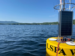 |
|||||||||
| Jul 09, 2024, 12:50 pm | Jan 08, 2025, 03:35 pm | Milton Reservoir, Weld County, CO, USA | NALMS Secchi Dip-In | 40.228700 | -104.639000 | lake/pond/reservoir | selundt | 12 entries | Optional/Pending | Web | No Ice | None | ||||||||||
| Jun 26, 2024, 03:20 pm | Jun 28, 2024, 04:21 pm | Hitchcock Lake, New Haven County, CT, USA | CT-9-11 | Hitchcock lake | 41.567669 | -72.953434 | lake/pond/reservoir | HitchcockNorth | 7 entries | Optional/Pending | Web | No Ice | None | |||||||||
| Jun 26, 2024, 03:20 pm | Jun 28, 2024, 04:09 pm | Hitchcock Lake, New Haven County, CT, USA | CT-9-11 | Hitchcock lake | 41.567669 | -72.953434 | lake/pond/reservoir | HitchcockNorth | 7 entries | Optional/Pending | Web | No Ice | None | |||||||||
| Jun 15, 2024, 12:15 pm | Sep 26, 2024, 03:55 pm | Lake Wallenpaupack, Pike County, PA, USA | North Colony Cove | PA-103-46 | PLEON: Wallenpaupack Citizen Science Program | 41.420780 | -75.206500 | lake/pond/reservoir | LindaT | 5 entries | Completed | iOS 2.4.2 | No Ice | None | ||||||||
| Jun 08, 2024, 12:05 pm | Jun 21, 2024, 02:35 pm | Hitchcock Lake, New Haven County, CT, USA | CT-9-11 | Hitchcock lake | 41.567669 | -72.953434 | lake/pond/reservoir | HitchcockNorth | 7 entries | Optional/Pending | Web | No Ice | None | |||||||||
| Jun 01, 2024, 03:45 pm | Jun 21, 2024, 01:39 pm | Hitchcock Lake, New Haven County, CT, USA | CT-9-11 | Hitchcock lake | 41.567669 | -72.953434 | lake/pond/reservoir | HitchcockNorth | 8 entries | Optional/Pending | Web | No Ice | None | |||||||||
| Jun 01, 2024, 02:11 pm | Sep 26, 2024, 03:47 pm | Lake Wallenpaupack, Pike County, PA, USA | North Colony Cove | PA-103-46 | PLEON: Wallenpaupack Citizen Science Program | 41.420780 | -75.206500 | lake/pond/reservoir | LindaT | Completed | iOS 2.4.2 | No Ice | None | |||||||||
| Jun 01, 2024, 12:50 pm | Jun 02, 2024, 03:48 pm | Lake Wallenpaupack, Pike County, PA, USA | SHM | PA-103-26 | PLEON: Wallenpaupack Citizen Science Program | 41.439818 | -75.211476 | lake/pond/reservoir | rick | 5 entries | Completed | Web | No Ice | None | ||||||||
| Apr 29, 2024, 10:25 am | Apr 29, 2024, 12:52 pm | Long Pond, New London County, CT, USA | Long-DH | CT-11-19 | Connecticut Lake Watch | 41.440045 | -71.945039 | lake/pond/reservoir | megdvm92 | 7 entries | Completed | iOS 2.4.2 | No Ice | None | ||||||||
| Feb 27, 2024, 12:01 pm | Jul 26, 2023, 06:14 pm | West Thompson Lake, Windham County, CT, USA | WestThompson-Mid | CT-15-17 | Connecticut Lake Watch | 41.954760 | -71.903160 | lake/pond/reservoir | mwitham52 | 9 entries | Completed | Web | No Ice | None | ||||||||
| Feb 27, 2024, 12:01 pm | Jul 10, 2023, 10:47 am | West Thompson Lake, Windham County, CT, USA | WestThompson-DH | CT-15-18 | Connecticut Lake Watch | 41.948040 | -71.902460 | lake/pond/reservoir | mwitham52 | 8 entries | Completed | Web | No Ice | None | ||||||||
| Feb 27, 2024, 12:01 pm | Jun 11, 2023, 09:40 am | Bush Pond, New London County, CT, USA, 41.441620, -71.942506 | BUSH-SouthCove | CT-11-20 | Connecticut Lake Watch | 41.438110 | -71.943040 | lake/pond/reservoir | megdvm92 | 9 entries | Completed | Web | No Ice | None | ||||||||
| Feb 24, 2024, 06:48 pm | Feb 24, 2024, 06:51 pm | Silver Lake, Ramsey County, MN, USA, 45.0443273, -93.2236891 | MN-123-1 | MN-123-1 | Silver Lake Ice Data | 45.046063 | -93.223020 | lake/pond/reservoir | ice covering about 97% of the lake; open areas along the shoreline | SAware | 4 entries | Optional/Pending | Web | Ice Thickness | 2.50 | 0.00 | Other: cloudy |
Photo 1 Photo 2 Photo 3 Photo 4 |
||||
| Feb 21, 2024, 07:56 pm | Feb 21, 2024, 08:01 pm | Silver Lake, Ramsey County, MN, USA, 45.0443273, -93.2236891 | MN-123-1 | MN-123-1 | Silver Lake Ice Data | 45.046063 | -93.223020 | lake/pond/reservoir | SAware | 4 entries | Optional/Pending | Web | Ice Thickness | 10.15 | Other: Cloudy |
Photo 1 Photo 2 Photo 3 Photo 4 |
||||||
| Feb 13, 2024, 08:00 pm | Feb 13, 2024, 08:07 pm | Silver Lake, Ramsey County, MN, USA, 45.0443273, -93.2236891 | MN-123-1 | MN-123-1 | Silver Lake Ice Data | 45.046063 | -93.223020 | lake/pond/reservoir | trace of snow, no ice thickness measurement taken as shoreline ice was mostly melted | SAware | 4 entries | Optional/Pending | Web | Percent Lake Cover | 98.0 |
Photo 1 Photo 2 Photo 3 Photo 4 |
||||||
| Feb 03, 2024, 08:40 pm | Feb 03, 2024, 08:44 pm | Silver Lake, Ramsey County, MN, USA, 45.0443273, -93.2236891 | MN-123-1 | MN-123-1 | Silver Lake Ice Data | 45.046063 | -93.223020 | lake/pond/reservoir | 100% | SAware | 5 entries | Optional/Pending | Web | Ice Thickness | 23.50 | 0.00 | Clear Ice |
Photo 1 Photo 2 Photo 3 Photo 4 |
||||
| Jan 28, 2024, 01:10 pm | Feb 02, 2024, 11:22 pm | Silver Lake, Ramsey County, MN, USA, 45.0443273, -93.2236891 | MN-123-1 | MN-123-1 | Silver Lake Ice Data | 45.046063 | -93.223020 | lake/pond/reservoir | SAware | 5 entries | Optional/Pending | Web | Ice Thickness | 28.00 | 0.00 | Clear Ice |
Photo 1 Photo 2 Photo 3 Photo 4 |
|||||
| Jan 21, 2024, 01:45 pm | Jan 21, 2024, 03:27 pm | Silver Lake, Ramsey County, MN, USA, 45.0443273, -93.2236891 | MN-123-1 | MN-123-1 | Silver Lake Ice Data | 45.046063 | -93.223020 | lake/pond/reservoir | SAware | 4 entries | Optional/Pending | Web | Ice Thickness | 30.48 | 0.00 | Clear Ice |
Photo 1 Photo 2 Photo 3 Photo 4 |
|||||
| Jan 13, 2024, 11:05 am | Jan 14, 2024, 11:04 pm | Silver Lake, Ramsey County, MN, USA, 45.0443273, -93.2236891 | MN-123-1 | MN-123-1 | Silver Lake Ice Data | 45.046063 | -93.223020 | lake/pond/reservoir | SAware | 5 entries | Optional/Pending | Web | Ice Thickness | 6.99 | 0.64 | Clear Ice |
Photo 1 Photo 2 Photo 3 Photo 4 |
|||||
| Jan 06, 2024, 03:20 pm | Jan 13, 2024, 12:15 am | Silver Lake, Ramsey County, MN, USA, 45.0443273, -93.2236891 | MN-123-1 | MN-123-1 | Silver Lake Ice Data | 45.046063 | -93.223020 | lake/pond/reservoir | SAware | 5 entries | Optional/Pending | Web | Percent Lake Cover | 80.0 |
Photo 1 Photo 2 Photo 3 Photo 4 |
|||||||
| Dec 28, 2023, 01:45 pm | Dec 28, 2023, 03:11 pm | Silver Lake, Ramsey County, MN, USA, 45.0443273, -93.2236891 | MN-123-1 | MN-123-1 | Silver Lake Ice Data | 45.046063 | -93.223020 | lake/pond/reservoir | Very thin ice | SAware | 5 entries | Optional/Pending | Web | Percent Lake Cover | 20.0 |
Photo 1 Photo 2 Photo 3 Photo 4 |
||||||
| Dec 20, 2023, 10:00 am | Dec 20, 2023, 10:52 am | Silver Lake, Ramsey County, MN, USA, 45.0443273, -93.2236891 | MN-123-2 | MN-123-2 | Silver Lake Ice Data | 45.045874 | -93.225195 | lake/pond/reservoir | SAware | 5 entries | Optional/Pending | Web | Ice Thickness | 9.50 | 0.00 | Clear Ice | None | |||||
| Dec 20, 2023, 09:55 am | Dec 20, 2023, 10:50 am | Silver Lake, Ramsey County, MN, USA, 45.0443273, -93.2236891 | MN-123-1 | MN-123-1 | Silver Lake Ice Data | 45.046063 | -93.223020 | lake/pond/reservoir | SAware | 5 entries | Optional/Pending | Web | Ice Thickness | 9.50 | 0.00 | Clear Ice | None | |||||
| Dec 09, 2023, 03:15 pm | Dec 10, 2023, 02:23 pm | Silver Lake, Ramsey County, MN, USA, 45.0443273, -93.2236891 | MN-123-2 | MN-123-2 | Silver Lake Ice Data | 45.045874 | -93.225195 | lake/pond/reservoir | ice melted on shore - measured ice from pieces near shore | SAware | 4 entries | Completed | Web | Ice Thickness | 4.00 | Clear Ice | None | |||||
| Dec 09, 2023, 02:59 pm | Dec 10, 2023, 02:40 pm | Silver Lake, Ramsey County, MN, USA, 45.0443273, -93.2236891 | MN-123-1 | MN-123-1 | Silver Lake Ice Data | 45.046063 | -93.223020 | lake/pond/reservoir | photos couldn't be submitted - 'entity too large' message | SAware | 5 entries | Completed | Web | Ice On | None | |||||||
| Dec 01, 2023, 11:35 am | Dec 03, 2023, 08:06 am | Silver Lake, Ramsey County, MN, USA, 45.0443273, -93.2236891 | MN-123-2 | MN-123-2 | Silver Lake Ice Data | 45.045874 | -93.225195 | lake/pond/reservoir | SAware | 5 entries | Completed | Web | Ice Thickness | 6.00 | Clear Ice | None | ||||||
| Dec 01, 2023, 11:30 am | Dec 03, 2023, 07:41 am | Silver Lake, Ramsey County, MN, USA, 45.0443273, -93.2236891 | MN-123-1 | MN-123-1 | Silver Lake Ice Data | 45.046060 | -93.223020 | lake/pond/reservoir | tried under 10MB jpegs and got message 'file too large' | SAware | Completed | Web | Ice On | None | ||||||||
| Nov 25, 2023, 02:30 pm | Nov 26, 2023, 01:42 pm | Silver Lake, Ramsey County, MN, USA, 45.0443273, -93.2236891 | MN-123-1 | MN-123-1 | Silver Lake Ice Data | 45.046060 | -93.223020 | lake/pond/reservoir | SAware | 5 entries | Completed | Web | Percent Lake Cover | 50.0 |
Photo 1 Photo 2 Photo 3 Photo 4 |
|||||||
| Nov 25, 2023, 02:25 pm | Nov 26, 2023, 01:45 pm | Silver Lake, Ramsey County, MN, USA, 45.0443273, -93.2236891 | MN-123-2 | MN-123-2 | Silver Lake Ice Data | 45.045870 | -93.225190 | lake/pond/reservoir | SAware | 3 entries | Completed | Web | Percent Lake Cover | 50.0 |
Photo 1 Photo 2 |
|||||||
| Oct 07, 2023, 09:43 am | Oct 07, 2023, 09:48 am | Lake Wallenpaupack, Pike County, PA, USA | North Colony Cove | PLEON: Wallenpaupack Citizen Science Program | 41.421506 | -75.204802 | lake/pond/reservoir | none | LindaT | 5 entries | Completed | iOS 2.4.2 | No Ice | None | ||||||||
| Sep 05, 2023, 10:04 am | Sep 05, 2023, 12:52 pm | West Thompson Lake, Windham County, CT, USA | WestThompson-Mid | CT-15-17 | Connecticut Lake Watch | 41.954760 | -71.903160 | lake/pond/reservoir | mwitham52 | 10 entries | Completed | Web | No Ice | None | ||||||||
| Aug 12, 2023, 12:36 pm | Aug 12, 2023, 01:02 pm | West Thompson Lake, Windham County, CT, USA | 41.954300 | -71.903600 | lake/pond/reservoir | mwitham52 | 9 entries | Not Available | Web | No Ice | None | |||||||||||
| Jul 09, 2023, 10:42 am | Jul 09, 2023, 10:48 am | Bush Pond, New London County, CT, USA, 41.441620, -71.942506 | BUSH-DH | CT-11-8 | Connecticut Lake Watch | 41.439770 | -71.942420 | lake/pond/reservoir | megdvm92 | 9 entries | Completed | Web | No Ice | None | ||||||||
| Jul 09, 2023, 10:42 am | Jul 09, 2023, 10:48 am | Bush Pond, New London County, CT, USA, 41.441620, -71.942506 | BUSH-DH | CT-11-8 | Connecticut Lake Watch | 41.439770 | -71.942420 | lake/pond/reservoir | megdvm92 | 9 entries | Completed | Web | No Ice | None | ||||||||
| Jul 09, 2023, 07:52 am | Jul 09, 2023, 07:59 am | Lake Wallenpaupack, Pike County, PA, USA | BSL | PA-103-38 | PLEON: Wallenpaupack Citizen Science Program | 41.440538 | -75.219471 | lake/pond/reservoir | lakelady | 5 entries | Completed | Web | No Ice | None | ||||||||
| Jul 03, 2023, 12:00 pm | Jul 04, 2023, 10:28 am | Lake Wallenpaupack, Pike County, PA, USA | BSL | PA-103-38 | PLEON: Wallenpaupack Citizen Science Program | 41.440538 | -75.219471 | lake/pond/reservoir | lakelady | 5 entries | Completed | Web | No Ice | None | ||||||||
| Jun 20, 2023, 11:12 am | Jun 20, 2023, 11:13 am | Long Pond, New London County, CT, USA | Long-Culv | CT-11-6 | Connecticut Lake Watch | 41.441130 | -71.945060 | lake/pond/reservoir | megdvm92 | 7 entries | Completed | iOS 2.4.1 | No Ice | None | ||||||||
| Jun 20, 2023, 11:01 am | Jun 20, 2023, 11:02 am | Long Pond, New London County, CT, USA | Long-Out | CT-11-7 | Connecticut Lake Watch | 41.439450 | -71.945870 | lake/pond/reservoir | megdvm92 | 7 entries | Completed | iOS 2.4.1 | No Ice | None | ||||||||
| Jun 17, 2023, 03:15 pm | Jun 17, 2023, 03:19 pm | Lake Wallenpaupack, Pike County, PA, USA | TKL | PA-103-46 | PLEON: Wallenpaupack Citizen Science Program | 41.420780 | -75.206500 | lake/pond/reservoir | LindaT | 5 entries | Completed | Web | No Ice | None | ||||||||
| Jun 11, 2023, 11:05 am | Jun 11, 2023, 11:06 am | Long Pond, New London County, CT, USA | Long-Culv | CT-11-6 | Connecticut Lake Watch | 41.441130 | -71.945060 | lake/pond/reservoir | megdvm92 | 7 entries | Completed | iOS 2.4.1 | No Ice | None | ||||||||
| Jun 11, 2023, 10:52 am | Jun 11, 2023, 10:53 am | Long Pond, New London County, CT, USA | Long-Out | CT-11-7 | Connecticut Lake Watch | 41.439450 | -71.945870 | lake/pond/reservoir | megdvm92 | 7 entries | Completed | iOS 2.4.1 | No Ice | None | ||||||||
| Jun 10, 2023, 02:55 pm | Jun 14, 2023, 01:45 pm | Lake Wallenpaupack, Pike County, PA, USA | BSL | PA-103-38 | PLEON: Wallenpaupack Citizen Science Program | 41.440538 | -75.219471 | lake/pond/reservoir | lakelady | 5 entries | Completed | Web | No Ice | None | ||||||||
| May 31, 2023, 02:54 pm | May 31, 2023, 02:55 pm | Long Pond, New London County, CT, USA | Long-Culv | CT-11-6 | Connecticut Lake Watch | 41.441130 | -71.945060 | lake/pond/reservoir | megdvm92 | 7 entries | Completed | iOS 2.4.1 | No Ice | None | ||||||||
| May 31, 2023, 02:44 pm | May 31, 2023, 02:46 pm | Long Pond, New London County, CT, USA | Long-Out | CT-11-7 | Connecticut Lake Watch | 41.439450 | -71.945870 | lake/pond/reservoir | megdvm92 | 7 entries | Completed | iOS 2.4.1 | No Ice | None | ||||||||
| May 31, 2023, 02:30 pm | Jun 01, 2023, 05:54 am | Bush Pond, New London County, CT, USA, 41.441620, -71.942506 | BUSH-DH | CT-11-8 | Connecticut Lake Watch | 41.439770 | -71.942420 | lake/pond/reservoir | megdvm92 | Completed | iOS 2.4.1 | No Ice | None | |||||||||
| May 16, 2023, 11:54 am | May 16, 2023, 11:55 am | Bush Pond, New London County, CT, USA, 41.441620, -71.942506 | BUSH-DH | CT-11-8 | Connecticut Lake Watch | 41.439770 | -71.942420 | lake/pond/reservoir | megdvm92 | 7 entries | Completed | iOS 2.4.1 | No Ice | None | ||||||||
| May 16, 2023, 11:41 am | May 16, 2023, 11:42 am | Long Pond, New London County, CT, USA | Long-Culv | CT-11-6 | Connecticut Lake Watch | 41.441130 | -71.945060 | lake/pond/reservoir | megdvm92 | 7 entries | Completed | iOS 2.4.1 | No Ice | None | ||||||||
| May 16, 2023, 11:31 am | May 16, 2023, 11:33 am | Long Pond, New London County, CT, USA | Long-Out | CT-11-7 | Connecticut Lake Watch | 41.439465 | -71.945902 | lake/pond/reservoir | megdvm92 | 14 entries | Completed | iOS 2.4.1 | No Ice | None | ||||||||
| May 11, 2023, 07:38 am | May 11, 2023, 07:43 am | Long Pond, New London County, CT, USA | Long-Out | CT-11-7 | Connecticut Lake Watch | 41.439450 | -71.945870 | lake/pond/reservoir | megdvm92 | 9 entries | Completed | iOS 2.4.1 | No Ice | None | ||||||||
| May 06, 2023, 01:15 pm | May 11, 2023, 07:52 am | Bush Pond, New London County, CT, USA, 41.441620, -71.942506 | BUSH-DH | CT-11-8 | Connecticut Lake Watch | 41.439770 | -71.942420 | lake/pond/reservoir | megdvm92 | 8 entries | Completed | iOS 2.4.1 | No Ice | None | ||||||||
| Apr 13, 2023, 12:58 pm | Apr 13, 2023, 01:00 pm | Silver Lake, Ramsey County, MN, USA, 45.0443273, -93.2236891 | Silver Lake Ice Data | 45.046313 | -93.225242 | lake/pond/reservoir | Majority of ice is gone. Some patches near the island and the south end of the lake. | aidantonidandel | 2 entries | Completed | iOS 2.4.1 | Percent Lake Cover | 20.0 | None | ||||||||
| Apr 11, 2023, 12:00 am | Apr 11, 2023, 04:59 pm | Halfmoon Lake, Belknap County, NH, USA | NALMS Secchi Dip-In | 43.395027 | -71.226197 | lake/pond/reservoir | GLEONE | Optional/Pending | iOS 2.2.5 | Ice Off | None | |||||||||||
| Apr 06, 2023, 12:06 pm | Apr 06, 2023, 12:08 pm | Silver Lake, Ramsey County, MN, USA, 45.0443273, -93.2236891 | Silver Lake Ice Data | 45.045824 | -93.225542 | lake/pond/reservoir | Still some evidence of winterkill, however, most of the bluegills have been removed. | aidantonidandel | 2 entries | Completed | iOS 2.4.1 | Percent Lake Cover | 95.0 |  |
||||||||
| Apr 04, 2023, 12:50 pm | Apr 04, 2023, 12:54 pm | Silver Lake, Ramsey County, MN, USA, 45.0443273, -93.2236891 | Silver Lake Ice Data | 45.046012 | -93.225325 | lake/pond/reservoir | Ice is not safe to walk anymore. There is also evidence of winterkill. A lot of dead bluegills in the shallows. | aidantonidandel | 2 entries | Completed | iOS 2.4.1 | Percent Lake Cover | 95.0 | None | ||||||||
| Mar 30, 2023, 11:52 am | Mar 30, 2023, 11:54 am | Silver Lake, Ramsey County, MN, USA, 45.0443273, -93.2236891 | Silver Lake Ice Data | 45.047178 | -93.225513 | lake/pond/reservoir | Shoreline starting to recede. Likely 1 or 2 weeks left until it is unsafe to walk on. | aidantonidandel | 2 entries | Completed | iOS 2.4.1 | Ice Thickness | 39.37 | 0.00 | None | |||||||
| Mar 30, 2023, 10:02 am | Mar 30, 2023, 10:03 am | Silver Lake, Ramsey County, MN, USA, 45.0443273, -93.2236891 | MN-123-2 | MN-123-2 | Silver Lake Ice Data | 45.046791 | -93.224487 | lake/pond/reservoir | kris20 | 2 entries | Completed | iOS 2.2.6 | Ice Thickness | 6.99 | None | |||||||
| Mar 28, 2023, 03:07 pm | Mar 28, 2023, 03:09 pm | Silver Lake, Ramsey County, MN, USA, 45.0443273, -93.2236891 | Silver Lake Ice Data | 45.047205 | -93.225461 | lake/pond/reservoir | Ice starting to recede around shoreline. some open water patches near shoreline as well. | aidantonidandel | 2 entries | Completed | iOS 2.4.1 | Ice Thickness | 41.91 | 0.00 | None | |||||||
| Mar 23, 2023, 02:01 pm | Mar 23, 2023, 02:02 pm | Silver Lake, Ramsey County, MN, USA, 45.0443273, -93.2236891 | Silver Lake Ice Data | 45.047241 | -93.225488 | lake/pond/reservoir | No snow on top of ice. Ice starting to go on a downward trend because of air temp getting warmer | aidantonidandel | 2 entries | Completed | iOS 2.4.1 | Ice Thickness | 112.90 | 0.00 | Clear Ice | None | ||||||
| Mar 21, 2023, 01:25 pm | Mar 21, 2023, 01:26 pm | Silver Lake, Ramsey County, MN, USA, 45.0443273, -93.2236891 | Silver Lake Ice Data | 45.047434 | -93.225394 | lake/pond/reservoir | aidantonidandel | 2 entries | Completed | iOS 2.4.1 | Ice Thickness | 45.09 | 5.08 | None | ||||||||
| Mar 16, 2023, 01:49 pm | Mar 16, 2023, 01:57 pm | Silver Lake, Ramsey County, MN, USA, 45.0443273, -93.2236891 | Silver Lake Ice Data | 44.972627 | -93.235281 | lake/pond/reservoir | Slush layer on top of ice. Created by rains | aidantonidandel | 3 entries | Completed | iOS 2.4.1 | Ice Thickness | 45.72 | 8.89 | None | |||||||
| Mar 14, 2023, 02:06 pm | Mar 14, 2023, 02:07 pm | Silver Lake, Ramsey County, MN, USA, 45.0443273, -93.2236891 | Silver Lake Ice Data | 45.047915 | -93.222666 | lake/pond/reservoir | Lots of snow on top of ice. more than usual. | aidantonidandel | 2 entries | Completed | iOS 2.4.1 | Ice Thickness | 115.49 | 32.26 | None | |||||||
| Mar 02, 2023, 02:44 pm | Mar 02, 2023, 02:45 pm | Silver Lake, Ramsey County, MN, USA, 45.0443273, -93.2236891 | Silver Lake Ice Data | 45.045748 | -93.225209 | lake/pond/reservoir | aidantonidandel | 2 entries | Completed | iOS 2.4.1 | Ice Thickness | 113.54 | 22.58 | None | ||||||||
| Feb 28, 2023, 03:00 pm | Feb 28, 2023, 03:00 pm | Silver Lake, Ramsey County, MN, USA, 45.0443273, -93.2236891 | Silver Lake Ice Data | 45.047260 | -93.225507 | lake/pond/reservoir | Lots of slush. | aidantonidandel | 2 entries | Completed | iOS 2.4.1 | Ice Thickness | 109.68 | 19.35 | None | |||||||
| Feb 21, 2023, 02:43 pm | Feb 21, 2023, 02:45 pm | Silver Lake, Ramsey County, MN, USA, 45.0443273, -93.2236891 | Silver Lake Ice Data | 45.047353 | -93.225452 | lake/pond/reservoir | More snow on top of ice than usual. | aidantonidandel | 2 entries | Completed | iOS 2.4.1 | Ice Thickness | 98.40 | 25.81 | None | |||||||
| Feb 16, 2023, 02:25 pm | Feb 16, 2023, 02:28 pm | Silver Lake, Ramsey County, MN, USA, 45.0443273, -93.2236891 | Silver Lake Ice Data | 45.047332 | -93.225460 | lake/pond/reservoir | Very clear ice. No snow on top of the ice. | aidantonidandel | 2 entries | Completed | iOS 2.4.1 | Ice Thickness | 39.12 | 0.00 | Clear Ice | None | ||||||
| Feb 14, 2023, 01:05 pm | Feb 14, 2023, 01:13 pm | Silver Lake, Ramsey County, MN, USA, 45.0443273, -93.2236891 | Silver Lake Ice Data | 45.047211 | -93.225546 | lake/pond/reservoir | aidantonidandel | 3 entries | Completed | iOS 2.4.1 | Ice Thickness | 101.30 | 12.90 | None | ||||||||
| Feb 12, 2023, 10:49 am | Feb 12, 2023, 10:57 am | Silver Lake, Ramsey County, MN, USA, 45.0443273, -93.2236891 | Silver Lake at Silverwood Park Monitoring | 45.045712 | -93.225034 | lake/pond/reservoir | ice depth greater than drill bit length | mcgearyk | 9 entries | Optional/Pending | iOS 2.4.1 | Ice Thickness | 30.48 | 2.54 | Clear Ice | None |
Algae Entries (showing 100 of 1397 results)
| Edit | Date/Time Recorded | Waterbody | Site Name | Site ID | Environment | Algae Type | Description | Dot Spacing (cm) | Visual Scale | Transparency (m) | Bloom Extent | Sample Collected? |
Sample ID | Recreational Suitability |
Physical Condition |
Photo | ||||||||||||
|---|---|---|---|---|---|---|---|---|---|---|---|---|---|---|---|---|---|---|---|---|---|---|---|---|---|---|---|---|
| Jun 23, 2026, 05:08 pm | Jun 23, 2026, 05:16 pm | Gulf St Vincent, AUS, -34.919754, 138.490906 | Glenelg Jetty | AUS-0-4 | FOSVG Secchi Project SA | -34.978151 | 138.507504 | other water | Johanna | 8 entries | Completed | Web | Near Shore | Unknown: | On the surface: NA, Nothing; In the water: NA, Nothing; | 0-0 | No bloom noted | No | 1: Beautiful, no aesthetic problems due to algae | 2: Not quite crystal clear – a little algae |
Photo 1 Photo 2 |
|||||||
| Jun 20, 2026, 04:24 pm | Jun 20, 2026, 04:27 pm | Gulf St Vincent, AUS, -34.919754, 138.490906 | Henley Beach Jetty | AUS-0-1 | FOSVG Secchi Project SA | -34.919800 | 138.490900 | other water | peter957 | 2 entries | Completed | Web | Near Shore | 0-0 | No |  |
||||||||||||
| Jun 18, 2026, 09:10 am | Jun 18, 2026, 09:12 am | Gulf St Vincent, AUS, -34.919754, 138.490906 | Henley Beach Jetty | AUS-0-1 | FOSVG Secchi Project SA | -34.919800 | 138.490900 | other water | FOSVGtu | Completed | Web | Near Shore | 0-0 | No |  |
|||||||||||||
| Jun 17, 2026, 10:24 pm | Jun 17, 2026, 10:32 pm | Gulf St Vincent, AUS, -34.919754, 138.490906 | Glenelg Jetty | AUS-0-4 | FOSVG Secchi Project SA | -34.978151 | 138.507504 | other water | Johanna | 7 entries | Completed | Web | Near Shore | On the surface: NA, Nothing; In the water: NA, Nothing; | > 2 | No | 1: Beautiful, no aesthetic problems due to algae | 1: Crystal clear water |
Photo 1 Photo 2 |
|||||||||
| Jun 17, 2026, 03:33 pm | Jun 17, 2026, 03:35 pm | Gulf St Vincent, AUS, -34.919754, 138.490906 | Henley Beach Jetty | AUS-0-1 | FOSVG Secchi Project SA | -34.919800 | 138.490900 | other water | pjames0123 | 2 entries | Completed | Web | Near Shore | 0-0 | No |  |
||||||||||||
| Jun 14, 2026, 09:15 am | Jun 14, 2026, 09:24 am | Lake Wallenpaupack, Pike County, PA, USA | PA-103-21 | 41.408956 | -75.239216 | lake/pond/reservoir | mentalfloss | 7 entries | Not Available | Web | Near Shore | On the surface: NA, Nothing; In the water: NA, Nothing; | 0-0 | No bloom noted | Yes | BNS 1 | None | |||||||||||
| Jun 12, 2026, 04:49 pm | Jun 12, 2026, 04:51 pm | Gulf St Vincent, AUS, -34.919754, 138.490906 | Henley Beach Jetty | AUS-0-1 | FOSVG Secchi Project SA | -34.919800 | 138.490900 | other water | FOSVGtu | Completed | Web | Near Shore | 0-0 | No |  |
|||||||||||||
| Jun 09, 2026, 11:22 am | Jun 09, 2026, 11:28 am | Lake Wallenpaupack, Pike County, PA, USA | PA-103-21 | 41.408956 | -75.239216 | lake/pond/reservoir | mentalfloss | 7 entries | Not Available | Web | Near Shore | On the surface: NA, Nothing; | > 2 | No bloom noted | No | 1: Beautiful, no aesthetic problems due to algae | None | |||||||||||
| Jun 09, 2026, 02:50 pm | Jun 09, 2026, 02:54 pm | Gulf St Vincent, AUS, -34.919754, 138.490906 | Glenelg Jetty | AUS-0-4 | FOSVG Secchi Project SA | -34.978151 | 138.507504 | other water | Johanna | 8 entries | Completed | Web | Near Shore | On the surface: NA, Nothing; In the water: NA, Nothing; | > 2 | No | None | |||||||||||
| Jun 07, 2026, 08:36 am | Jun 07, 2026, 08:44 am | Lake Wallenpaupack, Pike County, PA, USA | BNS | PA-103-21 | 41.408956 | -75.239216 | lake/pond/reservoir | brownish hue typical for this site | mentalfloss | 7 entries | Not Available | Web | Near Shore | On the surface: NA, Nothing; In the water: NA, Nothing; | > 2 | No | 1: Beautiful, no aesthetic problems due to algae | None | ||||||||||
| Jun 07, 2026, 01:13 pm | Jun 07, 2026, 01:14 pm | Gulf St Vincent, AUS, -34.919754, 138.490906 | Henley Beach Jetty | AUS-0-1 | FOSVG Secchi Project SA | -34.919800 | 138.490900 | other water | peter957 | 6 entries | Completed | iOS 2.4.4 | Near Shore | No |  |
|||||||||||||
| Jun 05, 2026, 05:58 am | Jun 07, 2026, 06:10 am | Gulf St Vincent, AUS, -34.919754, 138.490906 | Glenelg Jetty | AUS-0-4 | FOSVG Secchi Project SA | -34.978151 | 138.507504 | other water | Johanna | 8 entries | Completed | Web | Near Shore | On the surface: NA, Nothing; In the water: NA, Nothing; | > 2 | No |  |
|||||||||||
| Jun 04, 2026, 12:20 pm | Jun 04, 2026, 12:20 pm | Gulf St Vincent, AUS, -34.919754, 138.490906 | Henley Beach Jetty | AUS-0-1 | FOSVG Secchi Project SA | -34.919800 | 138.490900 | other water | peter957 | 6 entries | Completed | iOS 2.4.4 | Near Shore | No |  |
|||||||||||||
| May 24, 2026, 03:23 pm | May 24, 2026, 03:24 pm | Gulf St Vincent, AUS, -34.919754, 138.490906 | Henley Beach Jetty | AUS-0-1 | FOSVG Secchi Project SA | -34.919800 | 138.490900 | other water | peter957 | 6 entries | Completed | iOS 2.4.4 | Near Shore | No | None | |||||||||||||
| May 21, 2026, 12:40 pm | May 21, 2026, 12:50 pm | Gulf St Vincent, AUS, -34.919754, 138.490906 | FOSVG Secchi Project SA | -34.980556 | 138.508076 | other water | Johanna | 7 entries | Completed | Android 2.5.10 | Near Shore | No | None | |||||||||||||||
| May 19, 2026, 12:38 pm | May 19, 2026, 12:39 pm | Gulf St Vincent, AUS, -34.919754, 138.490906 | Henley Beach Jetty | AUS-0-1 | FOSVG Secchi Project SA | -34.919800 | 138.490900 | other water | peter957 | 6 entries | Completed | iOS 2.4.4 | Near Shore | No | None | |||||||||||||
| May 14, 2026, 12:57 pm | May 19, 2026, 06:33 pm | Gulf St Vincent, AUS, -34.919754, 138.490906 | FOSVG Secchi Project SA | -34.902623 | 138.495583 | other water | diver257a | 11 entries | Completed | iOS 2.4.4 | Near Shore | No | None | |||||||||||||||
| May 12, 2026, 12:45 pm | May 13, 2026, 04:49 pm | Gulf St Vincent, AUS, -34.919754, 138.490906 | FOSVG Secchi Project SA | -34.980568 | 138.508065 | other water | Johanna | 7 entries | Completed | Android 2.5.10 | Near Shore | On the surface: NA, Nothing; In the water: NA, Nothing; | > 2 | No bloom noted | No | 2: Minor aesthetic problems | 1: Crystal clear water | None | ||||||||||
| May 07, 2026, 09:59 pm | May 07, 2026, 10:19 pm | Gulf St Vincent, AUS, -34.919754, 138.490906 | Glenelg Jetty | AUS-0-4 | FOSVG Secchi Project SA | -34.978151 | 138.507504 | other water | A number of different micro algal observed under the microscope with the water sample collects | Johanna | 6 entries | Completed | Web | Near Shore | Unknown: Not trained enough to ID but can recognise eg diatiom and dinoflagellates (both present) | On the surface: Brown, Other: ; In the water: Brown, Other: ; | 0.15-0.3 | No |  |
|||||||||
| Apr 27, 2026, 10:44 am | Apr 27, 2026, 10:45 am | Kirby Lake, Taylor County, TX, USA | NALMS Secchi Dip-In | 32.430320 | -99.791183 | lake/pond/reservoir | SJESeagles | 8 entries | Optional/Pending | iOS 2.4.4 | Near Shore | On the surface: NA, Nothing; In the water: NA, Nothing; | 0-0.15 | No | None | |||||||||||||
| Apr 09, 2026, 10:08 am | Apr 09, 2026, 10:09 am | Gulf St Vincent, AUS, -34.919754, 138.490906 | AUS-0-1 | FOSVG Secchi Project SA | -34.919800 | 138.490900 | other water | FOSVGtu | 5 entries | Completed | iOS 2.4.4 | Near Shore | No | None | ||||||||||||||
| Apr 09, 2026, 10:04 am | Apr 09, 2026, 10:05 am | Gulf St Vincent, AUS, -34.919754, 138.490906 | AUS-0-1 | FOSVG Secchi Project SA | -34.919800 | 138.490900 | other water | FOSVGtu | Completed | iOS 2.4.4 | Near Shore | No | None | |||||||||||||||
| Apr 05, 2026, 09:50 am | Apr 05, 2026, 09:59 am | Gulf St Vincent, AUS, -34.919754, 138.490906 | undefined | AUS-0-2 | FOSVG Secchi Project SA | -35.040276 | 138.513147 | other water | MichaelA | 7 entries | Completed | Android 2.5.10 | Near Shore | 1-2 | No | 1: Beautiful, no aesthetic problems due to algae | 1: Crystal clear water | None | ||||||||||
| Apr 01, 2026, 08:22 am | Apr 01, 2026, 08:23 am | Gulf St Vincent, AUS, -34.919754, 138.490906 | AUS-0-1 | FOSVG Secchi Project SA | -34.919800 | 138.490900 | other water | FOSVGtu | Completed | iOS 2.4.4 | Near Shore | No | None | |||||||||||||||
| Apr 01, 2026, 05:21 am | Apr 01, 2026, 05:22 am | Gulf St Vincent, AUS, -34.919754, 138.490906 | undefined | AUS-0-2 | FOSVG Secchi Project SA | -35.040276 | 138.513147 | other water | MichaelA | Completed | Android 2.5.10 | Near Shore | No | None | ||||||||||||||
| Apr 01, 2026, 05:10 am | Apr 01, 2026, 05:16 am | Gulf St Vincent, AUS, -34.919754, 138.490906 | undefined | AUS-0-2 | FOSVG Secchi Project SA | -35.040276 | 138.513147 | other water | hu | MichaelA | 7 entries | Completed | Android 2.5.10 | Open Water | No | None | ||||||||||||
| Apr 01, 2026, 05:10 am | Apr 01, 2026, 05:16 am | Gulf St Vincent, AUS, -34.919754, 138.490906 | undefined | AUS-0-2 | FOSVG Secchi Project SA | -35.040276 | 138.513147 | other water | hu | MichaelA | 7 entries | Completed | Android 2.5.10 | Open Water | No | None | ||||||||||||
| Apr 01, 2026, 02:59 am | Apr 01, 2026, 03:04 am | Gulf St Vincent, AUS, -34.919754, 138.490906 | undefined | AUS-0-2 | FOSVG Secchi Project SA | -35.040276 | 138.513147 | other water | 5 | MichaelA | 8 entries | Completed | Android 2.5.10 | Near Shore | On the surface: No color, Other: ; In the water: No color, Other: ; | > 2 | No bloom noted | No | 1: Beautiful, no aesthetic problems due to algae | 1: Crystal clear water | None | |||||||
| Mar 31, 2026, 05:18 am | Mar 31, 2026, 05:19 am | Gulf St Vincent, AUS, -34.919754, 138.490906 | AUS-0-1 | FOSVG Secchi Project SA | -34.919800 | 138.490900 | other water | FOSVGtu | Completed | iOS 2.4.4 | Near Shore | No | None | |||||||||||||||
| Mar 29, 2026, 10:03 am | Mar 29, 2026, 10:10 am | Gulf St Vincent, AUS, -34.919754, 138.490906 | undefined | AUS-0-2 | FOSVG Secchi Project SA | -35.040276 | 138.513147 | other water | MichaelA | 6 entries | Completed | Android 2.5.10 | Near Shore | On the surface: NA, Nothing; In the water: NA, Nothing; | 1-2 | No bloom noted | Yes | 1: Crystal clear water | None | |||||||||
| Mar 29, 2026, 09:34 am | Mar 29, 2026, 09:49 am | Gulf St Vincent, AUS, -34.919754, 138.490906 | undefined | AUS-0-2 | FOSVG Secchi Project SA | -35.040276 | 138.513147 | other water | MichaelA | 6 entries | Completed | Android 2.5.10 | Near Shore | On the surface: NA, Nothing; In the water: NA, Nothing; | 0.5-1 | No bloom noted | No | None | ||||||||||
| Mar 27, 2026, 05:29 pm | Mar 27, 2026, 05:30 pm | Gulf St Vincent, AUS, -34.919754, 138.490906 | AUS-0-1 | FOSVG Secchi Project SA | -34.919800 | 138.490900 | other water | FOSVGtu | 6 entries | Completed | iOS 2.4.4 | Near Shore | No | None | ||||||||||||||
| Mar 27, 2026, 05:16 pm | Mar 27, 2026, 05:17 pm | Gulf St Vincent, AUS, -34.919754, 138.490906 | AUS-0-1 | FOSVG Secchi Project SA | -34.919800 | 138.490900 | other water | FOSVGtu | Completed | iOS 2.4.4 | Near Shore | No |  |
|||||||||||||||
| Mar 27, 2026, 05:01 pm | Mar 27, 2026, 05:03 pm | Gulf St Vincent, AUS, -34.919754, 138.490906 | AUS-0-1 | FOSVG Secchi Project SA | -34.919800 | 138.490900 | other water | FOSVGtu | 7 entries | Completed | iOS 2.4.4 | Near Shore | No | None | ||||||||||||||
| Mar 27, 2026, 05:01 pm | Mar 27, 2026, 05:13 pm | Gulf St Vincent, AUS, -34.919754, 138.490906 | AUS-0-1 | FOSVG Secchi Project SA | -34.919800 | 138.490900 | other water | FOSVGtu | 7 entries | Completed | iOS 2.4.4 | Near Shore | No | None | ||||||||||||||
| Feb 09, 2026, 09:36 am | Feb 09, 2026, 10:37 am | Kirby Lake, Taylor County, TX, USA | NALMS Secchi Dip-In | 32.374997 | -99.721018 | lake/pond/reservoir | SJESeagles | 7 entries | Optional/Pending | iOS 2.4.4 | Near Shore | On the surface: NA, Nothing; In the water: NA, Nothing; | 0-0.15 | No bloom noted | No | None | ||||||||||||
| Jan 12, 2026, 03:01 pm | Jan 12, 2026, 03:08 pm | North Tenmile Lake, Coos County, OR, USA | LD | 43.589130 | -124.141674 | lake/pond/reservoir | algae not noticeable unless you look closely no zooplankton noticed | Lakeman | Not Available | iOS 2.4.4 | Near Shore | On the surface: Green, Other; In the water: Green, Dots or clumps; | > 2 | No bloom noted | No | 2: Minor aesthetic problems | 3: Definite algae (green, yellow or brown) | None | ||||||||||
| Dec 15, 2025, 09:40 am | Feb 09, 2026, 10:44 am | Kirby Lake, Taylor County, TX, USA | NALMS Secchi Dip-In | 32.374997 | -99.721018 | lake/pond/reservoir | SJESeagles | 7 entries | Optional/Pending | iOS 2.4.4 | Near Shore | On the surface: Green, Dots or clumps; In the water: NA, Nothing; | 0-0.15 | Localized (~size of pontoon boat) | No | None | ||||||||||||
| Dec 15, 2025, 09:35 am | Dec 15, 2025, 10:19 am | Kirby Lake, Taylor County, TX, USA | NALMS Secchi Dip-In | 32.374600 | -99.733500 | lake/pond/reservoir | SJESeagles | 8 entries | Optional/Pending | Web | Near Shore | On the surface: Green, Dots or clumps; In the water: NA, Nothing; | 0-0.15 | No bloom noted | No | None | ||||||||||||
| Oct 05, 2025, 02:25 pm | Oct 30, 2025, 07:05 pm | Lake Wallenpaupack, Pike County, PA, USA | SHM | PA-103-26 | PLEON: Wallenpaupack Citizen Science Program | 41.439818 | -75.211476 | lake/pond/reservoir | rick | 4 entries | Completed | Web | Open Water | On the surface: Yellowish, Dots or clumps; On the surface: Yellowish, Spilled paint appearance; In the water: Yellowish, Dots or clumps; | Widespread/Lakewide | Yes | SHM-9 | 5: Swimming/boating nearly impossible | 4: High algae levels, limited clarity, possible odor | None | ||||||||
| Oct 04, 2025, 02:18 pm | Oct 04, 2025, 02:20 pm | Lake Wallenpaupack, Pike County, PA, USA | FLD | PA-103-36 | PLEON: Wallenpaupack Citizen Science Program | 41.367040 | -75.272540 | lake/pond/reservoir | Mayerk | 6 entries | Completed | iOS 2.4.4 | Near Shore | On the surface: No Color, Streaks; In the water: No Color, Dots or clumps; | Localized (~size of pontoon boat) | Yes | MY9 | 3: Swimming/boating slightly impaired | 2: Not quite crystal clear – a little algae | None | ||||||||
| Oct 03, 2025, 09:27 am | Oct 03, 2025, 09:33 am | Pigeon Lake, AB, CAN | 52.970872 | -113.968451 | lake/pond/reservoir | water level extremely low | MaurieMahon | 5 entries | Not Available | iOS 2.4.4 | Near Shore | > 2 | No bloom noted | No | 2: Minor aesthetic problems | 2: Not quite crystal clear – a little algae | None | |||||||||||
| Sep 29, 2025, 10:12 am | Sep 29, 2025, 10:16 am | Lake Kirby, Taylor County, TX, USA | 32.430296 | -99.791192 | lake/pond/reservoir | SJESeagles | 9 entries | Not Available | iOS 2.4.4 | Near Shore | On the surface: NA, Nothing; In the water: NA, Nothing; | 0.3-0.5 | No | None | ||||||||||||||
| Sep 29, 2025, 09:10 am | Oct 01, 2025, 12:04 pm | Kirby Lake, Taylor County, TX, USA | NALMS Secchi Dip-In | 32.430255 | -99.791094 | lake/pond/reservoir | SJESeagles | 7 entries | Optional/Pending | iOS 2.4.4 | Near Shore | On the surface: NA, Nothing; | 0.3-0.5 | No bloom noted | No | None | ||||||||||||
| Sep 28, 2025, 02:25 pm | Oct 30, 2025, 07:01 pm | Lake Wallenpaupack, Pike County, PA, USA | SHM | PA-103-26 | PLEON: Wallenpaupack Citizen Science Program | 41.439818 | -75.211476 | lake/pond/reservoir | rick | 5 entries | Completed | Web | Open Water | On the surface: Yellowish, Dots or clumps; In the water: Yellowish, Dots or clumps; | No | 4: Swimming/boating substantially impaired | 4: High algae levels, limited clarity, possible odor | None | ||||||||||
| Sep 27, 2025, 01:32 pm | Sep 27, 2025, 01:33 pm | Lake Wallenpaupack, Pike County, PA, USA | FLD | PA-103-36 | PLEON: Wallenpaupack Citizen Science Program | 41.367040 | -75.272540 | lake/pond/reservoir | Mayerk | 6 entries | Completed | iOS 2.4.4 | Near Shore | On the surface: NA, Nothing; In the water: NA, Nothing; | No bloom noted | No | 2: Minor aesthetic problems | 2: Not quite crystal clear – a little algae | None | |||||||||
| Sep 21, 2025, 02:45 pm | Oct 30, 2025, 06:58 pm | Lake Wallenpaupack, Pike County, PA, USA | SHM | PA-103-26 | PLEON: Wallenpaupack Citizen Science Program | 41.439818 | -75.211476 | lake/pond/reservoir | rick | 5 entries | Completed | Web | Open Water | On the surface: Yellowish, Dots or clumps; In the water: Yellowish, Dots or clumps; | Widespread/Lakewide | Yes | SHM-8 | 4: Swimming/boating substantially impaired | 4: High algae levels, limited clarity, possible odor | None | ||||||||
| Sep 14, 2025, 04:20 pm | Sep 14, 2025, 04:34 pm | Lake Wallenpaupack, Pike County, PA, USA | FLD | PA-103-36 | PLEON: Wallenpaupack Citizen Science Program | 41.367040 | -75.272540 | lake/pond/reservoir | Mayerk | 6 entries | Completed | iOS 2.4.4 | Near Shore | On the surface: NA, Nothing; In the water: NA, Nothing; | No bloom noted | No | 2: Minor aesthetic problems | 2: Not quite crystal clear – a little algae | None | |||||||||
| Sep 14, 2025, 12:50 pm | Oct 14, 2025, 08:53 pm | Lake Wallenpaupack, Pike County, PA, USA | SHM | PA-103-26 | PLEON: Wallenpaupack Citizen Science Program | 41.439818 | -75.211476 | lake/pond/reservoir | rick | 5 entries | Completed | Web | Open Water | On the surface: Green, Streaks; In the water: Yellowish, Dots or clumps; | Widespread/Lakewide | No | 4: Swimming/boating substantially impaired | 4: High algae levels, limited clarity, possible odor | None | |||||||||
| Sep 10, 2025, 11:17 am | Sep 10, 2025, 11:18 am | Floyd Lake, Becker County, MN, USA | MN-5-7 | MN-5-7 | MPCA | 46.862180 | -95.860933 | lake/pond/reservoir | KirstinStutzman | 4 entries | Completed | Web | Open Water | No | 4: Swimming/boating substantially impaired | 3: Definite algae (green, yellow or brown) | None | |||||||||||
| Sep 10, 2025, 10:56 am | Sep 10, 2025, 10:56 am | Detroit Lake, Becker County, MN, USA | MN-5-2 | MN-5-2 | MPCA | 46.782670 | -95.819769 | lake/pond/reservoir | waverlyreibel | 2 entries | Completed | iOS 2.4.4 | Open Water | No | 2: Minor aesthetic problems | 2: Not quite crystal clear – a little algae | None | |||||||||||
| Sep 07, 2025, 03:43 pm | Sep 07, 2025, 03:47 pm | Pigeon Lake, AB, CAN | 52.970888 | -113.968499 | lake/pond/reservoir | MaurieMahon | Not Available | iOS 2.4.4 | Near Shore | On the surface: Green, Full scum; In the water: Green, Thick soup; | > 2 | Widespread/lakewide | No | 5: Swimming/boating nearly impossible | 4: High algae levels, limited clarity, possible odor | None | ||||||||||||
| Sep 07, 2025, 02:42 pm | Sep 07, 2025, 02:43 pm | Lake Wallenpaupack, Pike County, PA, USA | FLD | PA-103-36 | PLEON: Wallenpaupack Citizen Science Program | 41.367040 | -75.272540 | lake/pond/reservoir | Mayerk | 6 entries | Completed | iOS 2.4.4 | Near Shore | On the surface: NA, Nothing; In the water: NA, Nothing; | 1-2 | No bloom noted | No | 2: Minor aesthetic problems | 2: Not quite crystal clear – a little algae | None | ||||||||
| Sep 07, 2025, 12:00 pm | Sep 07, 2025, 05:12 pm | Lake Wallenpaupack, Pike County, PA, USA | SHM | PA-103-26 | PLEON: Wallenpaupack Citizen Science Program | 41.439818 | -75.211476 | lake/pond/reservoir | rick | 6 entries | Completed | Web | Open Water | On the surface: NA, Nothing; In the water: Yellowish, Dots or clumps; | Widespread/Lakewide | Yes | SHM-7 | 4: Swimming/boating substantially impaired | 4: High algae levels, limited clarity, possible odor | None | ||||||||
| Aug 31, 2025, 01:23 pm | Aug 31, 2025, 07:24 pm | Lake Wallenpaupack, Pike County, PA, USA | FLD | PA-103-36 | PLEON: Wallenpaupack Citizen Science Program | 41.367040 | -75.272540 | lake/pond/reservoir | Mayerk | 6 entries | Completed | iOS 2.4.4 | Near Shore | On the surface: NA, Nothing; In the water: NA, Nothing; | No bloom noted | No | 1: Beautiful, no aesthetic problems due to algae | 2: Not quite crystal clear – a little algae | None | |||||||||
| Aug 31, 2025, 11:53 am | Sep 07, 2025, 05:04 pm | Lake Wallenpaupack, Pike County, PA, USA | SHM | PA-103-26 | PLEON: Wallenpaupack Citizen Science Program | 41.439818 | -75.211476 | lake/pond/reservoir | rick | 6 entries | Completed | Web | Open Water | On the surface: NA, Nothing; In the water: Yellowish, Dots or clumps; | Widespread/Lakewide | No | 4: Swimming/boating substantially impaired | 4: High algae levels, limited clarity, possible odor | None | |||||||||
| Aug 24, 2025, 03:06 pm | Aug 24, 2025, 03:09 pm | Lake Wallenpaupack, Pike County, PA, USA | FLD | PA-103-36 | PLEON: Wallenpaupack Citizen Science Program | 41.367040 | -75.272540 | lake/pond/reservoir | water has greenish color but no visible algae | Mayerk | 7 entries | Completed | iOS 2.4.4 | Near Shore | On the surface: NA, Nothing; In the water: NA, Nothing; | No bloom noted | Yes | MYR6 | 2: Minor aesthetic problems | 2: Not quite crystal clear – a little algae | None | |||||||
| Aug 23, 2025, 12:15 pm | Sep 07, 2025, 04:53 pm | Lake Wallenpaupack, Pike County, PA, USA | SHM | PA-103-26 | PLEON: Wallenpaupack Citizen Science Program | 41.439818 | -75.211476 | lake/pond/reservoir | rick | 6 entries | Completed | Web | Open Water | On the surface: NA, Nothing; In the water: Yellowish, Dots or clumps; | Widespread/Lakewide | Yes | SHM-6 | 4: Swimming/boating substantially impaired | 4: High algae levels, limited clarity, possible odor | None | ||||||||
| Aug 16, 2025, 02:01 pm | Aug 16, 2025, 02:03 pm | Lake Wallenpaupack, Pike County, PA, USA | FLD | PA-103-36 | PLEON: Wallenpaupack Citizen Science Program | 41.367040 | -75.272540 | lake/pond/reservoir | Mayerk | 6 entries | Completed | iOS 2.4.4 | Near Shore | On the surface: NA, Nothing; In the water: NA, Nothing; | No bloom noted | No | 1: Beautiful, no aesthetic problems due to algae | 2: Not quite crystal clear – a little algae | None | |||||||||
| Aug 16, 2025, 01:45 pm | Sep 07, 2025, 04:47 pm | Lake Wallenpaupack, Pike County, PA, USA | SHM | PA-103-26 | PLEON: Wallenpaupack Citizen Science Program | 41.439818 | -75.211476 | lake/pond/reservoir | rick | 6 entries | Completed | Web | Open Water | On the surface: NA, Nothing; In the water: Yellowish, Dots or clumps; | Widespread/Lakewide | No | 4: Swimming/boating substantially impaired | 4: High algae levels, limited clarity, possible odor | None | |||||||||
| Aug 09, 2025, 02:30 pm | Aug 09, 2025, 03:07 pm | Lake Wallenpaupack, Pike County, PA, USA | FLD | PA-103-36 | PLEON: Wallenpaupack Citizen Science Program | 41.367040 | -75.272540 | lake/pond/reservoir | Mayerk | 6 entries | Completed | iOS 2.4.4 | Near Shore | On the surface: NA, Nothing; In the water: NA, Nothing; | No bloom noted | Yes | MYR5 | 2: Minor aesthetic problems | 2: Not quite crystal clear – a little algae | None | ||||||||
| Aug 09, 2025, 12:30 pm | Sep 07, 2025, 04:14 pm | Lake Wallenpaupack, Pike County, PA, USA | SHM | PA-103-26 | PLEON: Wallenpaupack Citizen Science Program | 41.439818 | -75.211476 | lake/pond/reservoir | rick | 6 entries | Completed | Web | Open Water | On the surface: NA, Nothing; In the water: Yellowish, Dots or clumps; | Widespread/Lakewide | Yes | SHM-5 | 4: Swimming/boating substantially impaired | 4: High algae levels, limited clarity, possible odor | None | ||||||||
| Aug 08, 2025, 01:37 pm | Aug 08, 2025, 01:38 pm | Fox Lake, Charlevoix County, MI, USA | Beaver Island LakeWatch | 45.651551 | -85.566999 | lake/pond/reservoir | borrel | 6 entries | Completed | iOS 2.4.2 | Open Water | 1-2 | No bloom noted | No | 2: Minor aesthetic problems | 2: Not quite crystal clear – a little algae | None | |||||||||||
| Aug 08, 2025, 10:32 am | Aug 12, 2025, 02:17 pm | Green Lake, Green Lake County, WI, USA | Hattie Sherwood | WI-47-20 | Green Lake BGA | 43.840426 | -88.966478 | lake/pond/reservoir | Intern-GLA | 4 entries | Optional/Pending | Web | Near Shore | Gloeotrichia, Microcystis | On the surface: No Color, Dots or clumps; In the water: Green, Dots or clumps; | 0 | Regional (bay or cove) | No | 2: Minor aesthetic problems | 2: Not quite crystal clear – a little algae | None | |||||||
| Aug 05, 2025, 03:10 pm | Aug 12, 2025, 12:33 pm | Hitchcock Lake, New Haven County, CT, USA | Hitchcock-South | CT-9-12 | Connecticut Lake Watch | 41.559846 | -72.953045 | lake/pond/reservoir | HitchcockSouth | 8 entries | Optional/Pending | Web | Near Shore | No | None | |||||||||||||
| Aug 03, 2025, 12:40 pm | Sep 07, 2025, 04:06 pm | Lake Wallenpaupack, Pike County, PA, USA | SHM | PA-103-26 | PLEON: Wallenpaupack Citizen Science Program | 41.439818 | -75.211476 | lake/pond/reservoir | rick | 6 entries | Completed | Web | Open Water | On the surface: NA, Nothing; In the water: Yellowish, Dots or clumps; | Widespread/Lakewide | No | 4: Swimming/boating substantially impaired | 4: High algae levels, limited clarity, possible odor | None | |||||||||
| Aug 02, 2025, 07:38 pm | Aug 02, 2025, 07:41 pm | Lake Wallenpaupack, Pike County, PA, USA | FLD | PA-103-36 | PLEON: Wallenpaupack Citizen Science Program | 41.367040 | -75.272540 | lake/pond/reservoir | beautiful day | Mayerk | 6 entries | Completed | iOS 2.4.4 | Near Shore | On the surface: NA, Nothing; In the water: NA, Nothing; | No bloom noted | No | 1: Beautiful, no aesthetic problems due to algae | 1: Crystal clear water | None | ||||||||
| Aug 01, 2025, 01:23 pm | Aug 05, 2025, 01:24 pm | Green Lake, Green Lake County, WI, USA | Dodge Memorial Beach | WI-47-17 | Green Lake BGA | 43.779313 | -89.048225 | lake/pond/reservoir | emmalberger | 2 entries | Completed | Web | Near Shore | Microcystis | On the surface: NA, Nothing; In the water: NA, Nothing; | No bloom noted | No | 2: Minor aesthetic problems | 1: Crystal clear water | None | ||||||||
| Aug 01, 2025, 12:00 pm | Aug 05, 2025, 01:19 pm | Green Lake, Green Lake County, WI, USA | County K Marsh | WI-47-16 | Green Lake BGA | 43.776440 | -89.053240 | lake/pond/reservoir | emmalberger | 3 entries | Completed | Web | Near Shore | Aphanizomenon | On the surface: Green, Streaks; In the water: NA, Nothing; | Regional (bay or cove) | No | 4: Swimming/boating substantially impaired | 3: Definite algae (green, yellow or brown) | None | ||||||||
| Jul 30, 2025, 01:53 pm | Jul 30, 2025, 01:57 pm | Fox Lake, Charlevoix County, MI, USA | Beaver Island LakeWatch | 45.653683 | -85.566211 | lake/pond/reservoir | borrel | 7 entries | Completed | iOS 2.4.2 | Open Water | In the water: No Color, Dots or clumps; | 0.5-1 | No bloom noted | No | 3: Swimming/boating slightly impaired | 2: Not quite crystal clear – a little algae | None | ||||||||||
| Jul 30, 2025, 01:53 pm | Jul 30, 2025, 01:57 pm | Fox Lake, Charlevoix County, MI, USA | Beaver Island LakeWatch | 45.653683 | -85.566211 | lake/pond/reservoir | borrel | 7 entries | Completed | iOS 2.4.2 | Open Water | In the water: No Color, Dots or clumps; | 0.5-1 | No bloom noted | No | 3: Swimming/boating slightly impaired | 2: Not quite crystal clear – a little algae | None | ||||||||||
| Jul 29, 2025, 06:10 pm | Nov 04, 2025, 07:15 pm | Lake Plymouth, Litchfield County, CT, USA | Plymouth-DH | CT-5-17 | Connecticut Lake Watch | 41.651200 | -73.044900 | lake/pond/reservoir | Algae treatment was last week. Clarity is improving. | RebeccaW | 7 entries | Optional/Pending | Web | Near Shore | No | None | ||||||||||||
| Jul 26, 2025, 03:40 pm | Jul 26, 2025, 06:35 pm | Lake Wallenpaupack, Pike County, PA, USA | FLD | PA-103-36 | PLEON: Wallenpaupack Citizen Science Program | 41.367040 | -75.272540 | lake/pond/reservoir | Mayerk | 6 entries | Completed | iOS 2.4.4 | Near Shore | On the surface: NA, Nothing; In the water: NA, Nothing; | No bloom noted | Yes | MYR4 | 2: Minor aesthetic problems | 1: Crystal clear water | None | ||||||||
| Jul 26, 2025, 12:45 pm | Sep 07, 2025, 04:01 pm | Lake Wallenpaupack, Pike County, PA, USA | SHM | PA-103-26 | PLEON: Wallenpaupack Citizen Science Program | 41.439818 | -75.211476 | lake/pond/reservoir | rick | 6 entries | Completed | Web | Open Water | On the surface: NA, Nothing; In the water: Yellowish, Dots or clumps; | Widespread/Lakewide | Yes | SHM-4 | 4: Swimming/boating substantially impaired | 4: High algae levels, limited clarity, possible odor | None | ||||||||
| Jul 25, 2025, 12:00 pm | Aug 05, 2025, 03:13 pm | Green Lake, Green Lake County, WI, USA | County K Marsh | WI-47-16 | Green Lake BGA | 43.776436 | -89.053244 | lake/pond/reservoir | Intern-GLA | 3 entries | Optional/Pending | Web | Near Shore | Aphanizomenon, Microcystis | On the surface: Green, Streaks; | 0-0.15 | Regional (bay or cove) | No | 4: Swimming/boating substantially impaired | 3: Definite algae (green, yellow or brown) | None | |||||||
| Jul 23, 2025, 05:48 pm | Nov 04, 2025, 06:53 pm | Lake Plymouth, Litchfield County, CT, USA | Plymouth-DH | CT-5-17 | Connecticut Lake Watch | 41.651200 | -73.044900 | lake/pond/reservoir | Prior to an algae treatment | RebeccaW | 6 entries | Optional/Pending | Web | Near Shore | On the surface: Green, Streaks; On the surface: Green, Spilled paint appearance; | Regional (bay or cove) | No | None | ||||||||||
| Jul 23, 2025, 05:46 pm | Nov 04, 2025, 06:48 pm | Lake Plymouth, Litchfield County, CT, USA | Plymouth-DH | CT-5-17 | Connecticut Lake Watch | 41.651200 | -73.044900 | lake/pond/reservoir | RebeccaW | 8 entries | Optional/Pending | Web | Near Shore | On the surface: Green, Streaks; On the surface: Green, Spilled paint appearance; In the water: NA, Nothing; | Regional (bay or cove) | No | None | |||||||||||
| Jul 23, 2025, 12:40 pm | Sep 07, 2025, 03:54 pm | Lake Wallenpaupack, Pike County, PA, USA | SHM | PA-103-26 | PLEON: Wallenpaupack Citizen Science Program | 41.439818 | -75.211476 | lake/pond/reservoir | rick | 6 entries | Completed | Web | Open Water | On the surface: NA, Nothing; In the water: Yellowish, Dots or clumps; | Widespread/Lakewide | No | 4: Swimming/boating substantially impaired | 4: High algae levels, limited clarity, possible odor | None | |||||||||
| Jul 23, 2025, 10:30 am | Jul 23, 2025, 11:37 am | Fox Hill Lake, Fairfield County, CT, USA | Fox hill lake | 41.327800 | -73.488800 | lake/pond/reservoir | jasonpeyser | 6 entries | Optional/Pending | Web | Open Water | No | None | |||||||||||||||
| Jul 21, 2025, 01:30 pm | Jul 21, 2025, 01:32 pm | Lake Plymouth, Litchfield County, CT, USA | Plymouth-DH | CT-5-17 | Connecticut Lake Watch | 41.651200 | -73.044900 | lake/pond/reservoir | RebeccaW | 6 entries | Optional/Pending | Web | Near Shore | On the surface: Green, Streaks; On the surface: Green, Dots or clumps; | Regional (bay or cove) | No | None | |||||||||||
| Jul 20, 2025, 12:37 pm | Jul 20, 2025, 12:38 pm | Lake Wallenpaupack, Pike County, PA, USA | FLD | PA-103-36 | PLEON: Wallenpaupack Citizen Science Program | 41.367040 | -75.272540 | lake/pond/reservoir | Mayerk | 12 entries | Completed | iOS 2.4.4 | Near Shore | On the surface: NA, Nothing; In the water: Yellowish, Dots or clumps; | No bloom noted | No | 2: Minor aesthetic problems | 2: Not quite crystal clear – a little algae | None | |||||||||
| Jul 18, 2025, 01:50 pm | Jul 18, 2025, 01:51 pm | Fox Lake, Charlevoix County, MI, USA | Beaver Island LakeWatch | 45.652246 | -85.569739 | lake/pond/reservoir | borrel | 6 entries | Completed | iOS 2.4.2 | Open Water | In the water: NA, Nothing; | 1-2 | No bloom noted | No | 2: Minor aesthetic problems | 2: Not quite crystal clear – a little algae | None | ||||||||||
| Jul 15, 2025, 09:27 pm | Jul 15, 2025, 09:28 pm | Lake Wallenpaupack, Pike County, PA, USA | 41.367100 | -75.318730 | lake/pond/reservoir | carroll | Not Available | Android 2.5.9 | Near Shore | On the surface: No color, Streaks; | No | None | ||||||||||||||||
| Jul 15, 2025, 05:53 pm | Nov 04, 2025, 07:10 pm | Lake Plymouth, Litchfield County, CT, USA | Plymouth-DH | CT-5-17 | Connecticut Lake Watch | 41.651200 | -73.044900 | lake/pond/reservoir | There was green algae on the lake prior to the rain. After the rain the green streaks disapated and brown foam remained. | RebeccaW | 7 entries | Optional/Pending | Web | Near Shore | On the surface: Brown, Dots or clumps; In the water: Brown, Other: foam; | No | None | |||||||||||
| Jul 15, 2025, 01:27 pm | Jul 21, 2025, 01:30 pm | Lake Plymouth, Litchfield County, CT, USA | Plymouth-DH | CT-5-17 | Connecticut Lake Watch | 41.651200 | -73.044900 | lake/pond/reservoir | Algae was present but then disappeared with wind. | RebeccaW | 5 entries | Optional/Pending | Web | Near Shore | On the surface: Green, Streaks; On the surface: Green, Dots or clumps; | No | None | |||||||||||
| Jul 15, 2025, 01:23 pm | Jul 21, 2025, 01:27 pm | Lake Plymouth, Litchfield County, CT, USA | Plymouth-DH | CT-5-17 | Connecticut Lake Watch | 41.651200 | -73.044900 | lake/pond/reservoir | RebeccaW | 6 entries | Optional/Pending | Web | Near Shore | On the surface: Green, Streaks; On the surface: Green, Dots or clumps; | Regional (bay or cove) | No | None | |||||||||||
| Jul 15, 2025, 01:17 pm | Jul 21, 2025, 01:23 pm | Lake Plymouth, Litchfield County, CT, USA | Connecticut Lake Watch | 41.651900 | -73.047800 | lake/pond/reservoir | RebeccaW | 6 entries | Optional/Pending | Web | Near Shore | On the surface: Green, Streaks; On the surface: Green, Dots or clumps; | No | None | ||||||||||||||
| Jul 15, 2025, 01:17 pm | Jul 21, 2025, 01:23 pm | Lake Plymouth, Litchfield County, CT, USA | Connecticut Lake Watch | 41.651900 | -73.047800 | lake/pond/reservoir | RebeccaW | 6 entries | Optional/Pending | Web | Near Shore | On the surface: Green, Streaks; On the surface: Green, Dots or clumps; | No | None | ||||||||||||||
| Jul 13, 2025, 01:02 pm | Jul 13, 2025, 01:04 pm | Lake Wallenpaupack, Pike County, PA, USA | FLD | PA-103-36 | PLEON: Wallenpaupack Citizen Science Program | 41.367040 | -75.272540 | lake/pond/reservoir | Mayerk | 9 entries | Completed | iOS 2.4.3 | Near Shore | On the surface: NA, Nothing; In the water: Yellowish, Dots or clumps; | No bloom noted | No | 1: Beautiful, no aesthetic problems due to algae | 2: Not quite crystal clear – a little algae | None | |||||||||
| Jul 13, 2025, 12:53 pm | Jul 13, 2025, 12:54 pm | Lake Wallenpaupack, Pike County, PA, USA | FLD | PA-103-36 | PLEON: Wallenpaupack Citizen Science Program | 41.367040 | -75.272540 | lake/pond/reservoir | Mayerk | 5 entries | Completed | iOS 2.4.3 | Near Shore | On the surface: NA, Nothing; In the water: Yellowish, Dots or clumps; | No bloom noted | No | 2: Minor aesthetic problems | 2: Not quite crystal clear – a little algae | None | |||||||||
| Jul 12, 2025, 12:15 pm | Sep 07, 2025, 03:48 pm | Lake Wallenpaupack, Pike County, PA, USA | SHM | PA-103-26 | PLEON: Wallenpaupack Citizen Science Program | 41.439818 | -75.211476 | lake/pond/reservoir | rick | 6 entries | Completed | Web | Open Water | On the surface: NA, Nothing; In the water: Yellowish, Dots or clumps; | Widespread/Lakewide | Yes | SHM-3 | 4: Swimming/boating substantially impaired | 4: High algae levels, limited clarity, possible odor | None | ||||||||
| Jul 11, 2025, 12:52 pm | Jul 11, 2025, 12:52 pm | Fox Lake, Charlevoix County, MI, USA | Beaver Island LakeWatch | 45.653695 | -85.566455 | lake/pond/reservoir | borrel | 6 entries | Completed | iOS 2.4.2 | Open Water | In the water: NA, Nothing; | 1-2 | No | 2: Minor aesthetic problems | 2: Not quite crystal clear – a little algae | None | |||||||||||
| Jul 10, 2025, 05:30 pm | Nov 04, 2025, 06:41 pm | Lake Plymouth, Litchfield County, CT, USA | Plymouth-DH | CT-5-17 | Connecticut Lake Watch | 41.651200 | -73.044900 | lake/pond/reservoir | RebeccaW | 7 entries | Optional/Pending | Web | Near Shore | No | None | |||||||||||||
| Jul 10, 2025, 08:40 am | Jul 10, 2025, 08:43 am | Pameacha Pond, Middlesex County, CT, USA | Pameacha-DH | CT-7-14 | Connecticut Lake Watch | 41.546550 | -72.652683 | lake/pond/reservoir | Pameacha | 6 entries | Optional/Pending | iOS 2.4.3 | Near Shore | 1-2 | Localized (~size of pontoon boat) | No | None | |||||||||||
| Jul 06, 2025, 12:10 pm | Sep 07, 2025, 03:42 pm | Lake Wallenpaupack, Pike County, PA, USA | SHM | PA-103-26 | PLEON: Wallenpaupack Citizen Science Program | 41.439818 | -75.211476 | lake/pond/reservoir | rick | 6 entries | Completed | Web | Open Water | On the surface: NA, Nothing; In the water: Yellowish, Dots or clumps; | Widespread/Lakewide | No | 4: Swimming/boating substantially impaired | 4: High algae levels, limited clarity, possible odor | None | |||||||||
| Jul 06, 2025, 11:40 am | Jul 11, 2025, 01:30 pm | Long Meadow Pond, Litchfield County, CT, USA | Connecticut Lake Watch | 41.658800 | -73.208200 | lake/pond/reservoir | SammyC | 8 entries | Optional/Pending | Web | Open Water | On the surface: NA, Nothing; | 1-2 | No bloom noted | No | None | ||||||||||||
| Jul 05, 2025, 01:08 pm | Jul 13, 2025, 01:10 pm | Lake Wallenpaupack, Pike County, PA, USA | FLD | PA-103-36 | PLEON: Wallenpaupack Citizen Science Program | 41.367040 | -75.272540 | lake/pond/reservoir | Mayerk | 6 entries | Completed | iOS 2.4.3 | Near Shore | On the surface: NA, Nothing; In the water: No Color, Dots or clumps; | No bloom noted | No | 2: Minor aesthetic problems | 2: Not quite crystal clear – a little algae | None | |||||||||
| Jun 29, 2025, 12:20 pm | Jun 30, 2025, 10:25 pm | Long Meadow Pond, Litchfield County, CT, USA | Connecticut Lake Watch | 41.658800 | -73.208200 | lake/pond/reservoir | SammyC | 7 entries | Optional/Pending | Web | Open Water | On the surface: NA, Nothing; | No bloom noted | No | 1: Beautiful, no aesthetic problems due to algae | None | ||||||||||||
| Jun 28, 2025, 02:50 pm | Sep 07, 2025, 03:33 pm | Lake Wallenpaupack, Pike County, PA, USA | SHM | PA-103-26 | PLEON: Wallenpaupack Citizen Science Program | 41.439818 | -75.211476 | lake/pond/reservoir | rick | 6 entries | Completed | Web | Open Water | On the surface: NA, Nothing; In the water: Yellowish, Dots or clumps; | Widespread/Lakewide | Yes | SHM-2 | 3: Swimming/boating slightly impaired | 4: High algae levels, limited clarity, possible odor | None | ||||||||
| Jun 28, 2025, 12:36 pm | Jun 28, 2025, 12:37 pm | Fox Lake, Charlevoix County, MI, USA | Beaver Island LakeWatch | 45.653653 | -85.565496 | lake/pond/reservoir | borrel | 4 entries | Completed | iOS 2.4.2 | Open Water | In the water: NA, Nothing; | 1-2 | No bloom noted | No | 2: Minor aesthetic problems | 2: Not quite crystal clear – a little algae | None |
Aquatic Invasive Entries (showing 100 of 148 results)
| Edit | Date/Time Recorded | Waterbody | Site Name | Site ID | Report Type | Species | Depth (m) | Substrate | Density / # Observed | Photo | ||||||||||||
|---|---|---|---|---|---|---|---|---|---|---|---|---|---|---|---|---|---|---|---|---|---|---|
| Jun 23, 2026, 09:25 pm | Jun 23, 2026, 09:26 pm | Pigeon Lake, AB, CAN | 53.561437 | -113.900910 | lake/pond/reservoir | mussel monitoring tube | piperrad | Not Available | iOS 2.4.4 | Animal | none | Other/Unknown | 0 | None | ||||||||
| Jun 18, 2026, 10:53 am | Jun 18, 2026, 10:55 am | Pameacha Pond, Middlesex County, CT, USA | Pameacha-DH | CT-7-14 | Connecticut Lake Watch | 41.546550 | -72.652683 | lake/pond/reservoir | 9699 | 5 entries | Optional/Pending | iOS 2.4.4 | Plant | Curly Leaf Pondweed (Potamogeton crispus) | 0.3048 | Organic Matter | Moderately abundant | None | ||||
| May 15, 2026, 07:36 am | May 20, 2026, 09:45 am | Pameacha Pond, Middlesex County, CT, USA | Connecticut Lake Watch | 41.544200 | -72.652800 | lake/pond/reservoir | 9699 | 7 entries | Optional/Pending | Web | Plant | Curly Leaf Pondweed (Potamogeton crispus) | Organic Matter | Moderately abundant | None | |||||||
| May 15, 2026, 07:36 am | May 20, 2026, 09:45 am | Pameacha Pond, Middlesex County, CT, USA | Connecticut Lake Watch | 41.544200 | -72.652800 | lake/pond/reservoir | 9699 | 7 entries | Optional/Pending | Web | Plant | Curly Leaf Pondweed (Potamogeton crispus) | Organic Matter | Moderately abundant | None | |||||||
| May 15, 2026, 07:36 am | May 20, 2026, 09:45 am | Pameacha Pond, Middlesex County, CT, USA | Connecticut Lake Watch | 41.544200 | -72.652800 | lake/pond/reservoir | 9699 | 7 entries | Optional/Pending | Web | Plant | Curly Leaf Pondweed (Potamogeton crispus) | Organic Matter | Moderately abundant | None | |||||||
| Sep 29, 2025, 10:13 am | Sep 29, 2025, 10:16 am | Kirby Lake, Taylor County, TX, USA | Lake Kirby Water Monitoring Club | 32.430296 | -99.791192 | lake/pond/reservoir | SJESeagles | 9 entries | Completed | iOS 2.4.4 | Plant | unknown | Gravel | Very sparse/single plant | None | |||||||
| Jul 10, 2025, 12:23 pm | Jul 10, 2025, 08:43 am | Pameacha Pond, Middlesex County, CT, USA | Pameacha-DH | CT-7-14 | Connecticut Lake Watch | 41.546551 | -72.652679 | lake/pond/reservoir | Pameacha | 6 entries | Optional/Pending | iOS 2.4.3 | Plant | Carolina fanwort (Cabomba caroliniana) | 0.3 | Muck | Moderately abundant | None | ||||
| Jun 24, 2025, 04:36 pm | Jun 24, 2025, 04:43 pm | Chapultepec lake, MEX | 19.588468 | -99.262312 | lake/pond/reservoir | Valeria-Lievano15 | 6 entries | Not Available | Android 2.5.7 | - None selected - | none | 5 | Other/Unknown | None | ||||||||
| May 18, 2025, 11:55 am | May 24, 2025, 01:59 pm | Bush Pond, New London County, CT, USA, 41.441620, -71.942506 | Connecticut Lake Watch | 41.444637 | -71.947972 | lake/pond/reservoir | megdvm92 | 7 entries | Optional/Pending | iOS 2.4.2 | Plant | Fanwort (Cabomba caroliniana) | 1 | Muck | Moderately abundant | None | ||||||
| Sep 27, 2024, 10:30 am | Sep 30, 2024, 02:18 pm | Bush Pond, New London County, CT, USA, 41.441620, -71.942506 | Connecticut Lake Watch | 41.441600 | -71.942500 | lake/pond/reservoir | megdvm92 | 6 entries | Completed | Web | Plant | Fanwort (Cabomba caroliniana) | Muck | Moderately abundant | None | |||||||
| Sep 27, 2024, 10:30 am | Sep 30, 2024, 02:18 pm | Bush Pond, New London County, CT, USA, 41.441620, -71.942506 | Connecticut Lake Watch | 41.441600 | -71.942500 | lake/pond/reservoir | megdvm92 | 6 entries | Completed | Web | Plant | Watermilfoils (Myriophyllum sp.) | Muck | Abundant | None | |||||||
| Sep 08, 2024, 10:17 am | Sep 11, 2024, 08:49 am | Hitchcock Lake, New Haven County, CT, USA | Hitchcock-North | CT-9-11 | Connecticut Lake Watch | 41.567669 | -72.953434 | lake/pond/reservoir | HitchcockNorth | 6 entries | Completed | iOS 2.4.2 | Plant | spiral type weed | Other/Unknown | Moderately abundant | None | |||||
| Sep 06, 2024, 03:15 pm | Sep 14, 2024, 02:44 pm | Bush Pond, New London County, CT, USA, 41.441620, -71.942506 | Connecticut Lake Watch | 41.441600 | -71.942500 | lake/pond/reservoir | megdvm92 | 7 entries | Completed | Web | Plant | Carolina fanwort (Cabomba caroliniana) | Muck | Moderately abundant | None | |||||||
| Aug 07, 2024, 07:24 am | Aug 07, 2024, 07:27 am | Bush Pond, New London County, CT, USA, 41.441620, -71.942506 | Connecticut Lake Watch | 41.441600 | -71.942500 | lake/pond/reservoir | megdvm92 | 7 entries | Completed | Web | Plant | Carolina fanwort (Cabomba caroliniana) | Muck | Moderately abundant | None | |||||||
| Aug 02, 2024, 11:33 am | Aug 07, 2024, 06:38 am | Bush Pond, New London County, CT, USA, 41.441620, -71.942506 | Long-In | CT-11-4 | Connecticut Lake Watch | 41.448960 | -71.949160 | lake/pond/reservoir | megdvm92 | 7 entries | Completed | Web | Plant | Carolina fanwort (Cabomba caroliniana) | Muck | Very abundant/to the surface | None | |||||
| Aug 02, 2024, 11:33 am | Aug 07, 2024, 06:38 am | Bush Pond, New London County, CT, USA, 41.441620, -71.942506 | Long-In | CT-11-4 | Connecticut Lake Watch | 41.448960 | -71.949160 | lake/pond/reservoir | megdvm92 | 7 entries | Completed | Web | Plant | Variable-Leaf Water-Milfoil (Myriophyllum heterophyllum) | Muck | Very abundant/to the surface | None | |||||
| Jul 23, 2024, 01:30 pm | Jul 23, 2024, 02:45 pm | Pattagansett Lake, New London County, CT, USA | Pattagansett-DH | CT-11-5 | Connecticut Lake Watch | 41.373717 | -72.229267 | lake/pond/reservoir | Noted in two locations. Identified using the CT's Invasive Aquatic Plant, Clam, and Mussel Ident. Guide (4th Ed.) with tentative confirmation provided by Greg Bugbee of CAES | Don Danila | 24 entries | Completed | Web | Plant | American Water Lotus (Nelumbo lutea) | 1.5 | Muck | Sparse |
Photo 1 Photo 2 |
|||
| Jul 16, 2024, 10:40 am | Jul 16, 2024, 05:52 pm | Bush Pond, New London County, CT, USA, 41.441620, -71.942506 | BUSH-SouthCove | CT-11-20 | Connecticut Lake Watch | 41.438107 | -71.943044 | lake/pond/reservoir | megdvm92 | 7 entries | Completed | Web | Plant | Fanwort (Cabomba caroliniana) | Muck | Moderately abundant | None | |||||
| Jul 16, 2024, 10:40 am | Jul 16, 2024, 05:52 pm | Bush Pond, New London County, CT, USA, 41.441620, -71.942506 | BUSH-SouthCove | CT-11-20 | Connecticut Lake Watch | 41.438107 | -71.943044 | lake/pond/reservoir | megdvm92 | 7 entries | Completed | Web | Plant | Watermilfoils (Myriophyllum sp.) | Muck | Abundant | None | |||||
| Jul 07, 2024, 11:04 am | Jul 07, 2024, 11:51 am | Bush Pond, New London County, CT, USA, 41.441620, -71.942506 | Connecticut Lake Watch | 41.444706 | -71.948049 | lake/pond/reservoir | megdvm92 | 9 entries | Completed | iOS 2.4.2 | Plant | Variable-Leaf Water-Milfoil (Myriophyllum heterophyllum) | 3.048 | Muck | Very abundant/to the surface | None | ||||||
| Jun 29, 2024, 03:00 pm | Jun 30, 2024, 06:28 am | Bush Pond, New London County, CT, USA, 41.441620, -71.942506 | BUSH-SouthCove | CT-11-20 | Connecticut Lake Watch | 41.438107 | -71.943044 | lake/pond/reservoir | megdvm92 | 7 entries | Completed | Web | Plant | Variable-Leaf Water-Milfoil (Myriophyllum heterophyllum) | 2 | Muck | Abundant |  |
||||
| Jun 22, 2024, 10:55 am | Jun 30, 2024, 07:08 am | Bush Pond, New London County, CT, USA, 41.441620, -71.942506 | BUSH-SouthCove | CT-11-20 | Connecticut Lake Watch | 41.438107 | -71.943044 | lake/pond/reservoir | megdvm92 | 7 entries | Completed | Web | Plant | Variable-Leaf Water-Milfoil (Myriophyllum heterophyllum) | 2 | Muck | Moderately abundant | None | ||||
| Jun 04, 2024, 10:25 am | Jun 05, 2024, 10:44 am | Pattagansett Lake, New London County, CT, USA | Pattagansett-DH | CT-11-5 | Connecticut Lake Watch | 41.373717 | -72.229267 | lake/pond/reservoir | I was shown this plant by a PLA board member, who noted it near shore off her house on the northern part of the lake. My ID was confirmed by Greg Bugbee of CAES. | Don Danila | 24 entries | Completed | Web | Plant | Pond Water-starwort (Callitriche stagnalis) | 1 | Other/Unknown: | Moderately abundant | None | |||
| Jun 03, 2024, 06:16 pm | Jun 03, 2024, 06:20 pm | Bush Pond, New London County, CT, USA, 41.441620, -71.942506 | BUSH-SouthCove | CT-11-20 | Connecticut Lake Watch | 41.438107 | -71.943044 | lake/pond/reservoir | megdvm92 | 6 entries | Completed | Web | Plant | Watermilfoils (Myriophyllum sp.) | Muck | Sparse |  |
|||||
| May 26, 2024, 03:59 pm | May 26, 2024, 04:00 pm | Bush Pond, New London County, CT, USA, 41.441620, -71.942506 | Connecticut Lake Watch | 41.444591 | -71.948108 | lake/pond/reservoir | megdvm92 | 7 entries | Completed | iOS 2.4.2 | Plant | Fanwort (Cabomba caroliniana) | 1 | Muck | Moderately abundant | None | ||||||
| May 20, 2024, 11:10 am | May 21, 2024, 07:46 am | Bush Pond, New London County, CT, USA, 41.441620, -71.942506 | BUSH-SouthCove | CT-11-20 | Connecticut Lake Watch | 41.438107 | -71.943044 | lake/pond/reservoir | megdvm92 | 4 entries | Completed | iOS 2.4.2 | Plant | Fanwort (Cabomba caroliniana) | Muck | Moderately abundant | None | |||||
| Sep 28, 2023, 12:50 pm | Sep 30, 2023, 06:53 am | Bush Pond, New London County, CT, USA, 41.441620, -71.942506 | BUSH-DH | CT-11-8 | Connecticut Lake Watch | 41.439770 | -71.942420 | lake/pond/reservoir | megdvm92 | Completed | iOS 2.4.2 | Plant | Carolina fanwort (Cabomba caroliniana) | 3 | Muck | Very abundant/to the surface | None | |||||
| Sep 28, 2023, 12:50 pm | Sep 30, 2023, 06:53 am | Bush Pond, New London County, CT, USA, 41.441620, -71.942506 | BUSH-DH | CT-11-8 | Connecticut Lake Watch | 41.439770 | -71.942420 | lake/pond/reservoir | megdvm92 | Completed | iOS 2.4.2 | Plant | Carolina fanwort (Cabomba caroliniana) | 3 | Muck | Very abundant/to the surface | None | |||||
| Sep 28, 2023, 12:50 pm | Sep 30, 2023, 06:53 am | Bush Pond, New London County, CT, USA, 41.441620, -71.942506 | BUSH-DH | CT-11-8 | Connecticut Lake Watch | 41.439770 | -71.942420 | lake/pond/reservoir | megdvm92 | Completed | iOS 2.4.2 | Plant | Carolina fanwort (Cabomba caroliniana) | 3 | Muck | Very abundant/to the surface | None | |||||
| Aug 21, 2023, 09:59 am | Aug 21, 2023, 10:04 am | Avery Pond, New London County, CT, USA | 41.491863 | -71.981596 | lake/pond/reservoir | invasive extensive | Hotchkiss | Not Available | iOS 2.4.2 | Plant | Hydrilla (Hydrilla verticillata) | 0.6096 | Muck | Very abundant/to the surface |
Photo 1 Photo 2 |
|||||||
| Jul 26, 2023, 10:20 am | Jul 26, 2023, 12:01 pm | Pattagansett Lake, New London County, CT, USA | Pattagansett-DH | CT-11-5 | Connecticut Lake Watch | 41.373717 | -72.229267 | lake/pond/reservoir | On July 24 portions of the lake were treated with ProcellaCOR for milfoil and other plants. The company doing the herbicide treatment reported seeing some fanwort near the state boat ramp.t the | Don Danila | 24 entries | Completed | Web | Plant | Carolina fanwort (Cabomba caroliniana) | Muck | Very sparse/single plant | None | ||||
| Jul 26, 2023, 10:20 am | Jul 26, 2023, 12:01 pm | Pattagansett Lake, New London County, CT, USA | Pattagansett-DH | CT-11-5 | Connecticut Lake Watch | 41.373717 | -72.229267 | lake/pond/reservoir | On July 24 portions of the lake were treated with ProcellaCOR for milfoil and other plants. The company doing the herbicide treatment reported seeing some fanwort near the state boat ramp.t the | Don Danila | 24 entries | Completed | Web | Plant | Carolina fanwort (Cabomba caroliniana) | Muck | Very sparse/single plant | None | ||||
| Jul 09, 2023, 10:42 am | Jul 09, 2023, 10:48 am | Bush Pond, New London County, CT, USA, 41.441620, -71.942506 | BUSH-DH | CT-11-8 | Connecticut Lake Watch | 41.439770 | -71.942420 | lake/pond/reservoir | megdvm92 | 9 entries | Completed | Web | Plant | Fanwort (Cabomba caroliniana) | Muck | Moderately abundant | None | |||||
| Jul 09, 2023, 10:42 am | Jul 09, 2023, 10:48 am | Bush Pond, New London County, CT, USA, 41.441620, -71.942506 | BUSH-DH | CT-11-8 | Connecticut Lake Watch | 41.439770 | -71.942420 | lake/pond/reservoir | megdvm92 | 9 entries | Completed | Web | Plant | Watermilfoils (Myriophyllum sp.) | Muck | Moderately abundant | None | |||||
| Aug 04, 2022, 12:16 pm | Aug 04, 2022, 12:16 pm | Bush Pond, New London County, CT, USA, 41.441620, -71.942506 | Bush-1 | CT-11-8 | Connecticut Lake Watch | 41.438248 | -71.943051 | lake/pond/reservoir | megdvm92 | 8 entries | Completed | iOS 2.3.3 | Plant | Cabomba caroliniana | Other/Unknown | None | ||||||
| Aug 04, 2022, 12:02 pm | Aug 04, 2022, 12:04 pm | Long Pond, New London County, CT, USA | Long-Culv | CT-11-6 | Connecticut Lake Watch | 41.441115 | -71.945184 | lake/pond/reservoir | megdvm92 | 11 entries | Completed | iOS 2.3.3 | Myriophyllum sp. | None | ||||||||
| Sep 11, 2021, 07:11 am | Sep 11, 2021, 07:11 am | Long Pond, New London County, CT, USA | Long-Culv | CT-11-6 | Connecticut Lake Watch | 41.444600 | -71.947400 | lake/pond/reservoir | megdvm92 | 7 entries | Completed | Web | Plant | Carolina fanwort (Cabomba caroliniana) | Other/Unknown | None | ||||||
| Sep 06, 2021, 02:15 pm | Sep 11, 2021, 07:19 am | Long Pond, New London County, CT, USA | Long-Out | CT-11-7 | Connecticut Lake Watch | 41.439450 | -71.945870 | lake/pond/reservoir | megdvm92 | 7 entries | Completed | Web | Plant | Variable-Leaf Water-Milfoil (Myriophyllum heterophyllum) | Other/Unknown | None | ||||||
| Aug 31, 2021, 01:20 pm | Aug 31, 2021, 07:35 pm | Long Pond, New London County, CT, USA | Long-Out | CT-11-7 | Connecticut Lake Watch | 41.439450 | -71.945870 | lake/pond/reservoir | megdvm92 | 6 entries | Completed | Web | Plant | Variable-Leaf Water-Milfoil (Myriophyllum heterophyllum) | Other/Unknown | None | ||||||
| Aug 25, 2021, 01:30 pm | Aug 26, 2021, 10:29 am | Bush Pond, New London County, CT, USA, 41.441620, -71.942506 | Bush-1 | CT-11-8 | Connecticut Lake Watch | 41.439770 | -71.942420 | lake/pond/reservoir | megdvm92 | Completed | Web | Plant | Carolina fanwort (Cabomba caroliniana) | Other/Unknown |
Photo 1 Photo 2 Photo 3 |
|||||||
| Aug 25, 2021, 01:20 pm | Aug 26, 2021, 10:21 am | Long Pond, New London County, CT, USA | Long-Culv | CT-11-6 | Connecticut Lake Watch | 41.441130 | -71.945060 | lake/pond/reservoir | megdvm92 | 7 entries | Completed | Web | Plant | Variable-Leaf Water-Milfoil (Myriophyllum heterophyllum) | Other/Unknown | None | ||||||
| Aug 25, 2021, 12:40 pm | Aug 26, 2021, 10:25 am | Long Pond, New London County, CT, USA | Long-Out | CT-11-7 | Connecticut Lake Watch | 41.439450 | -71.945870 | lake/pond/reservoir | megdvm92 | 7 entries | Completed | Web | Plant | Variable-Leaf Water-Milfoil (Myriophyllum heterophyllum) | Other/Unknown | None | ||||||
| Aug 24, 2021, 09:40 am | Aug 25, 2021, 08:40 am | Pattagansett Lake, New London County, CT, USA | Pattagansett-DH | CT-11-5 | Connecticut Lake Watch | 41.373200 | -72.230500 | lake/pond/reservoir | White water lily, pickerelweed and water smartweed continue in flower | Don Danila | 31 entries | Completed | Web | Plant | Pickerelweeds (Pontederia sp.) | Other/Unknown | None | |||||
| Aug 24, 2021, 09:40 am | Aug 25, 2021, 08:40 am | Pattagansett Lake, New London County, CT, USA | Pattagansett-DH | CT-11-5 | Connecticut Lake Watch | 41.373200 | -72.230500 | lake/pond/reservoir | White water lily, pickerelweed and water smartweed continue in flower | Don Danila | 31 entries | Completed | Web | Plant | Smartweeds (Polygonum sp.) | Other/Unknown | None | |||||
| Aug 24, 2021, 09:40 am | Aug 25, 2021, 08:40 am | Pattagansett Lake, New London County, CT, USA | Pattagansett-DH | CT-11-5 | Connecticut Lake Watch | 41.373200 | -72.230500 | lake/pond/reservoir | White water lily, pickerelweed and water smartweed continue in flower | Don Danila | 31 entries | Completed | Web | Plant | White water lily (Nymphaea odorata) | Other/Unknown | None | |||||
| Aug 17, 2021, 10:50 am | Aug 17, 2021, 05:46 pm | Long Pond, New London County, CT, USA | Long-Out | CT-11-7 | Connecticut Lake Watch | 41.444600 | -71.947400 | lake/pond/reservoir | megdvm92 | 7 entries | Completed | Web | Plant | Variable-Leaf Water-Milfoil (Myriophyllum heterophyllum) | Other/Unknown | None | ||||||
| Aug 17, 2021, 10:20 am | Aug 17, 2021, 06:11 pm | Bush Pond, New London County, CT, USA, 41.441620, -71.942506 | Bush-1 | CT-11-8 | Connecticut Lake Watch | 41.439770 | -71.942420 | lake/pond/reservoir | megdvm92 | 8 entries | Completed | Web | Plant | Carolina fanwort (Cabomba caroliniana) | Other/Unknown | None | ||||||
| Aug 16, 2021, 10:35 am | Aug 16, 2021, 02:30 pm | Pattagansett Lake, New London County, CT, USA | Pattagansett-DH | CT-11-5 | Connecticut Lake Watch | 41.373200 | -72.230500 | lake/pond/reservoir | White water lily, water smartweed and pickerelweed still in bloom. Saw extremely few blooming yellow water lily | Don Danila | 31 entries | Completed | Web | Plant | Spatterdock (Nuphar advena) | Other/Unknown | None | |||||
| Aug 16, 2021, 10:35 am | Aug 16, 2021, 02:30 pm | Pattagansett Lake, New London County, CT, USA | Pattagansett-DH | CT-11-5 | Connecticut Lake Watch | 41.373200 | -72.230500 | lake/pond/reservoir | White water lily, water smartweed and pickerelweed still in bloom. Saw extremely few blooming yellow water lily | Don Danila | 31 entries | Completed | Web | Plant | Pickerelweeds (Pontederia sp.) | Other/Unknown | None | |||||
| Aug 16, 2021, 10:35 am | Aug 16, 2021, 02:30 pm | Pattagansett Lake, New London County, CT, USA | Pattagansett-DH | CT-11-5 | Connecticut Lake Watch | 41.373200 | -72.230500 | lake/pond/reservoir | White water lily, water smartweed and pickerelweed still in bloom. Saw extremely few blooming yellow water lily | Don Danila | 31 entries | Completed | Web | Plant | White water lily (Nymphaea odorata) | Other/Unknown | None | |||||
| Aug 16, 2021, 10:35 am | Aug 16, 2021, 02:30 pm | Pattagansett Lake, New London County, CT, USA | Pattagansett-DH | CT-11-5 | Connecticut Lake Watch | 41.373200 | -72.230500 | lake/pond/reservoir | White water lily, water smartweed and pickerelweed still in bloom. Saw extremely few blooming yellow water lily | Don Danila | 31 entries | Completed | Web | Plant | Smartweeds (Polygonum sp.) | Other/Unknown | None | |||||
| Aug 10, 2021, 11:25 am | Aug 10, 2021, 06:11 pm | Long Pond, New London County, CT, USA | Long-Culv | CT-11-6 | Connecticut Lake Watch | 41.441130 | -71.945060 | lake/pond/reservoir | megdvm92 | 8 entries | Completed | Web | Plant | Variable-Leaf Water-Milfoil (Myriophyllum heterophyllum) | Other/Unknown | None | ||||||
| Aug 10, 2021, 11:00 am | Aug 10, 2021, 06:17 pm | Long Pond, New London County, CT, USA | Long-Out | CT-11-7 | Connecticut Lake Watch | 41.439450 | -71.945870 | lake/pond/reservoir | megdvm92 | 7 entries | Completed | Web | Plant | Variable-Leaf Water-Milfoil (Myriophyllum heterophyllum) | Other/Unknown | None | ||||||
| Aug 10, 2021, 10:35 am | Aug 10, 2021, 03:10 pm | Pattagansett Lake, New London County, CT, USA | Pattagansett-DH | CT-11-5 | Connecticut Lake Watch | 41.373200 | -72.230500 | lake/pond/reservoir | White water lily and pickerelweed still in bloom. The number of yellow water lily (spatterdock) in bloom appears to have dropped off. | Don Danila | 30 entries | Completed | Web | Plant | Spatterdock (Nuphar advena) | Other/Unknown | None | |||||
| Aug 10, 2021, 10:35 am | Aug 10, 2021, 03:10 pm | Pattagansett Lake, New London County, CT, USA | Pattagansett-DH | CT-11-5 | Connecticut Lake Watch | 41.373200 | -72.230500 | lake/pond/reservoir | White water lily and pickerelweed still in bloom. The number of yellow water lily (spatterdock) in bloom appears to have dropped off. | Don Danila | 30 entries | Completed | Web | Plant | Pickerelweeds (Pontederia sp.) | Other/Unknown | None | |||||
| Aug 10, 2021, 10:35 am | Aug 10, 2021, 03:10 pm | Pattagansett Lake, New London County, CT, USA | Pattagansett-DH | CT-11-5 | Connecticut Lake Watch | 41.373200 | -72.230500 | lake/pond/reservoir | White water lily and pickerelweed still in bloom. The number of yellow water lily (spatterdock) in bloom appears to have dropped off. | Don Danila | 30 entries | Completed | Web | Plant | White water lily (Nymphaea odorata) | Other/Unknown | None | |||||
| Aug 10, 2021, 10:30 am | Aug 10, 2021, 06:08 pm | Bush Pond, New London County, CT, USA, 41.441620, -71.942506 | Bush-1 | CT-11-8 | Connecticut Lake Watch | 41.441600 | -71.942500 | lake/pond/reservoir | Additionally significant milfoil; both in open water and near shore | megdvm92 | 9 entries | Completed | Web | Plant | Carolina fanwort (Cabomba caroliniana) | Other/Unknown | None | |||||
| Aug 03, 2021, 02:50 pm | Aug 03, 2021, 03:50 pm | Pattagansett Lake, New London County, CT, USA | Pattagansett-DH | CT-11-5 | Connecticut Lake Watch | 41.373200 | -72.230500 | lake/pond/reservoir | As before most floating and emergent macrophytes appear to be in flower | Don Danila | 31 entries | Completed | Web | Plant | Unknown Plant | Other/Unknown | None | |||||
| Jul 29, 2021, 04:37 pm | Jul 29, 2021, 04:38 pm | Long Pond, New London County, CT, USA | Long-Out | CT-11-7 | Connecticut Lake Watch | 41.444600 | -71.947400 | lake/pond/reservoir | growing up from bottom blocks out disc | megdvm92 | Completed | Web | Plant | Variable-Leaf Water-Milfoil (Myriophyllum heterophyllum) | Other/Unknown | None | ||||||
| Jul 29, 2021, 11:55 am | Jul 29, 2021, 05:15 pm | Bush Pond, New London County, CT, USA, 41.441620, -71.942506 | Bush-1 | CT-11-8 | Connecticut Lake Watch | 41.439770 | -71.942420 | lake/pond/reservoir | milfoil growing up and overshadowing Sacchi disc so not visible | megdvm92 | 9 entries | Completed | Web | Plant | Eurasian Water-Milfoil (Myriophyllum spicatum) | Other/Unknown |  |
|||||
| Jul 29, 2021, 09:50 am | Jul 29, 2021, 02:12 pm | Pattagansett Lake, New London County, CT, USA | Pattagansett-DH | CT-11-5 | Connecticut Lake Watch | 41.373200 | -72.230500 | lake/pond/reservoir | Most surficial and emergent macrophytes remain in flower | Don Danila | 31 entries | Completed | Web | Plant | Unknown Plant | Other/Unknown | None | |||||
| Jul 21, 2021, 01:10 pm | Jul 21, 2021, 02:43 pm | Pattagansett Lake, New London County, CT, USA | Pattagansett-DH | CT-11-5 | Connecticut Lake Watch | 41.373200 | -72.230500 | lake/pond/reservoir | Most emergent and floating macrophytes continue to be in bloom | Don Danila | 31 entries | Completed | Web | Plant | Smartweeds (Polygonum sp.) | Other/Unknown | None | |||||
| Jul 21, 2021, 01:10 pm | Jul 21, 2021, 02:43 pm | Pattagansett Lake, New London County, CT, USA | Pattagansett-DH | CT-11-5 | Connecticut Lake Watch | 41.373200 | -72.230500 | lake/pond/reservoir | Most emergent and floating macrophytes continue to be in bloom | Don Danila | 31 entries | Completed | Web | Plant | Pickerelweeds (Pontederia sp.) | Other/Unknown | None | |||||
| Jul 21, 2021, 01:10 pm | Jul 21, 2021, 02:43 pm | Pattagansett Lake, New London County, CT, USA | Pattagansett-DH | CT-11-5 | Connecticut Lake Watch | 41.373200 | -72.230500 | lake/pond/reservoir | Most emergent and floating macrophytes continue to be in bloom | Don Danila | 31 entries | Completed | Web | Plant | Spatterdock (Nuphar advena) | Other/Unknown | None | |||||
| Jul 21, 2021, 01:10 pm | Jul 21, 2021, 02:43 pm | Pattagansett Lake, New London County, CT, USA | Pattagansett-DH | CT-11-5 | Connecticut Lake Watch | 41.373200 | -72.230500 | lake/pond/reservoir | Most emergent and floating macrophytes continue to be in bloom | Don Danila | 31 entries | Completed | Web | Plant | White water lily (Nymphaea odorata) | Other/Unknown | None | |||||
| Jul 19, 2021, 03:58 pm | Jul 19, 2021, 04:00 pm | Bashan Lake, Middlesex County, CT, USA | BASH-DEEP | CT-7-1 | Connecticut Lake Watch | 41.649782 | -72.795474 | lake/pond/reservoir | BTFsecchi44 | 5 entries | Completed | iOS 2.2.9 | Plant | Variable-Leaf Water-Milfoil (Myriophyllum heterophyllum) | Other/Unknown | None | ||||||
| Jul 13, 2021, 10:45 am | Jul 14, 2021, 11:42 am | Pattagansett Lake, New London County, CT, USA | Pattagansett-DH | CT-11-5 | Connecticut Lake Watch | 41.373200 | -72.230500 | lake/pond/reservoir | In coves, pickerelweed and white water lily continue to flower and now joined by some smartweed. There is considerable bladderwort in some shallow areas. | Don Danila | 31 entries | Completed | Web | Plant | Pickerelweeds (Pontederia sp.) | Other/Unknown | None | |||||
| Jul 13, 2021, 10:45 am | Jul 14, 2021, 11:42 am | Pattagansett Lake, New London County, CT, USA | Pattagansett-DH | CT-11-5 | Connecticut Lake Watch | 41.373200 | -72.230500 | lake/pond/reservoir | In coves, pickerelweed and white water lily continue to flower and now joined by some smartweed. There is considerable bladderwort in some shallow areas. | Don Danila | 31 entries | Completed | Web | Plant | White water lily (Nymphaea odorata) | Other/Unknown | None | |||||
| Jul 13, 2021, 10:45 am | Jul 14, 2021, 11:42 am | Pattagansett Lake, New London County, CT, USA | Pattagansett-DH | CT-11-5 | Connecticut Lake Watch | 41.373200 | -72.230500 | lake/pond/reservoir | In coves, pickerelweed and white water lily continue to flower and now joined by some smartweed. There is considerable bladderwort in some shallow areas. | Don Danila | 31 entries | Completed | Web | Plant | Bladderworts (Utricularia sp.) | Other/Unknown | None | |||||
| Jul 13, 2021, 10:45 am | Jul 14, 2021, 11:42 am | Pattagansett Lake, New London County, CT, USA | Pattagansett-DH | CT-11-5 | Connecticut Lake Watch | 41.373200 | -72.230500 | lake/pond/reservoir | In coves, pickerelweed and white water lily continue to flower and now joined by some smartweed. There is considerable bladderwort in some shallow areas. | Don Danila | 31 entries | Completed | Web | Plant | Smartweeds (Polygonum sp.) | Other/Unknown | None | |||||
| Jul 05, 2021, 10:15 am | Jul 06, 2021, 10:22 am | Pattagansett Lake, New London County, CT, USA | Pattagansett-DH | CT-11-5 | Connecticut Lake Watch | 41.373200 | -72.230500 | lake/pond/reservoir | Most pickerelweed, white water lily and watershield appear to be in bloom | Don Danila | 31 entries | Completed | Web | Plant | Pickerelweeds (Pontederia sp.) | Other/Unknown | None | |||||
| Jul 05, 2021, 10:15 am | Jul 06, 2021, 10:22 am | Pattagansett Lake, New London County, CT, USA | Pattagansett-DH | CT-11-5 | Connecticut Lake Watch | 41.373200 | -72.230500 | lake/pond/reservoir | Most pickerelweed, white water lily and watershield appear to be in bloom | Don Danila | 31 entries | Completed | Web | Plant | White water lily (Nymphaea odorata) | Other/Unknown | None | |||||
| Jul 05, 2021, 10:15 am | Jul 06, 2021, 10:22 am | Pattagansett Lake, New London County, CT, USA | Pattagansett-DH | CT-11-5 | Connecticut Lake Watch | 41.373200 | -72.230500 | lake/pond/reservoir | Most pickerelweed, white water lily and watershield appear to be in bloom | Don Danila | 31 entries | Completed | Web | Plant | Carolina fanwort (Cabomba caroliniana) | Other/Unknown | None | |||||
| Jun 21, 2021, 01:45 pm | Jun 22, 2021, 01:46 pm | Pattagansett Lake, New London County, CT, USA | Pattagansett-DH | CT-11-5 | Connecticut Lake Watch | 41.373200 | -72.230500 | lake/pond/reservoir | Don Danila | 30 entries | Completed | Web | Plant | Pickerelweeds (Pontederia sp.) | Other/Unknown | None | ||||||
| Jun 09, 2021, 09:50 am | Jun 09, 2021, 01:41 pm | Pattagansett Lake, New London County, CT, USA | Pattagansett-DH | CT-11-5 | Connecticut Lake Watch | 41.373200 | -72.230500 | lake/pond/reservoir | Some variable-leaf water milfoil appears to be in bloom - plants on NW shallow flat outside of NW cove area | Don Danila | 32 entries | Completed | Web | Plant | Variable-Leaf Water-Milfoil (Myriophyllum heterophyllum) | Other/Unknown | None | |||||
| Jun 02, 2021, 10:05 am | Jun 03, 2021, 10:30 am | Pattagansett Lake, New London County, CT, USA | Pattagansett-DH | CT-11-5 | Connecticut Lake Watch | 41.373200 | -72.230500 | lake/pond/reservoir | Submerged and emergent macrophytes continue to grow in extent. | Don Danila | 32 entries | Completed | Web | Plant | Pondweeds (Potamogeton sp.) | Other/Unknown | None | |||||
| Jun 02, 2021, 10:05 am | Jun 03, 2021, 10:30 am | Pattagansett Lake, New London County, CT, USA | Pattagansett-DH | CT-11-5 | Connecticut Lake Watch | 41.373200 | -72.230500 | lake/pond/reservoir | Submerged and emergent macrophytes continue to grow in extent. | Don Danila | 32 entries | Completed | Web | Plant | Variable-Leaf Water-Milfoil (Myriophyllum heterophyllum) | Other/Unknown | None | |||||
| Jun 02, 2021, 10:05 am | Jun 03, 2021, 10:30 am | Pattagansett Lake, New London County, CT, USA | Pattagansett-DH | CT-11-5 | Connecticut Lake Watch | 41.373200 | -72.230500 | lake/pond/reservoir | Submerged and emergent macrophytes continue to grow in extent. | Don Danila | 32 entries | Completed | Web | Plant | Carolina fanwort (Cabomba caroliniana) | Other/Unknown | None | |||||
| Jun 02, 2021, 10:05 am | Jun 03, 2021, 10:30 am | Pattagansett Lake, New London County, CT, USA | Pattagansett-DH | CT-11-5 | Connecticut Lake Watch | 41.373200 | -72.230500 | lake/pond/reservoir | Submerged and emergent macrophytes continue to grow in extent. | Don Danila | 32 entries | Completed | Web | Plant | White water lily (Nymphaea odorata) | Other/Unknown | None | |||||
| Jun 02, 2021, 10:05 am | Jun 03, 2021, 10:30 am | Pattagansett Lake, New London County, CT, USA | Pattagansett-DH | CT-11-5 | Connecticut Lake Watch | 41.373200 | -72.230500 | lake/pond/reservoir | Submerged and emergent macrophytes continue to grow in extent. | Don Danila | 32 entries | Completed | Web | Plant | Bladderworts (Utricularia sp.) | Other/Unknown | None | |||||
| Jun 02, 2021, 10:05 am | Jun 03, 2021, 10:30 am | Pattagansett Lake, New London County, CT, USA | Pattagansett-DH | CT-11-5 | Connecticut Lake Watch | 41.373200 | -72.230500 | lake/pond/reservoir | Submerged and emergent macrophytes continue to grow in extent. | Don Danila | 32 entries | Completed | Web | Plant | Robbins' pondweed (Potamogeton robbinsii) | Other/Unknown | None | |||||
| May 26, 2021, 01:10 pm | May 28, 2021, 10:34 am | Pattagansett Lake, New London County, CT, USA | Pattagansett-DH | CT-11-5 | Connecticut Lake Watch | 41.373200 | -72.230500 | lake/pond/reservoir | Some white water lilies as well as spatterdock now in flower. Lilies and water shield have reached the surface in most shallow areas. Numerous growths of bladderwort seen in coves. | Don Danila | 26 entries | Completed | Web | Plant | Spatterdock (Nuphar advena) | Other/Unknown | None | |||||
| May 26, 2021, 01:10 pm | May 28, 2021, 10:34 am | Pattagansett Lake, New London County, CT, USA | Pattagansett-DH | CT-11-5 | Connecticut Lake Watch | 41.373200 | -72.230500 | lake/pond/reservoir | Some white water lilies as well as spatterdock now in flower. Lilies and water shield have reached the surface in most shallow areas. Numerous growths of bladderwort seen in coves. | Don Danila | 26 entries | Completed | Web | Plant | Bladderworts (Utricularia sp.) | Other/Unknown | None | |||||
| May 26, 2021, 01:10 pm | May 28, 2021, 10:34 am | Pattagansett Lake, New London County, CT, USA | Pattagansett-DH | CT-11-5 | Connecticut Lake Watch | 41.373200 | -72.230500 | lake/pond/reservoir | Some white water lilies as well as spatterdock now in flower. Lilies and water shield have reached the surface in most shallow areas. Numerous growths of bladderwort seen in coves. | Don Danila | 26 entries | Completed | Web | Plant | Carolina fanwort (Cabomba caroliniana) | Other/Unknown | None | |||||
| May 26, 2021, 01:10 pm | May 28, 2021, 10:34 am | Pattagansett Lake, New London County, CT, USA | Pattagansett-DH | CT-11-5 | Connecticut Lake Watch | 41.373200 | -72.230500 | lake/pond/reservoir | Some white water lilies as well as spatterdock now in flower. Lilies and water shield have reached the surface in most shallow areas. Numerous growths of bladderwort seen in coves. | Don Danila | 26 entries | Completed | Web | Plant | White water lily (Nymphaea odorata) | Other/Unknown | None | |||||
| May 18, 2021, 10:25 am | May 21, 2021, 11:10 am | Pattagansett Lake, New London County, CT, USA | Pattagansett-DH | CT-11-5 | Connecticut Lake Watch | 41.373720 | -72.229270 | lake/pond/reservoir | Don Danila | 26 entries | Completed | Web | Plant | Spatterdock (Nuphar advena) | Other/Unknown | None | ||||||
| May 18, 2021, 10:25 am | May 21, 2021, 11:10 am | Pattagansett Lake, New London County, CT, USA | Pattagansett-DH | CT-11-5 | Connecticut Lake Watch | 41.373720 | -72.229270 | lake/pond/reservoir | Don Danila | 26 entries | Completed | Web | Plant | Pond Water-starwort (Callitriche stagnalis) | Other/Unknown | None | ||||||
| Feb 10, 2020, 12:07 pm | Feb 10, 2020, 04:44 pm | Pine Lake, King County, WA, USA | 47.587400 | -122.044800 | lake/pond/reservoir | Thick milfoil leftover from last year. I suspect this to be the case due to mild temperatures during the winter months. | wtp1993 | 6 entries | Not Available | Web | Plant | Watermilfoils (Myriophyllum sp.) | Other/Unknown | None | ||||||||
| Jan 30, 2020, 05:04 pm | Jan 31, 2020, 07:30 am | Beaver Lake, King County, WA, USA, 47.5912119, -121.9965086 | 47.591200 | -121.996500 | lake/pond/reservoir | Small aquatic plants along shoreline and milfoil in deeper water | wtp1993 | 5 entries | Not Available | Web | Plant | Unknown Plant | Other/Unknown |  |
||||||||
| Feb 02, 2019, 04:37 pm | Feb 02, 2019, 09:41 pm | Cooper Creek Reservoir, Douglas County, OR, USA | West Boat Ramp marina near dam | Oregon Lake Watch | 43.204363 | -123.348487 | lake/pond/reservoir | native species Moderate confidence Infrequent abundance P. crispus not seen | mikealjones | Completed | iOS 1.6.7 | Plant | Pondweeds (Potamogeton sp.) | Other/Unknown | None | |||||||
| Sep 01, 2018, 11:40 am | Mar 10, 2021, 02:51 pm | Lower Bolton Lake, Tolland County, CT, USA | LBDEEP | CT-13-3 | Connecticut Lake Watch | 41.800760 | -72.434700 | lake/pond/reservoir | CTLakeWatchCoordinator | Completed | Batch Upload | Plant | Eelgrass (Zostera sp.) | Other/Unknown | None | |||||||
| Aug 18, 2018, 07:21 pm | Aug 18, 2018, 11:23 pm | Garrison Lake, Curry County, OR, USA | Inlet stream | 42.755518 | -124.500794 | lake/pond/reservoir | PortOrfordJeff | Not Available | iOS 1.6.6 | Plant | Parrotfeather (Myriophyllum aquaticum) | Other/Unknown | None | |||||||||
| Jul 11, 2018, 02:57 pm | Jul 11, 2018, 06:59 pm | Thomas Pond, Cumberland County, ME, USA | TOM | ME-5-14 | NASA IDS - Forested Temperate Lakes | 43.911955 | -70.509430 | lake/pond/reservoir | borrel | Completed | iOS 1.6.5 | Plant | Bladderworts (Utricularia sp.) | Other/Unknown | None | |||||||
| Jul 09, 2018, 10:30 am | Feb 02, 2019, 09:30 pm | Cooper Creek Reservoir, Douglas County, OR, USA | West Boat Ramp marina near dam | Oregon Lake Watch | 43.204412 | -123.348747 | lake/pond/reservoir | High confidence Common abundance | mikealjones | Completed | iOS 1.6.7 | Plant | Brazilian Elodea (Egeria densa) | Other/Unknown | None | |||||||
| Jul 09, 2018, 10:30 am | Feb 02, 2019, 09:37 pm | Cooper Creek Reservoir, Douglas County, OR, USA | West Boat Ramp marina near dam | Oregon Lake Watch | 43.204363 | -123.348487 | lake/pond/reservoir | High confidence Common abundance | mikealjones | Completed | iOS 1.6.7 | Plant | Eurasian Water-Milfoil (Myriophyllum spicatum) | Other/Unknown | None | |||||||
| Jun 30, 2018, 11:58 am | Jun 30, 2018, 04:00 pm | Wononskopomuc Lake, Litchfield County, CT, USA | Park dock | 41.961328 | -73.443396 | lake/pond/reservoir | borrel | Not Available | iOS 1.6.5 | Plant | multiple | Other/Unknown | None | |||||||||
| May 31, 2018, 10:38 am | May 31, 2018, 02:39 pm | Lake Lily, Cape May County, NJ, USA | Cape May Bird Observatory | 38.936722 | -74.963818 | lake/pond/reservoir | swan family and in photo | borrel | Not Available | iOS 1.6.5 | Plant | Floatinghearts (Nymphoides sp.) | Other/Unknown | None |
Metaphyton Entries (showing 19 of 19 results)
| Edit | Date/Time Recorded | Waterbody | Site Name | Site ID | Colony Shape | Colony Position | Colony Color | Photo | ||||||||||||
|---|---|---|---|---|---|---|---|---|---|---|---|---|---|---|---|---|---|---|---|---|
| Jun 17, 2025, 12:05 pm | Jun 17, 2025, 12:22 pm | Hitchcock Lake, New Haven County, CT, USA | Hitchcock-North | CT-9-11 | Connecticut Lake Watch | 41.567669 | -72.953434 | lake/pond/reservoir | Kathy | 10 entries | Optional/Pending | Web | Other | Attached | Other | None | ||||
| Sep 06, 2024, 03:15 pm | Sep 14, 2024, 02:44 pm | Bush Pond, New London County, CT, USA, 41.441620, -71.942506 | Connecticut Lake Watch | 41.441600 | -71.942500 | lake/pond/reservoir | megdvm92 | 7 entries | Completed | Web | Pillow | Floating | Green | None | ||||||
| Aug 02, 2024, 11:33 am | Aug 07, 2024, 06:38 am | Bush Pond, New London County, CT, USA, 41.441620, -71.942506 | Long-In | CT-11-4 | Connecticut Lake Watch | 41.448960 | -71.949160 | lake/pond/reservoir | saw 6 patches | megdvm92 | 7 entries | Completed | Web | Pillow | Floating | Green | None | |||
| Jul 26, 2024, 11:15 am | Aug 07, 2024, 07:24 am | Bush Pond, New London County, CT, USA, 41.441620, -71.942506 | Connecticut Lake Watch | 41.441600 | -71.942500 | lake/pond/reservoir | megdvm92 | 7 entries | Completed | Web | Pillow | Floating | Green | None | ||||||
| Aug 20, 2022, 01:00 pm | Aug 20, 2022, 01:01 pm | Bush Pond, New London County, CT, USA, 41.441620, -71.942506 | BUSH-DH | CT-11-8 | Connecticut Lake Watch | 41.439770 | -71.942420 | lake/pond/reservoir | megdvm92 | 8 entries | Completed | Web | Other | Floating | Brown | None | ||||
| Aug 04, 2022, 12:04 pm | Aug 04, 2022, 12:04 pm | Long Pond, New London County, CT, USA | Long-Culv | CT-11-6 | Connecticut Lake Watch | 41.441115 | -71.945184 | lake/pond/reservoir | megdvm92 | 11 entries | Completed | iOS 2.3.3 | Other | On Bottom | Other | None | ||||
| Aug 25, 2021, 01:30 pm | Aug 26, 2021, 10:17 am | Bush Pond, New London County, CT, USA, 41.441620, -71.942506 | Bush-1 | CT-11-8 | Connecticut Lake Watch | 41.438050 | -71.943001 | lake/pond/reservoir | megdvm92 | 8 entries | Completed | Web | Pillow | Floating | Brown |
Photo 1 Photo 2 Photo 3 |
||||
| Aug 17, 2021, 10:20 am | Aug 17, 2021, 06:11 pm | Bush Pond, New London County, CT, USA, 41.441620, -71.942506 | Bush-1 | CT-11-8 | Connecticut Lake Watch | 41.439770 | -71.942420 | lake/pond/reservoir | megdvm92 | 8 entries | Completed | Web | Pillow | Floating | Brown |
Photo 1 Photo 2 |
||||
| Aug 10, 2021, 11:00 am | Aug 10, 2021, 06:17 pm | Long Pond, New London County, CT, USA | Long-Out | CT-11-7 | Connecticut Lake Watch | 41.439450 | -71.945870 | lake/pond/reservoir | small green specs floating in the water. | megdvm92 | 7 entries | Completed | Web | Other | Floating | Green | None | |||
| Aug 10, 2021, 10:30 am | Aug 10, 2021, 06:08 pm | Bush Pond, New London County, CT, USA, 41.441620, -71.942506 | Bush-1 | CT-11-8 | Connecticut Lake Watch | 41.441600 | -71.942500 | lake/pond/reservoir | megdvm92 | 9 entries | Completed | Web | Pillow | Floating | Green | None | ||||
| Jul 29, 2021, 11:55 am | Jul 29, 2021, 05:15 pm | Bush Pond, New London County, CT, USA, 41.441620, -71.942506 | Bush-1 | CT-11-8 | Connecticut Lake Watch | 41.439770 | -71.942420 | lake/pond/reservoir | megdvm92 | 9 entries | Completed | Web | Pillow | Floating | Green |
Photo 1 Photo 2 Photo 3 |
||||
| Jul 12, 2018, 10:44 am | Jul 12, 2018, 02:49 pm | Sabattus Pond, Androscoggin County, ME, USA | SAB | ME-1-19 | NASA IDS - Forested Temperate Lakes | 44.118180 | -70.098675 | lake/pond/reservoir | borrel | Completed | iOS 1.6.5 | Pillow | On Bottom | Green | None | |||||
| Jun 24, 2017, 10:44 am | Jun 24, 2017, 02:55 pm | Lake Thunderbird, Cleveland County, OK, USA, 35.220903, -97.2191 | Lake Thunderbird State Park | 35.233505 | -97.236199 | Lake/pond/reservoir | kristenstein | Not Available | Android 1.4.5 | Other | Floating | N/A | None | |||||||
| Aug 04, 2016, 09:36 am | Aug 15, 2016, 06:56 pm | Lake Auburn, Androscoggin County, ME, USA | 4 | 44.172694 | -70.273545 | Lake/pond/reservoir | hewing | Not Available | Android 1.2.05 | Oblong | On Bottom | green | None | |||||||
| Jul 21, 2016, 09:45 am | Jul 21, 2016, 05:18 pm | Lake Auburn, Androscoggin County, ME, USA | 4 | 44.172900 | -70.273900 | lake/pond/reservoir | hewing | Not Available | iOS 1.1.0 | Pillow | On Bottom | green | None | |||||||
| Jun 30, 2016, 02:57 pm | Jul 14, 2016, 01:40 pm | Lake Minnewaska, Ulster County, NY, USA | S30 | 41.722154 | -74.233491 | lake/pond/reservoir | thelionking | Not Available | Android 1.1.13 | Oblong | On Bottom | brownish-green | None | |||||||
| Aug 13, 2015, 09:23 am | Aug 13, 2015, 06:38 pm | Lake Auburn, Androscoggin County, ME, USA | 4 | 44.172858 | -70.273900 | lake/pond/reservoir | hewing | Not Available | Android 1.0.0 | Pillow | On Bottom | green | None | |||||||
| Jul 23, 2015, 09:31 am | Jul 23, 2015, 04:35 pm | Lake Auburn, Androscoggin County, ME, USA | 4 | 44.172642 | -70.273559 | lake/pond/reservoir | hewing | Not Available | Android 0.3.8 | Oblong | On Bottom | green | None | |||||||
| Jul 09, 2015, 10:01 am | Jul 09, 2015, 09:26 pm | Lake Auburn, Androscoggin County, ME, USA | 4 | 44.172729 | -70.273369 | lake/pond/reservoir | hewing | Not Available | Android 0.3.8 | Pillow | Attached | green | None |